Download
1 / 45
450 likes | 546 Views
If Mineral Physics provides the eyes for seeing into the earth…. Seismology provides the ears …. Courtesy of J. Tromp. KEY SEISMOLOGICAL PRACTICES : MULTISCALE 3D and 4D IMAGING AND MODELING OF COMPLEX EARTH SYSTEMS.

E N D
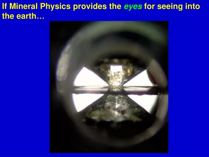
If Mineral Physics provides the eyes for seeing into the earth…
Seismology provides the ears… Courtesy of J. Tromp
KEY SEISMOLOGICAL PRACTICES :MULTISCALE 3D and 4D IMAGING AND MODELING OF COMPLEX EARTH SYSTEMS Nankai trench off the Izu Peninsula, Japan (Courtesy of UTexas, Jackson School of Geosciences)
KEY SEISMOLOGICAL PRACTICES :MULTISCALE 3D and 4D IMAGING AND MODELING OF COMPLEX EARTH SYSTEMS Velocities at depth of a recent 3D S-wave velocity model (Courtesy of Kustowski et al.)
KEY SEISMOLOGICAL PRACTICES:MULTISCALE 3D and 4D IMAGING AND MODELING OF COMPLEX EARTH SYSTEMS EarthScope: Has provided a lot more ears over North America Rayleigh wave group velocities for 60,000 8-sec waves from 3 years of continuous data (Courtesy of Moschetti et al.)
log (lateral scale in meters) 0 1 2 3 4 5 6 7 0 1 2 3 4 5 6 7 Surface noise processes Environmental remediation Geotechnical problems Groundwater reservoirs Ice movements Crust Nuclear explosions Petroleum reservoirs Magmatic processes log (depth in meters) Tectonic fault ruptures Upper mantle Lower mantle Core Societal challenges for seismology are concentrated in the near-surface environment… Tomographic threshold Scattered-wave threshold (Courtesy of Tom Jordan)
GRAND CHALLENGE 1. HOW DO FAULTS SLIP? Topography of an exposed fault surface measured in Klamath Falls, Oregon (Courtesy of E. Brodsky)
GRAND CHALLENGE 1. HOW DO FAULTS SLIP? Rupture process for the 2001 Kokoxili, Tibet, (Mw 7.8) earthquake (Courtesy of Walker and Shearer)
GRAND CHALLENGE 1. HOW DO FAULTS SLIP? Rupture zones of the 26 December 2004 and 28 March 2005 great Sumatra earthquakes (Courtesy of C.J. Ammon)
Sidebar 3: Ambient Noise and Fault Zone Healing Change of ground structure between seismic stations over time, measured from cross-correlation of microseismic noise (Courtesy of Brenguier et al.)
Sidebar 4: Episodic Tremor and Slip (ETS) Tremor “event” in January, 2007, corresponding with slow slip of a few cm. Events repeat every 14 months (Courtesy of K.Creager)
GRAND CHALLENGE 2. HOW DOES THE NEAR-SURFACE ENVIRONMENT AFFECT NATURAL HAZARDS AND RESOURCES? San Gabriel and Los Angeles Basins showing soil structures as indicators of future shaking during an earthquake (Courtesy of Thelen et al.)
GRAND CHALLENGE 2. HOW DOES THE NEAR-SURFACE ENVIRONMENT AFFECT NATURAL HAZARDS AND RESOURCES? Seismic cross section of a subsurface clay-bounded channel (center) containing a dense liquid contaminant (Courtesy of Gao et al.) Meters
Sidebar 8: Gas Hydrates as an Energy Source, Environmental Hazard, and a Factor in Global Climate Change (Courtesy of Trehu et al.)
GRAND CHALLENGE 3. WHAT IS THE RELATIONSHIP BETWEEN STRESS AND STRAIN IN THE LITHOSPHERE? Plate boundary deformations, involving surface velocities, shear strains, and mean strains for the San Andreas System from geodetic measurements (Courtesy of Platt et al.)
Sidebar 9: Remote Triggering of Earthquakes Tiny Montana earthquakes triggered by waves from the 2002 Mw 7.9 Denali Earthquake (Courtesy of Manga and Brodsky)
GRAND CHALLENGE 4. HOW DO PROCESSES IN THE OCEAN AND ATMOSPHERE INTERACT WITH THE SOLID EARTH? Average sources of long period “hum” (Winter/Summer), compared to averaged wave heights from Topex/Poseidon (Courtesy of Rhie and Romanowicz)
GRAND CHALLENGE 4. HOW DO PROCESSES IN THE OCEAN AND ATMOSPHERE INTERACT WITH THE SOLID EARTH? Infrasonic sources monitored across Europe using regional infrasound records for 2000-2007 (Courtesy of Le Pichon et al.)
Sidebar 11: Cryoseismology Greenland events associated with outflow of major continental glaciers (Courtesy of Ekström et al.)
Sidebar 12: Seismic Imaging of Ocean Structure Imaging fine-scale (5m resolution) features of ocean layers, revealing thermohaline circulation eddies (Courtesy, S. Holbrook)
GRAND CHALLENGE 5. WHERE ARE WATER AND HYDROCARBONS HIDDEN BENEATH THE SURFACE? Sidebar 13: Exploration Seismology and Resources: Energy and Mining 4D seismic imaging of reservoirs can show the changing locations of hydrocarbons as they are extracted (Courtesy of J. Louie)
Sidebar 15: Four-Dimensional Imaging of Carbon Sequestration Ex/ CO2 injection (8 Mton) at the Sleipner field in the Norwegian North Sea (Courtesy of Chadwick et al.)
GRAND CHALLENGE 6. HOW DO MAGMAS ASCEND AND ERUPT? Slices from a 3D image of Okmok Volcano, Alaska
GRAND CHALLENGE 6. HOW DO MAGMAS ASCEND AND ERUPT? Ratio of P/S velocities in the Nicaraguan subduction zone; Dark red areas show presence of rising melts from water dehydration (Courtesy of Syracuse et al.)
Sidebar 16: Four-Dimensional Monitoring of Volcanoes Using Ambient Seismic Noise Ex/ Changing seismic velocity just before the 1999 (left) and 2006 (right) eruptions of Piton de la Fournaise volcano (Reunion) (Courtesy of Brenguier et al.)
GRAND CHALLENGE 7. WHAT IS THE LITHOSPHERE-ASTHENOSPHERE BOUNDARY? Seismic velocity discontinuities beneath the Sierra Nevada, suggesting detachment of lower crust (continental lithosphere is more complex than we realized) (Courtesy of Gilbert et al.)
GRAND CHALLENGE 7. WHAT IS THE LITHOSPHERE-ASTHENOSPHERE BOUNDARY? Example of seismically imaged ancient continental lithospheric sutures, persisting to the present (Courtesy of M. Bostock)
GRAND CHALLENGE 7. WHAT IS THE LITHOSPHERE-ASTHENOSPHERE BOUNDARY? Seismic velocity contrasts associated with the lithosphere-asthenosphere boundary under New England are too sharp for just temperature (hydrated? melt?) (Courtesy of Rychert et al.)
Sidebar 17: Intraplate Earthquakes Intraplate seismicity of New Madrid seismic zone superimposed on map of topography (Courtesy of M.B. Magnani)
GRAND CHALLENGE 7. WHAT IS THE LITHOSPHERE-ASTHENOSPHERE BOUNDARY?
GRAND CHALLENGE 8. HOW DO PLATE BOUNDARY SYSTEMS EVOLVE? Map of diffuse plate boundary regions (Updated from Gordon and Stein)
GRAND CHALLENGE 8. HOW DO PLATE BOUNDARY SYSTEMS EVOLVE? Seismic tomography of upper 1000 km beneath Western US showing disruption of subducting Juan de Fuca plate by upwelling plume (Courtesy of R. Allen)
Sidebar 18: Plate Boundary Field Laboratories Ex/ The Nankai Trough Seismogenic Zone Experiment (NanTroSEIZE) images the interface between the subducting Philippine Plate and overriding continental plate, examining conditions for seismic/aseismic slip
GRAND CHALLENGE 9. HOW DO TEMPERATURE AND COMPOSITION VARIATIONS CONTROL MANTLE AND CORE CONVECTION? Global 3D configuration of seismic velocity heterogeneities in the mantle as imaged by seismic tomography (Courtesy of A. Dziewonski)
GRAND CHALLENGE 9. HOW DO TEMPERATURE AND COMPOSITION VARIATIONS CONTROL MANTLE AND CORE CONVECTION? Seismic sampling of the sub-African superplume? Megaplume? Megapile? LLSVP! (Courtesy of Wang and Wen)
Sidebar 20:The Mysterious Inner Core 3D distribution of anisotropic fabric within the outer part of inner core; there is unusual east-west variation in velocity, attenuation, and anisotropy (Courtesy of X. Song)
Sidebar 21:Planetary Seismology Buzz Aldrin deploying a seismometer on the Moon during the Apollo 11 mission; seismometers are planned for future missions to both Mars and the Moon (Courtesy of NASA)
GRAND CHALLENGE 9. HOW DO TEMPERATURE AND COMPOSITION VARIATIONS CONTROL MANTLE AND CORE CONVECTION?
GRAND CHALLENGE 10. HOW ARE EARTH’S INTERNAL BOUNDARIES AFFECTED BY DYNAMICS? Topography on three major Earth boundaries at and beneath South America, showing the dominating effects of subduction (Courtesy of N. Schmerr)
GRAND CHALLENGE 10. HOW ARE EARTH’S INTERNAL BOUNDARIES AFFECTED BY DYNAMICS? Cross sections in a 3D seismic migration image of S-wave reflectivity in the mantle wedge adjacent to subducting Tonga slab; quasihorizontal structures not explained by standard petrological models (Courtest of Y. Zheng)
GRAND CHALLENGE 10. HOW ARE EARTH’S INTERNAL BOUNDARIES AFFECTED BY DYNAMICS? Migrated S-wave reflector images of the core-mantle boundary (Courtesy of van der Hilst et al.)
Sidebar 22:Core-Mantle Boundary Heat Flow The transition from perovskite to post-perovskite. (Courtesy of Hernlund et al.)
GRAND CHALLENGE 10. HOW ARE EARTH’S INTERNAL BOUNDARIES AFFECTED BY DYNAMICS?