Download

1 / 23
400 likes | 1.23k Views
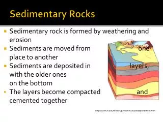
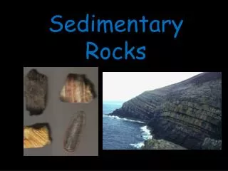
Sedimentary Basins (Part One). What are Sedimentary Basins?. Holes in the ground where sediment accumulates Global distribution: Sub-aerial and submarine. Why are Basins Interesting?. Hydrocarbons: Oil, Gas, Coal Ores & Minerals. Some estimates….

E N D
What are Sedimentary Basins? Holes in the ground where sediment accumulates Global distribution: Sub-aerial and submarine
Why are Basins Interesting? Hydrocarbons: Oil, Gas, Coal Ores & Minerals
Some estimates… Liquid hydrocarbon production will peak in ~10 years at 30 Billion Barrels per annum, declining to ~5 Billion Barrels per annum by the end of the 21st Century
Keeping up Supply: Importance of Technology 1988 and 1995 3D seismic surveys BP Forties Field: Monthly Average Oil Production Rate 1973 Year 2003 Technologies: Seismic Reflection Imaging Deep Water drilling/production Finding: Direct hydrocarbon Indicators Extracting: Mopping up the dregs
Peak Oil: Supply Peaks & Declines Smoothly? Technology buffers decline?
Basins form through Tectonic Subsidence Accommodation Space Sea-Level Change Tectonic Uplift / Subsidence
World’s Thickest Sediment Accumulations Thickest sediment accumulations are 15 to 20 km Tend to form in enclosed basins supplied by major rivers
Probing Sedimentary Basins • Surface sampling and mapping • Topography and bathymetry • Boreholes (<5 km) • Seismic experiments (2D, 3D, 4D) • Earthquake analysis Undeformed basins are subsurface
Very little of a typical underformed basin is accessible by surface sampling / mapping
12 km Seismic Reflection Imaging Ninian Fault Block, North Sea vertical exageration x3 to x4
Borehole Records 1. Thicknesses 2. Ages 3. Sediment Composition Reconstruct sediment acccumulation history Hence reconstruct tectonic subsidence history
Timing of source maturation: Cumulative Stratigraphy Plot
Basin Classification: Process ‘Basin Analysis’, Allen & Allen, Chapter 1
Basin Classification: This Course • Extensional basins (60-70%) • Flexural or foreland basins (10-20%) • Basins associated with subduction zones • Other basin types…