Download
1 / 14
140 likes | 231 Views
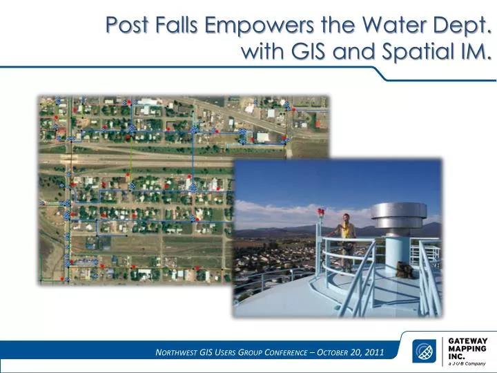
Post Falls Empowers the Water Dept. with GIS and Spatial IM. The Water System Master Plan. Sleepless Nights?. Make information useful for multiple departments. Legacy data and all of its issues Update and keep data current Increase awareness of available information. Solutions.

E N D
Post Falls Empowers the Water Dept. with GIS and Spatial IM.
Sleepless Nights? • Make information useful for multiple departments. • Legacy data and all of its issues • Update and keep data current • Increase awareness of available information
Solutions • Planning • How to update and use information • Who will fill what roles • What information will be included • Setup/Implement • Build database • Make it accessible to users • Implement Spatial IM • Training • How to use the tools (toys) • How to work independently and collectively • Provide resources and encouragement
“If you fail to plan, you plan to fail” • Desired Results • Data structure/schema • Data flow • Specific tasks • Personnel • Benefits
I meant Implement! Data Inputs: CAD, As-builts, GPS, Outside providers, Documents Process Water Models SDE GDB & ArcGIS Server • Map your system • Keep inventory • Track work histories • Attach photos, plans, etc. • Create reports • Comply with regulations • Plan for maintenance and upgrades Asset Management Applications (ArcMap/ Spatial IM) Reports and Maps Products • General GIS Web Applications • Map Production/ Geoprocessing
New Toys and Training • ArcMap Extension • Data Entry • Track History Events • Link Documents (Scrapbook) • Multi-User Integration • Searching and Reporting • Logic Builder – Maps and Data • Network Tracer • ArcGIS Desktop • ArcMap • ArcSDE • Replication • ArcEditor (license) • ArcView (license) • File GDB format
Benefits Engineering, Public works, GIS, and Management all access the same information. Data is integrated from multiple sources. Flexibility and the ability to expand. Easy to use setup for all of the staff. Increased access and awareness of GIS capabilities
Examples Track maintenance events and repair history
Examples Link pics and docs
Examples Build queries and reports
Examples Integrate multiple users
Neal Fraser, GISP Gateway Mapping, Inc. 888-464-4447 www.gatewaymapping.com Dave Williamson City of Post Falls, ID 208-292-2347 www.postfallsidaho.org