Download
1 / 28
280 likes | 424 Views
The Cretaceous Cayo Formation at Puerto Cayo, Western Ecuador. Habte G. Churnet Department of Physics, Geology, and Astronomy The University of Tennessee at Chattanooga. Jonathan W. Mies Department of Physics, Geology, and Astronomy The University of Tennessee at Chattanooga.

E N D
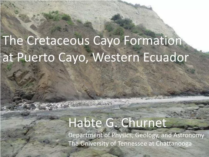
The Cretaceous Cayo Formation at Puerto Cayo, Western Ecuador Habte G. Churnet Department of Physics, Geology, and Astronomy The University of Tennessee at Chattanooga
Jonathan W. Mies Department of Physics, Geology, and Astronomy The University of Tennessee at Chattanooga Location: Geologic Environment of Ecuador Quito Trench o Forearc Ridge Galapagos Carnegie Ridge [aseismic] cayo o Forearc basin Magmatic arc o Backarc basin Grijalva scarp Trench Grijalva scarp: south side is 700 meters below north side
Objective Review of tectonic and neo-tectonic setting of Ecuador Show structures in the Cayo FM. and provide inferences. new REE L Igneous provenance from discrimination diagrams, e.g., Rare Earth Elements (REE) B. Cretaceous, Farallon Plate Two oceanic plateaus that were appended to Ecuador since the Cretaceous, which otherwise was mostly submarine. S = San Jun Plateau- 1st ocean Plateau P = Pinon Plateau – successor Ocean Plateau Pinon Plateau was 100s km south of its current position In Ecuador. D. South America has been rotating clockwise E. Volcanic activity since the Eocene covered earlier terranes and formed the Ecuadorian Andes. Calc-alkaline (e.g., Island arc) H Tholeiite (e.g., oceanic Plateau)
Objective (continued) new F. Currently, the Nazca subduction zone is 150 km beneath the Ecuadorian Andes G. Compression above the edge of the supra-subducting plate is associated with generally NE-SW dextral faults such as the Jamie, and the Puertovijo, and E-W Sinistral faults such as the Montecristi (Pedoja et al., 2004). H. Subduction of the relatively hot, aseismic Carnegie Ridge is associated with uplift of the continental margin of Ecuador, and reactivated faults. For example, The Monticristisinstral fault was reactivated into a north side up thrown normal fault (Pedoja et al., 2004). This uplift is apparently why cliffed coasts [secondary coasts in that waves and tides have also shaped the coastline with sea stacks separated from mainland by erosion] occur over miles on either sides of the Manta peninsula. Wave action erodes coastal man made structures, roads, fences, houses in the current global-warming-related sea level rise. I. Uplift of the continental margin is punctuated with interglacial inundation, and glacial coastal erosion. The punctuated uplift is marked by flat terraces present on land as in the Manta peninsula, which is associated with 360 m uplift above sea level, an on La Plata island that is uplifted 170 meters above sea level (Pedoja et al.)
Cartoon: Farallon to Nazca Geologic map ( adapted from Jaillard et al., 2009) San Juan (S) Late K C DGC C C DGC E Cayo Formation (C) Late K Late Eocene -Recent Naranjal Q Guaranda Terrnae (G) M San Juan T Guaranda Macuchi Island Arc LP Pinon C 100 0 Macuchi arc (M) Northward movement along the Dextral Guayaquil- Carcas Megashear (DGC) km G C N Nazca Plate (N) subducted DGC Calc-alkaline REE No magmatic arc from 140 to 40 Ma. Clockwise rotation of S America. Tholeiite
1, Jama; 2, Portoviejo; (dextral) 3,Montecristi; (sinisteral) 4, Colonche; 5, Carrizal. C Compression before 3 to 2 Ma Uplift & extension since 3 to 2 Ma Uplift –subducted Carnegie Manta ~ 360 meters La Plata ~ 170 meters Marine terraces. 0.3 mmyr-1 PG, Punta Galera; CP, Cape Pasado; BC, Bahia de Caraquez; MP, Manta Peninsula; C, Puerto Cayo PI, La Plata Island; CS, Cape Salinas; SEP, Santa Elena Peninsula; PU, PunaÅL Island; GG, Gulf of Guayaquil; ZFZ, Zambapala fault zone. Plio-Quaternary Uplift from Pedoja et al., 2004. A. Bathymetry of Carnegie Ridge; B. DEM of Manta Peninsula & La Plata Island
Cretaceous (Pinon?) pillowed lava, blue line shows bedding Pre-3 Ma folding, west vergent Post 3-2 Ma uplift. Post 3k marine terrace, (T2? of Pedoja et al., 2004) Marine terrace Pillow
Puerto Cayo sea level rise is outstrips coastal uplift Wave erosion of bottom of fence. Black sand is of magnetite from eroded Cayo Formation
unconformity fault faults Algal mat
Heliasterstarfish in lower intertidal. Reportedlythe starfish is extinct at Galapagos
Heliasterstarfish in lower intertidal. Reportedlythe starfish is extinct at Galapagos
unconformity fault faults meters Algal mat
333 Debris flow deposit. Coarse grained. Granules, clasts. Periwinkles attached to rock
Triangular graben down thrown Pencil parallel to slickenlines Hammer for scale
Zoom of previous picture, pencil parallel to slickenline. Steps show block is down thrown
Close spaced fracture and faulting Trend E-W. Broken zone
Hammer on up thrown Block.
Dark Colored Cayo. Plane Polarized Thin Section. View 5 mm across Calcite. Zeolite Plagioclase Quartz, Chlorite Opaque Most stained Yellow by iron
Dark Colored Cayo. Crossed Polaris Thin Section. View 5 mm across Calcite. Zeolite Plagioclase Quartz, Chlorite Opaque
White Rock. Crossed polars- Biogenic Ooze, Forams, view 5 mm across
North part of Puerto Lopez. Steeper limb of anticlines dips west to the Pacific Ocean • West vergent anticline.
Puerto Lopez Fining upward grain-size graded turbidite
CONCLUSION A. Two oceanic plateaus: the San Juan and its successor plateau, the Pinon are significant Cretaceous Plateaus. The San Juan was thrust northeastwardward and accreted on Ecuador The Pinon was thrust southwestward in the Cretaceous before the coastal margin was under thrust by the Nazca Plate. B. At Puerto Cayo. Grain flow and debris flow [high density turbidites?] volcaniclastics dominate [minerals include: , heulandite, calcite, plagioclase, quartz Magnetite and pyrite. Iron staining] Blue footed Booby. La Plata Island
Conclusion continued Frigate bird at its nesting site at La Plata Island C. Summary of structure In the Cayo FM at Puerto Cayo Formation declines at 25° to SE, different from the attitude in overlying rock. Therefore, tilting is likely Cretaceous. Formation is broken up & faulting is post depositional. 3. Broken zone. Did the faulting occur as a relaxation after the Carnegie Ridge uplifted the area? Or is the broken zone associated with westward thrusting of the Cayo FM? I prefer the latter, though it might have been reactivated later.