Download
1 / 21
220 likes | 345 Views
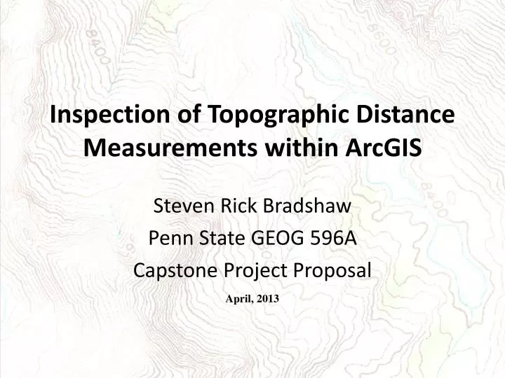
Inspection of Topographic Distance Measurements within ArcGIS. Steven Rick Bradshaw Penn State GEOG 596A Capstone Project Proposal. April, 2013. Background - Issues with GIS Measurements.

E N D
Inspection of Topographic Distance Measurements within ArcGIS Steven Rick Bradshaw Penn State GEOG 596A Capstone Project Proposal April, 2013
Background - Issues with GIS Measurements In a non-projected global coordinate system, GIS software measures geodetic distances using the surface of a reference ellipsoid. Geodetic distance: “…the length of the shortest curve between those two points along the surface of the earth model being used by the spatial reference system. Geodetic distance behaves well for wide areas of coverage, and takes the earth's curvature into account.” The OpenGIS Consortium
Background - Issues with GIS Measurements Geodetic distance measurements using a reference ellipsoid, will not consider changes in elevation between two points. Compared to geodetic distances, topographic distances can be much longer. The following scenario will illustrate the need for a tool within GIS software that measures topographical distances. Currently, GIS software tools offered by major vendors, do not provide an accurate analysis of topographic distances. The results of this study will suggest the need to develop appropriate tools that compute topographic distance within GIS software.
Background - Issues with GIS Measurements Scenario Consider two cities (A and B) separated by a mountain range. When traveling from City A to City B, a traveler changes elevation crossing over the summit of the range. When GIS software calculates the distance between City A and B, the resultant distance is calculated using geodetic (or planar) distance but does not include the changes in topography.
Background - Previous Research on Problem Literature Review Currently, there is little research on topographic distance measurement within a GIS environment. Previous and current research on GIS based distance measurements can be classified into three categories Methods used in ArcGIS to Measure Geodetic and Euclidean Distances Euclidean Distance Geodetic Distances Cost-Weighted Distance Proximity Analysis
Background - Previous Research on Problem Literature Review Continued … 2. Distance Measurement Algorithm Development Meyer’s Topographic Distance Watershed Algorithm Utilizes watershed lines to calculate geodetic distances. It also uses slope to calculate the topographic distances of water traveling toward the minimum watershed line values from a chosen starting point. Yang’s cell based algorithm for evaluating Directional Distance Identifies the nearest object borderlines to a given point within the map. The algorithm pre-processes a map into a grid, identifies the nearest object borderline and creates radiating “fetch lines” in multiple directions.
Background - Previous Research on Problem Literature Review Continued… 3. Research on Issues with Current Distance Measurement Methodology. Liu et al. (2007) examined the effects of raster cell resolution on Cost Distance Modeling. Hunghu et al. (2011) studied on the effects of DEM cell resolution on slope length calculations. Napieralski and Napela (2008) investigated the effect of DEM cell resolution on landform morphology.
Proposed Methodology Research Approach Hypothesis- Given the same route, topographic distances would be greater than geodetic distances. Two sections of Highway 70 that traverses White Sands Missile Range, NM will be mapped with GPS and cast in WGS-84 and NAD27. 1. Organ Mountain Site - a route over a mountain pass with moderate elevation changes. 2. Flats Site – a route across an extinct lakebed with little elevation change.
Proposed Methodology Research Approach Organ Mountain Site- Highway 70 is a four lane divided, with high rate of traffic. Speed limit ranges from 50 to 75 MPH within study site. Length- 18 km Elevation- 3,963 ft. to 5,719 ft at the Pass
Proposed Methodology Research Approach Flats Site- Is also a four lane divided highway, with high rate of traffic. Speed limit is 75 MPH within study site. Length- 3 km Elevation- 3,955 ft. to 3,998 ft
Trimble R-8 Receivers Proposed Methodology Cont… Research Steps – Data Collection 1. Physical survey of study sites Relative GPS surveying methods will be used to survey both sites collecting coordinates every 150 meters. These WGS-84 coordinates will be used to generate topographic distances. Orthometric heights are determined by calculating the relationship of ellipsoid heights above the reference ellipsoid and the heights of the geoid The results are comparable to the traditional elevation values of a vertical datum.
Proposed Methodology Cont… Research Steps – Data Collection The Survey at Flat Site In addition to the GPS survey, the Flats Site will measure the actual surface distance with a device (measuring wheel). This distance will be used as a baseline of the surface distance to be compared to the measured geodetic distance and the GPS collected Topographic distance.
Proposed Methodology Cont… Research Steps – Data Collection 2. Transform Horizontal Coordinates to NAD27 To illustrate how different reference ellipsoids can affect topographic distances, coordinates of both sites will be transformed into the North American Datum of 1927 (NAD27) using survey processing software. 3. Transform Vertical Coordinates to NGVD29 NAD27 elevation values collected during the survey will be cast in the National Geodetic Vertical Datum of 1929 (NGVD29).
Proposed Methodology Cont… Research Steps – Data Collection Continued… 4. Modify Vertical data for Organ Mountain Pass Site All vertical data for the Organ Mountain Pass Site will be manipulated to represent extreme elevation changes. Generate Slant Distances of all Datasets Topographic distances will be calculated with DoD software using 3 dimensional coordinates (x, y, z) of two points on a reference ellipsoid, then calculating the slant distance between those points.
Proposed Methodology Cont.. Organ Mountain Extreme Elevation WGS-84 Elevation Manipulation Organ Mountain WGS-84 Extreme Slant Distance Proposed Methodology Organ Mountain Site WGS-84 Organ Mountain Site WGS-84 Organ Mountain WGS-84 Slant Distance Organ Mountain Site NAD27/NGVD29 Organ Mountain Site NAD27 Transform NGVD29 Transform NAD27 Organ Mountain NAD27 Slant Distance Organ Mountain Site NAD27/NGVD29 Dataset Workflow Elevation Manipulation Organ Mountain NAD27 Extreme Slant Distance Flats Site WGS-84 Slant Dist. Slant Dist. Slant Dist. Slant Dist. Slant Dist. Slant Dist. Organ Mountain Extreme Elevation WGS-84 Transform NAD27 Flats Site NAD27 Slant Distance Flats Site NAD27 Flats Site WGS-84 Slant Distance
Proposed Methodology Cont… Research Steps – Data Analysis 6. Comparison of Reference Ellipsoids WGS-84 is a geocentric reference system ellipsoid with an origin at center of Earth’s mass. The orientation of the system is oriented and fixed to astronomic observations. NAD27 is a horizontal control datum that utilizes the Clarke Spheroid of 1866. The origin is a single survey marker at Meade's Ranch, Kansas. The origin of NAD27’s reference ellipsoid, Clarke 1866 is approximately 236 meters away from WGS-84 Earth-centered Earth-fixed reference ellipsoid. The orientation of these reference ellipsoids differ by nearly 11 minutes of angle, with NAD27 tilted counter-clockwise to WGS 84. (Roman, 2007)
Proposed Methodology Cont… Research Steps – Data Analysis Cont… 7. Comparing Distances Topographic distance results of all six routes will be compared to the geodetic and actual surface distance. The actual surface distance of the Flats Site will also be compared to the topographic and geodetic distances. WGS-84 topographic distance will be compared to the NAD27 topographic and actual surface distance data. 8. Explore Data It is expected any differences in distances will be caused by both the physical distinctions in the dimensions of the reference ellipsoids and the orthometric heights and the NGVD29 elevation values.
Anticipated Results The following results are anticipated. 1. The greater the elevation changes between two locations, the greater the difference between the geodetic and topographic distance. 2. The topographical distance of datasets with extreme elevation changes will be much greater than the geodetic distance. 3. Datasets with smaller elevation changes will have similar topographic and geodetic distances. 4. The differences in the topographic distances between WGS-84 and NAD27 will highlight the importance of selecting the proper reference ellipsoid and its application for a particular geographic region. The results will illustrate the need for and warrant further study into developing a function within GIS software that measures topographical distances.
Project Timeline May to June 2013 Complete Steps 1, 2, 3 Identify and establish a study area. GPS the study area and process the data. Transform WGS-84 horizontal coordinates to NAD27. Transform WGS-84 orthometric heights to NGVD29 elevation values. July 2013- Complete Steps 4 and 5 Complete research on WGS-84 and NAD27 and conduct a discussion on the differences between WGS-84 and NAD27 in respect to New Mexico to identify causes of differences in topographic distances. Create new routes by modifying elevation values. August 2013- Complete Steps 6, 7 and 8 Calculate slant distances of all routes to create topographic distances. Analyze all topographic and geodetic distances. Compare and contrast the differences of topographic and geodetic distances. September to November 2013- GEOG 596B Prepare for presentation for formal professional presentation. Present results of capstone at the North American Cartographic Society Conference in Greenville, South Carolina October, 2013.
References Defense Mapping Agency. 1984. Geodesy for the Layman. Washington, D.C. Available at http://www.ngs.noaa.gov/PUBS_LIB/Geodesy4Layman/TR80003A.HTM ESRI. (n.d.). GIS Dictionary. Retrieved from http://support.esri.com/en/knowledgebase/GISDictionary/term/Clarke ellipsoid of 1866 Open Geospatial Consortium, T. C. (2007, December 28). Schema for Coverage Geometry and Functions. Retrieved from http://www.opengeospatial.org/standards/as Hoghu, L., Kessel, J., Hormann, G., & Fohrer, N. (2011). Effects of DEM Horizontal Resolution and Methods on Calculating the Slope Length Factor in Gently Rolling Landscapes. Catena, 368-375. Retrieved from http://ac.els-cdn.com.ezaccess.libraries.psu.edu/S0341816211001408/1-s2.0-S0341816211001408-main.pdf?_tid=afdd1c1a-87771-11e2-ba1b-00000aacb35f Liu, W., Chen, D., & Scott, N. A. (2007, August). In Peng Gong (Chair). Effects of Cell Sizes on Resistance Surfaces in GIS-based Cost Distance Modeling for Landscape Analyses. Paper submitted at: Geoinformatics 2007: Geospatial Information Technology and Applications, Nanjing, China. doi: 10.1117/12.764597 Meyer, F. (1994). Topographic Distance and Watershed Lines. Signal Processing, 113 - 125. Retrieved from http://www.sciencedirect.com/science/article/pii/0165168494900604 Napieralski, J., & Nalepa, N. (2010). The application of control charts to determine the effect of grid cell size on landform morphology. Computers and Geosciences, 222-230. Retrieved from http://sciencedirect.comezaccess.libraries.psu.edu/science/article/pii/S0098300409002428 NGA. National Geospatial-Intelligence Agency (2009, June 16). Egm2008- WGS 84 Version. Retrieved from http://earth-info.nga.mil/GandG/wgs84/gravitymod/egm2008/egm08_wgs84.html NH.GOV. New Hampshire State Government (2007), Flood Plain Management. (2007). NGVD to NAVD. Retrieved from website: http://www.nh.gov/oep/programs/floodplainmanagement/documents/NGVDtoNAVD.pdf NIMA. National Imagery and Mapping Agency, (2000). Department of Defense World Geodetic System 1984 (TR8350.2). Retrieved from website: http://earth-info.nga.mil/GandG/publications/tr8350.2/tr8350_2.html NOAA. (2009, June 03). Geodetic Glossary. Retrieved from http://www.ngs.noaa.gov/CORS-Proxy/Glossary/xml/NGS_Glossary.xml Roman, D.A.(2007) Datums, Heights and Geodesy. Central Chapter of the Professional Land Surveyors of Colorado 2007 Annual Meeting, Colorado. Retreived from http://www.ngs.noaa.gov/GEOID/PRESENATIONS/2007_02_24_CCPS/Roman_A_PLSC2007notes.pdf Wolf, P., & Ghilani, C. (2006). Elementary Surveying: An Introduction to Geomatics. (11th ed., pp. 549-550). Upper Saddle River, New Jersey: Pearson Prentice Hall. Yang, S., Yong, J. H., & Sun, H. G. (2010). A Cell Based Algorithm for Evaluating Directional Distances in GIS. International Journal of Geographical Information Science, 24(4), Retrieved from http://www.tandfonline.com.ezaccess.libraries.psu.edu/doi/abs/10.1080/13658810902988419