Download
1 / 56
570 likes | 812 Views
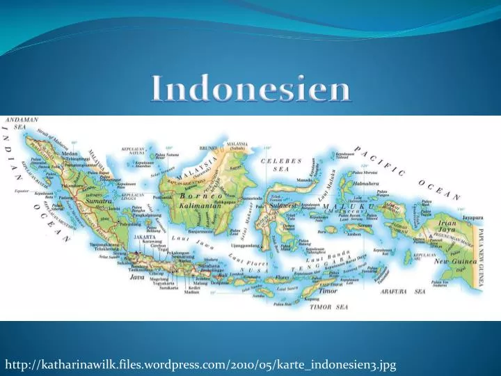
Indonesien. http://katharinawilk.files.wordpress.com/2010/05/karte_indonesien3.jpg.

E N D
Indonesien http://katharinawilk.files.wordpress.com/2010/05/karte_indonesien3.jpg
http://www.google.de/imgres?imgurl=http%3A%2F%2Fupload.wikimedia.org%2Fwikipedia%2Fcommons%2F5%2F5b%2FINDONESIA_geology_map.jpg&imgrefurl=http%3A%2F%2Fde.wikipedia.org%2Fwiki%2FIndonesien&h=483&w=780&tbnid=9Fg2iAb2lHdRUM%3A&zoom=1&docid=qUFF6BP9XXajIM&ei=5QmoU6OPMsr74QTRsoGoBw&tbm=isch&client=firefox-a&iact=rc&uact=3&dur=598&page=1&start=0&ndsp=7&ved=0CCAQrQMwAAhttp://www.google.de/imgres?imgurl=http%3A%2F%2Fupload.wikimedia.org%2Fwikipedia%2Fcommons%2F5%2F5b%2FINDONESIA_geology_map.jpg&imgrefurl=http%3A%2F%2Fde.wikipedia.org%2Fwiki%2FIndonesien&h=483&w=780&tbnid=9Fg2iAb2lHdRUM%3A&zoom=1&docid=qUFF6BP9XXajIM&ei=5QmoU6OPMsr74QTRsoGoBw&tbm=isch&client=firefox-a&iact=rc&uact=3&dur=598&page=1&start=0&ndsp=7&ved=0CCAQrQMwAA
Känozoikum? 0-1,8 Mill. Jahre Quartär 1,8-65 Mill. Jahre Tertiär Mesozoikum? 65-250 Mill. Jahre Kreide Jura Trias Paläozoikum? 250-540 Mill. Jahre Perm Karbon Devon Silur Ordovizium Kambrium
http://www.geodz.com/deu/d/images/1744_deutsche_bodenklassifikation.pnghttp://www.geodz.com/deu/d/images/1744_deutsche_bodenklassifikation.png
http://www.zum.de/Faecher/Materialien/beck/bilder/waerme1.GIFhttp://www.zum.de/Faecher/Materialien/beck/bilder/waerme1.GIF
http://wiki.bildungsserver.de/klimawandel/upload/thumb/CO2_640000.jpg/420px-CO2_640000.jpghttp://wiki.bildungsserver.de/klimawandel/upload/thumb/CO2_640000.jpg/420px-CO2_640000.jpg
Spätglazial Holozän 18O (‰) 20.000 15.000 10.000 5.000 0 Jahre vor heute (BP) GISP2 18O-Werte (SMOW) als Temperaturindikatoren Quelle: http://www.gisp2.sr.unh.edu/DATA/Data.html verändert
http://www.convictcreations.com/aborigines/images/wallacesline.gifhttp://www.convictcreations.com/aborigines/images/wallacesline.gif
http://www.eoearth.org/files/136601_136700/136605/wallaceline.jpghttp://www.eoearth.org/files/136601_136700/136605/wallaceline.jpg
http://upload.wikimedia.org/wikipedia/commons/thumb/9/9c/Travertin_Rom.jpg/220px-Travertin_Rom.jpghttp://upload.wikimedia.org/wikipedia/commons/thumb/9/9c/Travertin_Rom.jpg/220px-Travertin_Rom.jpg
Lösungs- und Einsturzdolinen http://www.webgeo.de/g_003/
Höhlensysteme http://www.webgeo.de/g_003
Höhlensystem über Trockental http://www.webgeo.de/g_003
Vulkanformen http://www.vulkane.net/vulkanismus/grafiken/vulkanformen.gif
Abflussregime http://www.geodz.com/deu/d/images/1036_abflussregime.png