Download
1 / 24
240 likes | 336 Views
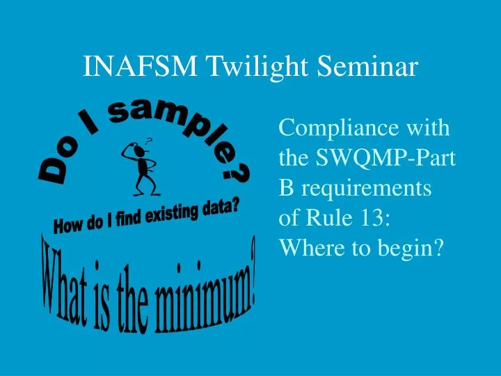
INAFSM Twilight Seminar. Compliance with the SWQMP-Part B requirements of Rule 13: Where to begin?. Do I sample?. How do I find existing data?. What is the minimum?. Rule Requirements. 1. Baseline Data Collection Characterize all known receiving waters

E N D
INAFSM Twilight Seminar Compliance with the SWQMP-Part B requirements of Rule 13: Where to begin? Do I sample? How do I find existing data? What is the minimum?
Rule Requirements 1 • Baseline Data Collection • Characterize all known receiving waters • Utilize existing or new information to describe chemical, biological, or physical condition of water (monitoring optional)
Rule Requirements 2 • Baseline Data Evaluation • Investigate land usage • ID sensitive areas • Review existing and available monitoring data • ID problem areas • Assess current structural/nonstructural BMPs
Rule Requirements 3 • On-Going Characterization Plan • Optional…depends on sufficiency of available data to draw conclusions and if more receiving waters will be identified • On-going data collection summaries/evaluations submitted with corresponding annual report(s) Data Evaluation Baseline Data Draw Conclusions Collect More Data
Rule Requirements • Submit Part B within 180 days of NOI letter submittal…most due by May 3, 2004 • Include the completed Part B checklist (state form #51275)
Agency Expectations • IDEM wants to see: • A baseline “snapshot” of the water quality in each receiving water (or a plan to do it) • An evaluation of the MS4 area to determine where improvements need to be made and where BMPs should be utilized • Documentation that an opportunity for the public to give feedback and suggestions was provided
Agency Expectations • IDEM does not want to see: • Volumes of water quality data (the data should be maintained by the MS4 operator, and available for review)
Assessment Information Management System Assessment Branch Office of Water Quality Indiana Department of Environmental Management
Surface Water Quality Monitoring Strategy 2001-2005GOALS • Measurethe physical, chemical, bacteriological, and biological quality of the aquatic environment in all river basins and identify factors responsible for impairment • Assessthe impact of human or other activities that occur in all river basins and the probable effects of these activities on the quality of the dynamic ecosystem and drinking water source protection • Identifytrends through the analysis of environmental data from a variety of sources and make recommendations for the protection of designated uses of the surface water resources of the State • Provideenvironmental quality assessment to support the water quality management program in partnership with customers and stakeholders
Surface Water Quality Monitoring Strategy is the Assessment Branch “Business Plan” to Measure, Assess, Identify and Provide Information on the Quality of: • Surface Water • Sediments • Macroinvertebrate Communities • Fish Communities • Fish Tissues • Habitat • NPDES Effluents
Data Sets (Projects) in AIMS11/5/2003 MACROINVERTEBRATE COMMUNITY 1990 Macroinvertebrates 1991 Macroinvertebrates 1992 Macroinvertebrates 1993 Macroinvertebrates 1994 Macroinvertebrates 1995 Macroinvertebrates 1996 Macroinvertebrates 1997 Macroinvertebrates 1998 Macroinvertebrates 1999 Macroinvertebrates 2000 Macroinvertebrates 2001 Macroinvertebrate 2002 Macroinvertebrates 2003 Macroinvertebrates SOURCE ID 2000 Big Raccoon Creek Source ID 2000 Brouilletts Creek Source ID 2000 Busseron and Buck Creek 2000 Iroquois Source ID 2000 Kankakee River Bio Imparirment Source ID 2000 Little Raccoon Creek Source ID Study 2000 Otter Creek Source ID 2000 Source ID Dausman Ditch 2000 Source ID East Branch Stoney Run 2000 Source ID Rowan Ditch Tributary 2000 Source ID Thompson/Rowen Ditches 2000 Sugar Creek Source ID at Earl Park 2000 Williams Creek Source ID 2000 Williams Ditch Source ID 2000 Yeoman Ditch Source ID 2001 Blue Creek Source ID 2001 Fish Creek Source ID 2001 Laughery Creek Source ID 2001 Little Pigeon Creek Source ID 2001 Little Sandy Creek Source ID 2001 Miller Fork Source ID 2001 Sugar Creek in Pike County 2001 Yankee Creek Source ID FISH COMMUNITY 1996 FishComm 1997 E.F. White Lick Creek FishComm Special Pjct. 2000 FishComm 2003 Limberlost IBC Study 2003 Targeted Fish Community FISH TISSUE 1986 Fish Tissue 1987 Fish Tissue 1988 Fish Tissue 1989 Fish Tissue 1990 Fish Tissue 1991 Fish Tissue 1992 Fish Tissue 1993 Fish Tissue 1994 Fish Tissue 1995 Fish Tissue 1996 Fish Tissue 1997 Fish Tissue 1998 Fish Tissue 1999 Fish Tissue 2000 Fish Tissue 2001 Fish Tissue 2002 Fish Tissue 2003 Fish Tissue PESTICIDES 1997 Pesticides 1998 Pesticides 1999 Pesticides 2000 Pesticides 2001 Pesticides FIXED STATION 1990 Fixed Station 1991 Fixed Station 1992 Fixed Station 1993 Fixed Station 1994 Fixed Station 1995 Fixed Station 1996 Fixed Station 1997 Fixed Station 1998 Fixed Station 1999 Fixed Station 2000 Fixed Station 2000 Fixed Upstream-Downstream 2001 Fixed Station 2001 Fixed Station Upstream-Downstream 2002 Fixed Station 2003 Fixed Station 2003 Fixed Station E coli QUALITY ASSURANCE 2000 Field Blank contaminationInvestigation 2002 Lab Water Quality SEDIMENTS 1986 Sediment 1987 Sediment 1988 Sediments Bio 1989 Sediments 1990 Sediments 1991 Sediments 1992 Sediments 1993 Sediments 1994 Sediments 1995 Sediments 1996 Sediments 1997 Sediments 1998 Sediments 1999 Sediments 2000 Sediment Bio 2001 Sediment Bio 2002 Sediment Bio 2003 Sediment Bio WATERSHED 1996 Synoptic 1996 Watershed 1997 Synoptic 1997 Watershed 1998 Watershed 1999 Watershed 1999 Watershed Extra Sites 1999 Watershed Paired Study 2000 Corvallis 2001 Corvallis 2001 Corvallis Biological 2001 Watershed Extra Sites 2002 Corvallis 2003 Corvallis 2004 Corvallis E. COLI 1998 E. coli 1998 USGS E coli 1999 E Coli 1999 USGS E coli 2000 E Coli 2000 USGS E coli 2000 Yellow River E. Coli, Bremen 2001 E. coli -Patoka and Lower WFWR 2001 E. coli-Upper WFWR 2001 E.coli Upper WFWR below Indy 2001 E.coli-Lower WFWR and Eel 2002 E. coli Muscatatuck and Upper EF WR 2002 E. coli in E.F. White River 2002 E. coli in Whitewater River 2003 E.coli in the Upper Wabash
Data Sets (Projects) in AIMS11/5/2003(continued) TMDL 1998 Wildcat 1998 Wildcat Sediments 1999 Cobb Creek/Breyfogel Ditch TMDL 1999 Pine Creek TMDL 1999 Wyatt Ditch 2000 Blue Creek Assessment 2000 Burns Ditch TMDL Assessment 2000 Cedar Creek E. Coli Assessment1 2000 Crawford Ditch Assessment 2000 Cypress Creek Assessment 2000 East Branch Little Calumet River 2000 Garrett City Ditch Assessment 2000 Habegger Ditch Assessment 2000 Little Pigeon Creek Assessment 2000 Lower Elkhart River Assessment 2000 Mather Ditch TMDL 2000 Mud Creek Assessment 2000 Orland Tributary TMDL 2000 Pigeon Creek Assessment 2000 Salt Creek Assessment 2000 Schwartz-Carnahan Ditch Assessment 2000 St. Joseph River 2000 Tiernan Ditch Assessment 2000 Trail Creek Assessment 2001 Beanblossom Creek 2001 Cicero Creek Assessment 2001 Conneley Ditch TMDL e.coli 2001 Duck Creek TMDL 2001 Eagle Creek TMDL Assessment 2001 Eel River TMDL 2001 Indian Creek Assessment 2001 Kessinger Ditch Assessment 2001 Killbuck Creek TMDL 2001 Kokomo Creek TMDL Monitoring 2001 Lambs Creek 2001 Lick Creek TMDL 2001 Little Pigeon Creek Assessment 2001 Mather Ditch TMDL -continued 2001 Mill Creek upstream of US 40 Assessment 2001 Mud Creek and Orland Ditch Assessment 2001 Orland Ditch Assessment 2001 Pipe Creek TMDL 2001 Plummer Creek Assessment 2001 Richland Creek Assessment 2001 Stony Creek Assessment 2001 W F White R Muncie to Madison Co Assessment 2001 W Fk White River in Hamilton Co Assessment 2001 W fk White River in Madison County 2001 WF White River White Lick to Buckhall Boat 2001 WF White River White Lick to Buckhall Bridges 2001 WFWR L. Buck Cr.-Wht. Lick Cr. TMDL Asses. 2001 Wabash and Erie Canal TMDL 2002 Big Blue R/Rays Crossing Assessment 2002 Clifty Creek Assessment 2002 East Fork Whitewater River TMDL Assessment 2002 First Creek Assessment 2002 Flatrock River E. coli TMDL 2002 Kokomo Creek Assessment Sampling 2002 Mud Creek and Orland Ditch Assessments 2002 Pigeon Creek Assessment 2002 Prairie Creek Assessment 2002 Sugar Creek E.coli 2002 Tiernan Ditch DO (re-sample) 2002 Youngs Cr TMDL Assessment 2003 Big Monon Ditch TMDL Assessment 2003 Heavilon Ditch Assessment 2003 Lauramie TMDL Assessment 2003 Mid Fr Wildcat Cr TMDL 2003 Wildcat Creek Watershed Project 2004 St Marys Watershed SPECIAL STUDIES 2000 + 1999 Hartford City 2000 Eagle Creek Reservoir 2000 Indy White River 2000 Montgomery Ditch 2000 Morgan Foods, Austin 2001 Anderson WWTP 2001 Belmont Study 2001 Morgan Foods, Austin 2001 Wildcat Creek Fish Kill Investigation 2001 William Baker/Shatto Ditch 2001 Wolcottville MWTP WLA Verification 2002 Clean Sampling and Ultra-Clean Analyses 2002 Greensburg Reservoir 2002 Marsh Lake Conductivity Study 2002 McCormicks Creek School 2002 Morgan Foods, Austin 2002 Rose Acres Farm, Jenn Acres Fac.,Jennings Cty 2002 South Dearborn RSD 2002 Tippecanoe Co. YOCW WQ Monitoring Day 2002/3 Warsaw WWTP / Walnut Cr Assessment 2003 Clean Sampling and Ultra-Clean Analyses 2003 Grand Calumet Ammonia Study 2003 Lake of the Woods E. coli 2003 Nonpoint Source Indicator Study Hartford City, Little Lick and Big Lick Creek
DATA GENERATION Monitoring Permits Rules Compliance Modeling Emergency Response TMDL 305b/303d Activities Agency Initiatives Legislative Initiatives Project Definition Data Retrieval Data Summary Data Analysis Site Selection Site Reconnaissance Report Generation Sampling Event Quality Assurance Procedures on Data
Federal US EPA Corps of Engineers US Geological Survey State DNR Riverwatch DNR Fisheries DNR LARE Program DEM Watershed Grants County Health Department SWCD Industrial Municipal WWTP SRCER Other Data Sources