Download
1 / 33
340 likes | 803 Views
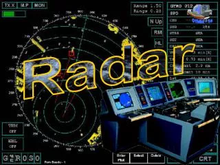
Radar Systems. Where are the radars located? What is the radar coverage? What are some of the characteristics that differentiate between radar systems? Radar Scan strategies? Radar products?. Radar History – in Brief. Radar Radio Detection And Ranging

E N D
Radar Systems • Where are the radars located? • What is the radar coverage? • What are some of the characteristics that differentiate between radar systems? • Radar Scan strategies? • Radar products?
Radar History – in Brief • Radar Radio Detection And Ranging • In 1887, a physicist named Heinrich Hertz began experimenting with radio waves in his laboratory in Germany. • Sir Robert Alexander Watson-Watt (1892--1973)Watson-Watt was the Scottish physicist who developed the radar locating of aircraft in England. • Radar was patented (British patent) in April, 1935. • Doppler RADAR is named after Christian Andreas Doppler, an Austrian physicist who first described in 1842, how the observed frequency of light and sound waves was affected by the relative motion of the source and the detector. This phenomenon became known as the Doppler effect. • Weather radar. started in 1943 as a Canadian Army project in Ottawa
Canadian Radar Coverage – Canadian Composite For the masses….
Nominal Radar Coverage with 256 km range However, in winter …
Effective Radar Coverage with 2 km echo tops Large blind swaths across the country ♫ I’m dreaming of gap-filling X-band network … Even here on the 401
NWS Radar Composite Meteorologists without Borders
Conventional: 24 PPI scans top down 6 RPM 24.6 to 0.3 degrees (0.1 in winter) 5 minutes to complete 10 seconds per elevation angle, 6 per minute Doppler: 3 scan angles bottom up ? much slower (0.85 RPM) since more sample points are collected for the Doppler processing fills much of remaining 5 minutes Antenna Scan Strategies 10 minute cycle
Some basic radar products CAPPI vs. PRECIP • CAPPI 1.0 • Uses conventional reflectivity scans • 1 km AGL out to 100 km, then rides up the lowest PPI angle (~0.1° winter & 0.3 ° summer) out to 256 km • Precipitation is relatively high above ground and can grow considerably between 1 km AGL and the surface • PRECIP • Uses long range doppler reflectivity scan within 125 km of radar, including ground clutter removal • Uses lowest PPI conventional reflectivity scan beyond 125 km of radar • Doppler reflectivity not quite as sensitive to weak echoes • Best product for seeing precipitation close to ground • Therefore, Precipitation Accums (PA) from PRECIP product should be better than from CAPPI, as long as ground doesn’t absorb too much beam power
18 25.0 0 10 2.0 0 2 0.0 0 Some basic radar products CAPPI 1.0 km vs. PRECIP product CAPPI 1.0 PRECIP beam height (km) Doppler reflectivity Conventional reflectivity range (km)
PRECIP product example Boundary between doppler & conventional reflectivity scans
Gain vs Beamwidth • The smaller the beamwidth, better the gain • Improved gain means higher signal strength for distant objects or small targets • e.g. light precipitation may be detected at greater distances
Weather Radar Bands • The more common weather radar wavelengths and letter designations are:
Pulse Repetition Frequency (PRF) • The pulse repetition frequency (PRF) is the number of pulses emitted by the radar per second (pps) • A pulse travelling to a target at range rmax and back will cover a distance 2rmax • The pulse will make it back to the radar before the next pulse is emitted if: 2rmax=c/PRF
PRF and radar range • Thus, the higher the PRF, the lower the effective range (ignoring second-trip echos from objects located beyond rmax) • The lower the PRF, the higher the range. Or…. rmax=c/2PRF
Rmax in selected modes The Clear Air PRF is 50 allowing greater range.
CONVENTIONAL RADAR DISPLAYS • PPI • CAPPI • FOUR CAPPI • MAX R • ECHO TOP • SEVERE WEATHER • CROSS SECTION STYLE: • DIAMETER CROSS SECTION • ARBITRARY CROSS SECTION
18 25.0 0 10 2.0 0 1.00 beam 2 0.0 0 Radar beam height vs. range Height of radar beam in normal atmospheric conditions Cone of silence beam height (km) Beam widens with range range (km) Overshoots low tops
0.3 Degree PPI 0.3 Degree PPI PPI and CAPPI 4.0 km CAPPI 1.5km CAPPI