Download
1 / 26
260 likes | 434 Views
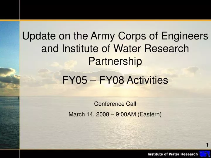
Update on the Army Corps of Engineers and Institute of Water Research Partnership FY05 – FY08 Activities Conference Call March 14, 2008 – 9:00AM (Eastern). Army Corps of Engineers (ACOE) Jan Miller Lakes & Rivers Division Tony Friona Buffalo District

E N D
Update on the Army Corps of Engineers and Institute of Water Research Partnership FY05 – FY08 Activities Conference Call March 14, 2008 – 9:00AM (Eastern)
Army Corps of Engineers (ACOE) • Jan Miller Lakes & Rivers Division • Tony Friona Buffalo District • David Bucaro Chicago District • Jim Selegean Detroit District • Institute of Water Research (IWR) • Jon Bartholic • Yi Shi • Saichon Seedang • Pam Hunt • Glenn O'Neil • Jeremiah Asher • National Association of Conservation Districts (NACD) • Tom Middleton • Department of Environmental Quality (DEQ) • Bob DayDepartment of Environmental Quality, • Water Bureau, • Surface Water Assessment Section, • Nonpoint Source Unit • Michigan Department of Agriculture (MDA) • Mark Swartz Resource Conservation Section Manager, • Environmental Stewardship Division • Resource, Conservation & Development • Kristine Foight Executive Director, • Clinton Conservation Department • Soil and Water Conservation Society • Daniel F. Kesselring President, Michigan Chapter • Wetlands and Coastal Resources • Tom Bennett Senior Coastal Specialist • Natural Resources Conservation Service (USDA-NCRS) • Kevin Wickey Asst State Conservationist • Great Lakes Commission – • Gary Overmier Project Manager, Resource Management • USDA - Natural Resources Conservation Service • Steve Davis Year 1, task 1: Develop and empower an advisory group. • First meeting of the Advisory team (April 13, 2006) • Advisory team development (Ref. List of team members)
Year 1, task 2: Develop and use simple screening tools to locate potential sediment contributing areas in a watershed. • Tested calculating RUSLE for an entire watershed in a GIS gridded environment. Gridded RUSLE data Tested areas
SEDMOD Land Cover Surface Roughness Delivery Ratio Soil Texture Weighting Soil Clay Content Estimated Potential Sediment LoadingContributed from Cropland (tons/yr.) Distance to Stream DEM Sediment Yield LS Factor C Factor Landuse/Tillage K Factor Soil Erosion Soil Erodibility R Factor Rainfall P Factor Support Practice RUSLE Year 1, task 3: Develop and use watershed-based sediment modeling tools to conduct detailed studies on the high risk areas spotted in Task 2 and test the system on four different 8-digit watersheds. • Conducted erosion and sediment analyses for the entire Great Lakes Basin at 90-meter (30-meter in some areas) resolution using SEDMOD and RUSLE. • Began 10-meter resolution analyses of four 8-digit watershed watersheds in the Great Lakes Basin: the Lower Maumee (04100009), the Auglaize (04100007), Calumet-Galien (04040001), and the Maple (04050005).
Year 1, task 4: Review economic information of BMPs from landowners and begin to develop policy tools that can be used with sediment risk maps. • Reviewed conservation programs and existing BMPs implemented at farm level (e.g. several discussions with NRCS staff, advisory team members, conservation district staff, Great Lakes commission staff, etc.) • Reviewed BMP costs (e.g. EQUIP payment) and BMP effectiveness results from the estimation of previous model simulation scenarios from RUSLE/SEDMOD (Ref. Ouyang et al 2005; Kerr et al 2004) • http://www.hydra.iwr.msu.edu/iwr/cv/proposals/publications/documents/Assessing%20Sediment%20Loading2005.pdf
From Year 1 to Year 2 Year 1 provided us with the core technical knowledge and experience to explore advanced refinements of the erosion and sediment models (e.g. working with finer resolution data and richer model inputs). In Year 2 these refinements were facilitated by partnerships with local conservation districts and on-the-ground evaluations.
Year 2, task 1: Continue interactions with the advisory team and provide written summaries of their comments and evaluations . • Second advisory team meeting (October 16, 2007) provided first-hand demonstration and computer exercise of the web-tool components (e.g. DW, Burn Ditch and Trail Creek decision tool models, and introduction of the HIT web-based system to the advisory team (Ref. http://35.9.116.206/hit/hit.asp) • Evaluations and summary inputs and outcomes: • http://www.iwr.msu.edu/corp-outreach/RESULTS_ACoE SurveyOct06.pdf
Year 2, task 2: Implement design documents from Year 1 and produce preliminary 3-D visualization and 2-D improved web mapping software. • Developed 3-D DEM visualization for 8 digit watersheds.
Year 2, task 2: Implement design documents from Year 1 and produce preliminary 3-D visualization and 2-D improved web mapping software. • Developed Linkage to Google Earth for 3-D watershed visualization in GE.
Year 2, task 2: Implement design documents from Year 1 and produce preliminary 3-D visualization and 2-D improved web mapping software. • Developed new search entry for 2-D watershed web mapping so users can locate 8-digit watershed by HUC code and name.
Year 2, task 2: Implement design documents from Year 1 and produce preliminary 3-D visualization and 2-D improved web mapping software. • Developed new Google style address search entry for 2-D watershed web mapping. • Improved 2-D web mapping system stability.
Year 2, task 3: Develop a web-accessible High Impact Tools (HIT) system with reporting functionality plus an assessment of the cookbook and education modules for use in the field. • Developed on-line HIT system to allow users to analyze sediment and erosion data, and view high-risk areas spatially for selected watersheds.
Year 2, task 3: Develop a web-accessible High Impact Tools (HIT) system with reporting functionality plus an assessment of the cookbook and education modules for use in the field. • Developed on-line HIT system to allow users to analyze sediment and erosion data, and view high-risk areas spatially for selected watersheds.
Year 2, task 3: Develop a web-accessible High Impact Tools (HIT) system with reporting functionality plus an assessment of the cookbook and education modules for use in the field. • System is being utilized by local conservation districts (Clinton, Huron, and Lenawee in Michigan) • Still refining the system based on user feedback, therefore education modules have not yet been implemented
Year 2, task 3: Develop a web-accessible High Impact Tools (HIT) system with reporting functionality plus an assessment of the cookbook and education modules for use in the field. • Conducted thorough on-the ground evaluation of system’s prediction of high-risk areas in three watersheds (about 70% success rate)
Year 2, task 3: Develop a web-accessible High Impact Tools (HIT) system with reporting functionality plus an assessment of the cookbook and education modules for use in the field. • Conducted initial comparisons to monitoring data from Heidelberg College (NW Ohio). • More detailed comparisons are being conducted in the Kalamazoo River Watershed with Kellogg Biological Station monitoring data.
Year 2, task 4: Continue development with a more detailed perspective ofintegrating BMP utilization, examples of specific zoning ordinances, and an analysis of economic trade-offs. • Incorporated selected BMPs and costs into the HIT system and allowed a resource manger to evaluate benefits and costs of selected BMPs for their sediment reduction management BMP cost/benefit data BMP costs can be recalculated on-the-fly
Year 2, task 4: Continue development with a more detailed perspective ofintegrating BMP utilization, examples of specific zoning ordinances, and an analysis of economic trade-offs. • Provided guidance and discussion with several soil conservation agencies and local planners (e.g. conservation district staff, drain commissioners, etc.) on how high impact targeting can be incorporated into their local planning in concern areas such as floodplain, wetlands
Year 2, task 5: Initiate data gathering for ten watershed studies needed to conduct the analysis of high risk sediment contributing areas and related infrastructure. • Prioritized Great Lakes Basin watersheds by percent agriculture, predicted Phosphorus loading, and percent agriculture on steep slopes using ATtILA (Analytical Tools Interface for Landscape Assessments). • Prioritized Great Lakes Basin watersheds by predicted upstream accumulated sediment, essentially a potential ranking of harbors by predicted sediment. • Working with USACE for selection of 10 watersheds.
From Year 2 to Year 3 The Year 2 modeling and system refinements, resulting from inputs from our conservation district partners and on-the-ground evaluations, provided us with a framework for expanding these efforts across the Great Lakes Basin in Year 3 and beyond.
Year 3, Task1: Continue general development of web-based tools applicable throughout the Great Lakes Basin. Continue development of models for smaller tributaries and sub-watersheds beginning with one tributary in each of four states: MI, WI, OH and NY. Create three general categories of web-based modeling portals targeted for very specific users and /or specific watershed or land-use types. Apply tools to 10 tributaries and evaluate the sub-watersheds for erosion potential with some limited consideration of existing BMP utilization. Continue development of a web-based tool for general application in the region, in cooperation with Purdue and other state universities.
Year 3, task 2: Aggressively pursue identifying and assessing trends or issues that may impact overall program objectives. • Research paper (in progress) on applications of web-based sediment modeling tools that can help harbor communities manage their sediment (e.g. governance trading)
Year 3, task 3: Maintain and enhance partnerships with regional organizations and programs related to soil conservation and non-point source pollution prevention. • Partner with Great Lakes Committee of National Association of Conservation Districts • Presented HIT at MACD (Michigan Association of Conservation Districts) conference December 2007. • Work with the GLC (in progress) • Presented at Soil and Water Conservation “Planning for Extremes” Workshop (Milwaukee, WI)
Year 3, task 4: Continue interactions with the advisory team enhanced with more region-wide representation. Hold two detailed meetings with the extended advisory team. • Additional discussion/guidance needed
Goals for the Future • Continue to pursue goal of basin-wide sediment analysis system • Continue enhancements to SEDMOD and RUSLE Distance to Stream Network Previously had taken hours if not days to complete and yield map at right.
Goals for the Future • Continue to pursue goal of basin-wide sediment analysis system • Establish baseline analysis for each 8-digit HUC in the Great Lakes Basin • Open dialogue and create partnerships with local conservation districts to facilitate use of the system and on-the-ground implementation of conservation practices • Explore modeling of additional BMPs in selected locations • Continue watershed governance efforts