Download
1 / 14
140 likes | 326 Views
Oracle Spatial. Extension of the RDBMS Oracle by spatial data types and operations introduced in version 8 (current version is 10G Release 2) is based on the object relational extensions of Oracle user defined data types and object classes is possible

E N D
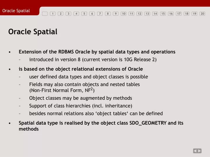
Oracle Spatial • Extension of the RDBMS Oracle by spatial data types and operations • introduced in version 8 (current version is 10G Release 2) • is based on the object relational extensions of Oracle • user defined data types and object classes is possible • Fields may also contain objects and nested tables (Non-First Normal Form, NF2) • Object classes may be augmented by methods • Support of class hierarchies (incl. inheritance) • besides normal relations also ‘object tables‘ can be defined • Spatial data type is realised by the object class SDO_GEOMETRY and its methods
Features of Oracle Spatial 10G (I) • Representation of 0-2 dimensional geometric and topological primitives, complexes, and aggregates • Coordinate values can have 2-4 dimensions • Representation of 3D objects is possible • allerdings keine Konzepte für Volumina enthalten: keine 3D-Topologie; keine dreidimensionalen Funktionen und Operatoren • pragmatisches Vorgehen: Speicherung der Boundary Representation eines 3D-Objekts als Flächenaggregat mit 3D-Koordinatenwerten • Geometric and topological functions (only for 2D coordinates) • among others: Egenhofer-relations and 2D CSG operations • Spatial indexing using R-Trees (2D-4D) and Quadtrees (2D) • especially important for spatial joins
Features of Oracle Spatial 10G (II) • Coordinate Reference Systems (CRS) within the DB • geodetic and projective CRS • linear referencing systems (e.g. for street networks or hydrography) • methods for coordinate transformations are included within the DB • Graph algorithms for network analyses (shortest paths, maximum flows) • Functions for spatial analysis • clustering • Geocoding of spatial data • e.g. association of addresses and coordinates • Representation of regular grids of (nearly) arbitrary size (GeoRaster) • each raster cell can hold a n-dimensional vector of values • GeoRaster are georeferenced • efficient access methods (e.g. retrieval of a specific rectangular area)
Spatial Datatype in Oracle: SDO_GEOMETRY • Object class, that is defined within the Oracle user accound MDSYS • Access or referencing: MDSYS.SDO_GEOMETRY Attributes of class SDO_GEOMETRY: • SDO_GTYPE NUMBER • Geometry type (e.g. 2003 = Polygon with two-dimensional coordinates) • SDO_SRID NUMBER • Identifier (ID) of the spatial reference system within the DB • SDO_POINT MDSYS.SDO_POINT_TYPE • Point geometry • SDO_ELEM_INFO MDSYS.SDO_ELEM_INFO_ARRAY • Structure and interpretation of the coordinate list • SDO_ORDINATES MDSYS.SDO_ORDINATE_ARRAY • List of coordinates (cf. ‘Spaghetti‘ representation)
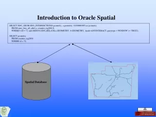
Example for a Table with a Spatial Attribute CREATE TABLE TabWithGeometry ( ID NUMBER(8), DESCRIPTION VARCHAR2(30), GEOMETRY MDSYS.SDO_GEOMETRY);
Geometry Types • All geometries may have 2-4D coordinates • Polygons can have holes • Besides, there also exist aggregates, in which geometries of the same type or of mixed type can be contained, e.g.: • MultiPoint • MultiPolygon • MultiGeometry
Geometry Metadata • Any column of type SDO_GEOMETRY must be explicitly registered within the DBMS • Ensures automatic updating of spatial indices • Naming of coordinate axes and restriction of value domains • Definition of a tolerance value for spatial queries and operations • System tables for the storage and query of geometry metadata • USER_SDO_GEOM_METADATA • Metadata for all spatial attributes of the current user • ALL_SDO_GEOM_METADATA • Metadata for all spatial attributes of the whole database (of all user accounts) with read permission for the current user • DBA_SDO_GEOM_METADATA • Metadata for all spatial attributes of the whole database (of all user accounts); only accessible by database administrators
USER_SDO_GEOM_METADATA For any column of type SDO_GEOMETRY a row has to be inserted into USER_SDO_GEOM_METADATA. Attributes: • TABLE_NAME VARCHAR2(32) • Name of the table containing the column of type SDO_GEOMETRY • COLUMN_NAME VARCHAR2(32) • Name of the column containing the SDO_GEOMETRY • DIMINFO MDSYS.SDO_DIM_ARRAY • Identifier, extent, and tolerance of each dimension. Here, objects from the class MDSYS.SDO_DIM_ARRAY have to be specified. • SRID NUMBER • ID of the spatial reference system (foreign key referring to the system table MDSYS.CS_SRS). If unknown or undefined, enter NULL value.
SDO_DIM_ARRAY • SDO_DIM_ARRAY consists of one SDO_DIM_ELEMENT per dimension of the coordinate values of the geometry Structure of SDO_DIM_ELEMENT: • SDO_DIMNAME VARCHAR2(64) • Identifier (name) of the dimension; e.g. ‘easting‘ or ‘latitude‘ • SDO_LB NUMBER • Minimum coordinate value of that dimension • SDO_UB NUMBER • Maximum coordinate value of that dimension • SDO_TOLERANCE NUMBER • minimal distance up to which two coordinate values are considered as being equal
Continuation of the Example: Creation of Metadata INSERT INTO USER_SDO_GEOM_METADATA (TABLE_NAME, COLUMN_NAME, DIMINFO, SRID) VALUES(‘TabWithGeometry‘, ‘Geometry‘, MDSYS.SDO_DIM_ARRAY( MDSYS.SDO_DIM_ELEMENT(‘X‘, -180.0, 180.0, 0.00000005), MDSYS.SDO_DIM_ELEMENT(‘Y‘, -90.0, 90.0, 0.00000005) ), null );
SDO_GTYPE Spatial refe-rence system SDO_ELEM_INFO SDO_ORDINATES Insertion of Spatial Data (I) INSERT INTO TabWithGeometry VALUES (1, ‘A simple point‘, MDSYS.SDO_GEOMETRY(2001, NULL, MDSYS.SDO_POINT_TYPE(10,11,NULL), NULL, NULL) ); inserts a tuple with a point object at coordinates (10,11) into the table.
Point in theWell-Known-Text format Constructor of the class SDO_GEOMETRY creates from Well-Known-Text geometries corresponding Oracle Spatial geometries Insertion of Spatial Data (II) INSERT INTO TabWithGeometry VALUES (1, ‘A simple point‘, MDSYS.SDO_GEOMETRY(‘POINT(10 11)‘) ); inserts a tuple with a point object at coordinates (10,11) into the table. Same example as before, but for the specification of the geometry object the Well-Known-Text format (WKT) is used (cf. lecture 8, slide 16)
SDO_GTYPE: Polygon Spatial refe- rence system 1st coordinate starts at 1st position; outer ring; straight line segments It is not a simple point! 5 coordinate pairs define the closed ring; the last pair has to match the first pair Insertion of Spatial Data (III) INSERT INTO TabWithGeometry VALUES (2, ‘A polygon‘, MDSYS.SDO_GEOMETRY(2003, NULL, NULL, MDSYS.SDO_ELEM_INFO(1,1003,1), MDSYS.SDO_ORDINATES(9,9, 12,9, 12,10, 9,10, 9,9) ) ); inserts a tuple with a polygon into the table.
SDO_GTYPE: Polygon Spatial refe- rence system 1st coordinate starts at 1st position; outer ring; straight line segments It is not a simple point! 1st coordinate begins at 11th position; inner ring; straight line segments The first 5 coordinate pairs define the outer ring; the following 4 the inner ring Insertion of Spatial Data (IV) INSERT INTO TabWithGeometry VALUES (3, ‘Polygon with hole‘, MDSYS.SDO_GEOMETRY(2003, NULL, NULL, MDSYS.SDO_ELEM_INFO(1,1003,1, 11,2003,1), MDSYS.SDO_ORDINATES(9,9, 12,9, 12,10, 9,10, 9,9, 10,10, 10.5,10.5, 11,10, 10,10) ) ); inserts a polygon (rectangle) with (triangular) hole into the table.