Download
1 / 23
230 likes | 328 Views
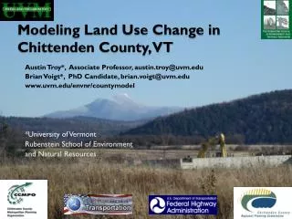
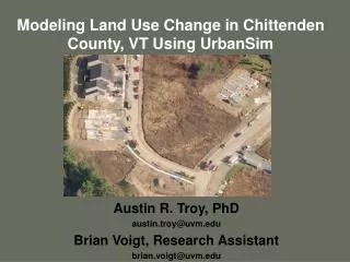
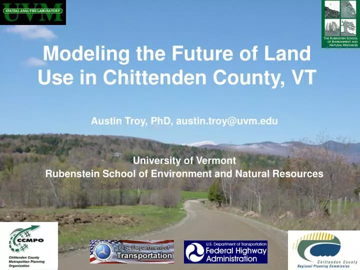
Modeling the Future of Land Use in Chittenden County, VT. Austin Troy, PhD, austin.troy@uvm.edu University of Vermont Rubenstein School of Environment and Natural Resources. Collaborators and Funders. Graduate researchers: Brian Voigt, Alexandra Reiss, Brian Miles

E N D
Modeling the Future of Land Use in Chittenden County, VT Austin Troy, PhD, austin.troy@uvm.edu University of Vermont Rubenstein School of Environment and Natural Resources
Collaborators and Funders • Graduate researchers: Brian Voigt, Alexandra Reiss, Brian Miles • Current funder: US DOT Federal Highway Administration, • Previous funders: US EPA, MacIntire Stennis Program, Northeastern States Research Cooperative • UVM Collaborators: Breck Bowden, Jon Erickson, David Capen, Alexei Voinov • UVM Spatial Analysis Lab and Rubenstein School of Environment • Collaborating organizations: • Chittenden County Regional Planning Commission • Chittenden County Metropolitan Planning Organization • Resource Systems Groups, Inc, White River Junction, VT • University of Washington Center for Urban Simulation and Policy Analysis: Paul Waddell, David Socha, many others
What are the trends in land use and transportation in Chittenden County?
Shelburne road, circa 1937 And in 2003
Spear St. Dorset St. So. Burlington, 1937
Spear St. Dorset St. So. Burlington, 2003
Project: “Dynamic land use and transportation modeling” • Purpose: to simulate future land use and environmental impact in Chittenden County under baseline and alternative scenarios • Tools: UrbanSim and TransCAD + original modules
Research Questions • What will land use patterns in Chittenden County look like in 20-30 years under current and basline conditions? • What effect will future urban development patterns have on the environment • How might these outcomes change?
UrbanSim • Complex land use model • Integrated with TransCAD • Dynamic • “Disequilibrium” • Modular • Simulates behavior of “agents” • Based on relationships observed in past
UrbanSim: Sectors • Residential • Commercial/ employment • Transportation
UrbanSim: Submodels • land price • accessibility –derived from TransCAD • economic transition – distribution of jobs through employment sectors • demographic transition – distribution of households by type over time • employment and household mobility • employment and household location • real estate development
Looks at individual households Block Group: 500070011002 Grid_ID:23674 HSHLD_ID: 23 AGE_OF_HEAD: 42 INCOME: $65,000 Workers: 1 KIDS: 3 CARS: 4
Block Group: 500070011001 Grid_ID: 59736 Employment_ID: 413 Sector: 7 Employees: 2 Block Group: 500070011001 Grid_ID: 60211 Employment_ID: 427 Sector: 2 Employees: 135 …and individual employers
4 Step Travel Demand model: TransCAD • trip generation: quantify incoming & outgoing travel by zone • trip distribution: assign trips to zones • modal split: estimates trips by mode for each zone • traffic assignment: identifies trip route
Models changes to housing and employment • Abandonment • Moves • Development • Based on supply and demand
Parcel ID: 043000200 Year: 1930 Driven by empirical trends
Environment sub-modules • Working on developing sub-models that take output from UrbanSim to estimate environmental impacts on landscape • Modeling water quality/ watershed impairment/ nutrient output based on development intensity (Breck Bowden) • Modeling habitat fragmentation and associated wildlife impacts (David Capen)
Alternative Scenarios • What happens to outputs if we change some of the inputs and assumptions? • This is a way to model the potential impacts of proposed policies and investments, and anticipated events • More detail on this after questions
Project timeline • Nearing completion of database development • Next two months: statistical analysis to develop model coefficients • February 2007: run baseline model and validate • March-November 2007: run scenarios • December 2007: followup meeting
Purpose of this Workshop • We: • Present the model and the project purpose • Present sample scenarios • Discuss technical limitations of certain scenarios • You: • Identify critical scenarios that policy makers and other stakeholders would like to model • Define details and specifics of scenarios • Prioritize scenarios • Present us with a set of recommendations
Purpose of this Workshop • We will take recommendations from this workshop and perform as many as possible, based on technical difficulty and time requirements • We will post results on the web site as they become available • Follow up meeting in about one year to present completed results of scenarios
Agenda • 9-9:15: opening presentation • 9:15-9:30: questions on the project and model • 9:30-9:45: presentation on alternative scenarios • 9:45-10:00: general feedback on scenarios • 10:00-10:10: break • 10:10-11:00: breakout sessions • 11:00-11:15: presentations by group leaders • 11:15-11:30: dot voting and wrapup