Download
1 / 43
460 likes | 477 Views
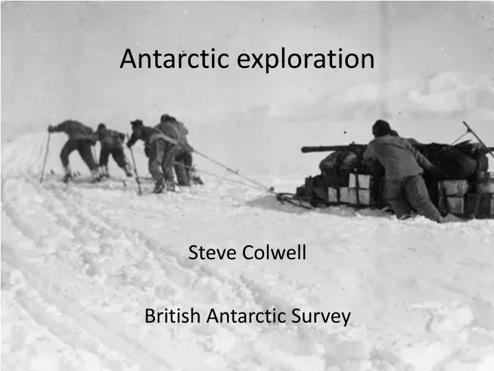
Antarctic exploration. Steve Colwell British Antarctic Survey. Origins of Terra Australis.

E N D
Antarctic exploration Steve Colwell British Antarctic Survey
Origins of Terra Australis • Legends of Terra Australis —an "unknown land of the South"—date back to Roman times and before, and were commonplace in medieval geography, although not based on any documented knowledge of the continent. • The notion of Terra Australis was introduced by Aristotle, who simply declared that "...there must be a region bearing the same relation to the southern pole as the place we live in bears to our pole...". His ideas were later expanded by Ptolemy (1st century AD), who believed that the Indian Ocean was enclosed on the south by land, and that the lands of the Northern Hemisphere should be balanced by land in the south.
The first depiction of Terra Australis on a globe was probably on Johannes Schöner's lost 1523 globe
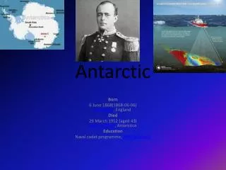
Captain James Cook The second voyage 1772–1775, commissioned by the British government with advice from the Royal Society, was designed to circumnavigate the globe as far south as possible to finally determine whether there was any great southern landmass. On 17 January 1773, Resolution was the first ship to cross the Antarctic Circle. Cook undertook a series of vast sweeps across the Pacific, finally proving there was no Terra Australis by sailing over most of its predicted locations and predicted that an Antarctic land would be found beyond the ice barrier. 1728 -1779
Fabian Gottlieb von Bellingshausen Emperor Alexander I authorized an expedition to the south polar region in 1819, the authorities selected Bellingshausen to lead it as an experienced captain and explorer, and a prominent cartographer. The expedition was intended to explore the Southern Ocean and to find land in the proximity of the South Pole. Leaving Portsmouth on 5 September 1819 the expedition crossed the Antarctic Circle on 26 January 1820. On 28 January 1820 the expedition discovered the Antarctic mainland. During the voyage Bellingshausen discovered and named Peter I, Zavodovski, Leskov and Visokoi Islands, and a peninsula of the Antarctic mainland which he named the Alexander Coast but which is now known as Alexander Island.
Heroic Age of Antarctic Exploration • 1897–99 Belgian Antarctic Expedition • This was the first expedition to overwinter within the Antarctic Circle, after the ship was icebound in the Bellingshausen Sea. It collected the first annual cycle of Antarctic meteorological observations. • 1898–1900 British Antarctic Expedition (Southern Cross Expedition) • The first expedition to overwinter on the Antarctic mainland (Cape Adare), it was the first to make use of dogs and sledges. • It made the first ascent of The Great Ice Barrier, and set a Farthest South record at 78°30'S. It also calculated the location of the South Magnetic Pole. • 1901–04 National Antarctic Expedition • It made the first ascent of the Western Mountains in Victoria Land, and discovered the polar plateau. Its southern journey set a new Farthest South record, 82°17'S. • 1901–03 First German Antarctic Expedition • The first expedition to investigate eastern Antarctica • 1902–04 Scottish National Antarctic Expedition • The permanent Orcadas weather station in South Orkney Islands was established, this data record is continuous up to the present day. • The Weddell Sea was penetrated to 74°01'S, and the coastline of Coats Land was discovered, defining the sea's eastern limits. • 1907–09 British Antarctic Expedition (Nimrod Expedition) • The first expedition led by Shackleton. Based in McMurdo Sound, it pioneered the Beardmore Glacier route toward the South Pole, and the (limited) use of motorised transport. Its southern march reached 88°23'S, a new Farthest South record 97 geographical miles from the Pole. • The Northern Party reached the location of the South Magnetic Pole. • 1910–12 Amundsen's South Pole expedition • First to the South Pole: He discovered a new route to the polar plateau via the Axel Heiberg Glacier. A party of five led by Amundsen reached the South Pole via this route on 14 December 1911. • 1910–13 British Antarctic Expedition 1910 (Terra Nova Expedition) • Scott's last expedition: Scott and four companions reached the South Pole via the Beardmore route on 17 January 1912, 33 days after Amundsen. All five died on the return journey from the Pole, through a combination of starvation and cold.
Heroic Age of Antarctic Exploration • 1911–13 Second German Antarctic Expedition • The objective was the first crossing of Antarctica. The expedition made the southernmost Weddell Sea penetration to date, reaching 77°45'S. • It failed to establish a shore base from which to mount its transcontinental march, and after a long drift in the Weddell Sea pack ice it returned to South Georgia. • 1911–14 Australasian Antarctic Expedition • The expedition concentrated on the stretch of Antarctic coastline between Cape Adare and Mount Gauss, carrying out mapping and survey work on coastal and inland territories. • 1914- 17 Imperial Trans-Antarctic Expedition • Another transcontinental crossing attempt. It failed to land the Weddell Sea shore party after Endurance was trapped and crushed in ice.
1940’s and 1950’s Operation Tabarin was a World War II military undertaking by the Admiralty and the Colonial Office in 1943 to establish a permanent British presence in the Antarctic. The bases built were the first ever to be constructed in Antarctica. Bases were established during February on Deception Island at Port Lockroy and at Hope Bay. The International Geophysical Year (IGY) was an international scientific project that lasted from July 1, 1957, to December 31, 1958. This saw the establishment of year round research stations in Antarctic many of which are still operating today. The IGY encompassed eleven Earth sciences which included: aurora, cosmic rays, geomagnetism, gravity, ionospheric physics, meteorology, seismology and solar activity. Antarctica is an ideal place for measuring these.
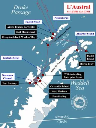
Antarctic tourism • Tourism in Antarctica started with sea tourism in the 1960s and now over 30,000 tourists visit Antarctic each Antarctic summer season November to March. • Most tourist join ships in South America and then sail down the Antarctic Peninsula. • International Association of Antarctic Tour Operators (IAATO) is an international organization, comprised of more than 100 companies and organizations. • To advocate and promote the practice of safe and environmentally responsible travel to the Antarctic. • Members are to subscribe to the principle that their planned activities will have no more than a minor or transitory impact on the Antarctic environment. • To enhance public awareness and concern for the conservation of the Antarctic environment • To support science in Antarctica through cooperation with national Antarctic programs, including logistical support and research. • Adventure Network International (ANI) has a summer station at Union Glacier where there is a blue ice runway allowing planes to fly directly from Punta Arenas in Chile.
Union Glacier Mount Vinson 4,892 metres (16,050 ft)
MV Explorer 23 November 2007 The ship hit an iceberg in the early hours of the morning and a mayday call was put out at 04:24 UTC this was responded to very quickly. Rescue operations were quickly coordinated by the Argentines and the Chlileans. Chile dispatched the icebreaker Almirante Viel, and nearby commercial ships responded including the MN Ushuaia, the National Geographic Endeavor, and the Norwegian Coastal Express ship MS Nordnorge which was operating as a passenger cruise ship at the time. By 07:30 UTC, all 91 passengers, 9 guides and 54 crew, from over 14 countries, were evacuated and had taken to the Explorer's lifeboats. The evacuees drifted for 5 hours until they were picked up by the Norwegian ship MS Nordnorge which arrived on scene at approximately 10:00 UTC.
Science exploration Several countries claim territory in Antarctica but under the terms of the Antarctic treaty all claims are frozen so people can go anywhere to do scientific research. Antarctica is a vast continent and is over 50 times the size of the UK so large scale research or surveying projects tend to be collaborations between several countries. The Antarctic treaty states that any data collecting in Antarctica must be made freely available for anyone who asks for it.
Long term in-situ datasets The ozone data collect at BAS stations since 1957 lead to the discovery of the hole in the ozone layer in the mid 1980’s by BAS scientists Joe Farman, Brian Gardiner and Jon Shanklin. This then led to the signing of the Montreal Protocol. Long term meteorological datasets allow us to look at the changes in temperature on and above Antarctica over the last 50 – 60 years.
Long term in-situ datasets The clean air facility (CASlab) at Halley is used for making many continuous atmosphere chemistry measurements. Halley station is a WMO Global Atmosphere Watch (GAW) global station one of only 30 around the world. Antarctica is an idea location for looking at atmospheric chemistry background measurements.