Download
1 / 34
340 likes | 344 Views
International Oceanographic Organisation: JCOMM GOOS GLOSS. Philip L. Woodworth Permanent Service for Mean Sea Level.

E N D
International Oceanographic Organisation: JCOMM GOOS GLOSS Philip L. Woodworth Permanent Service for Mean Sea Level
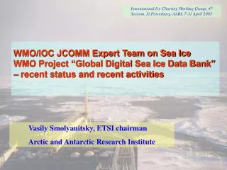
In 2001 the Intergovernmental Oceanographic Commission (IOC) and the World Meteorological Organisation (WMO) merged a number of their marine activities into a new Joint Technical Commission for Oceanography and Marine Meteorology (JCOMM) in order to best address the requirements being placed on both agencies for global observing programmes, in particular the Global Ocean Observing System (GOOS). JCOMM can be thought of as the implementation arm of GOOS. GOOS, the Global Terrestrial Observing System (GTOS) and the Global Climate Observing System (GCOS) make up what is called the G3OS of global observing programmes.
The Futureof Operational Oceanography Co-Presidents: Savi Narayanan, Johannes Guddal JOINT WMO/IOC TECHNICAL COMMISSION FOR OCEANOGRAPHY AND MARINE METEOROLOGY (JCOMM)
The Vision of JCOMM • Integrated ocean observing system • Integrated data management • State-of-the-art technologies and capabilities • New products and services • User responsiveness and interaction • Involvement of all maritime countries
Management Comm. Management Committee 2 Copresidents 4 PA coordinators Reps. of Scientific Bodies 1 or 2 others 2 Copresidents 4 PA coordinators Reps. of Scientific Bodies OBS Coord Group Chair, OBS Coord. Rapporteurs Satellite Expert . 1 or 2 others DM Coordination Group Chair, DM Coord Rapporteurs . CB Coord . Group Chair, CB Coord Rapporteurs . PA PA PA PA SERV Coord . Group Chair, SERV Coord. Observations Services Data Management Capacity Building PA Observations PA Services PA Capacity Building PA Data Management OBS Coord . Group DM Coordination CB Coord . Group Chair, OBS Coord. Group SERV Coord . Group Chair, CB Coord. Rapporteurs Chair, DM Coord. Ship Obs.Team Data Buoy Obs. Team Link to Argo Team Sea Level Obs.Teaml Chair, SERV Coord. Rapporteurs Satellite Expert Rapporteurs Expert team Maritime Safety Services Expert Team Waves/Surges Expert Team Sea Ice Rapporteurs Data Buoy Ship Link to Argo Sea Level Task Team Point of Contact / Obs. Team Obs.Team Team Obs.Team Resources User Forums Task Team Resources Point of Contact / User Forums Expert Team Data Mgt Practices ASAPP Expert Team Marine Climatology Expert Team Marine ET on Data Mgt Practices . ASAPP Climatology . Expert team Expert Team Expert Team Maritime Safety Rapporteurs Sea Ice Waves/Surges Services SOOPIP SOOPIP Editor, JCOMM Products Bulletin VOS Editor, JCOMM Rapporteur Products Bulletin MPERSS Rapporteur MPERSS VOS JCOMM STRUCTURE
Ship observations ASAP Sea level Drifting buoy Argo Moorings Integrated Observing System
Where are we now • 5000 VOS observing meteorology • 120 vessels observing subsurface T&S • 1400 drifters observing meteorology • 100’s of ocean buoys for met & ocean • 300 GLOSS • Argo • Sea Ice • Satellite
Required improvements • Ship based obs • DBCP • Argo • GLOSS • TIP
Maritime Safety Pollution response Oceanographic Sea Ice information Waves and surges Services
Build Infrastructure Education Training Capacity Building
Where are we going? • Status • GOOS Capacity Building Strategy and Implementation Plans • JCOMM Capacity Building Strategy • Each JCOMM element has identified the need for Capacity building • IOC programs have similar needs • Parallel efforts under other international programs, such as POGO CB needs financial and institutional support
Integrated Data Management IODE & WDCs WMO Industry JCOMM GOSIC ICES Navies FAO Institutions/Universities Regional GOOS Centers
Products • JCOMM Portal (http://ioc.unesco.org/jcomm/)
Products(… ) • JCOMMOPS(http://www.jcommops.org)
Products(… ) • Electronic Bulletin(http://iri.ldeo.columbia.edu/climate/monitoring/ipb/)
GOOS IS • A SUSTAINED, COORDINATED INTERNATIONAL SYSTEM FOR: • GATHERING AND PROCESSING DATA ABOUT THE OCEANS AND SEAS • GENERATING USEFUL PRODUCTS AND SERVICES INCLUDING ACCURATE DESCRIPTIONS OF PRESENT CONDITIONS AND FORECASTS OF FUTURE CONDITIONS • CREATING LONG TERM DATA SETS • PRE-OPERATIONAL RESEARCH AND DEVELOPMENT FOR NEW AND IMPROVED PRODUCTS AND SERVICES
MEETING THE NEEDS OF CONVENTIONS • CLIMATE CHANGE • BIODIVERSITY • LAW OF THE SEA • PROTECT FROM LAND BASED POLLUTION • AGENDA 21 • LONDON DUMPING CONVENTION • HIGHLY MIGRATORY & STRADDLING STOCKS • REGIONAL SEAS
GOOS ACTIVITIES • DATA COLLECTING • DATA AND INFORMATION MANAGEMENT • DATA ANALYSIS, PREPARATION AND DISSEMINATION OF PRODUCTS • NUMERICAL MODELLING AND FORECASTING • TRAINING, TECHNICAL ASSISTANCE AND TECHNOLOGY TRANSFER • ENABLING RESEARCH
TYPICAL PRODUCTS • FORECASTS OF CHANGE IN WATER LEVEL • POSITIONS & STRENGTHS OF CURRENTS • OCCURRENCE OF UNUSUALLY HIGH WAVES • EXTENT OF SEA ICE • INCIDENCE OF HARMFUL ALGAL BLOOMS • VULNERABILITY OF FISH STOCKS AND FARMS • RAINFALL PREDICTIONS IN DRY AREAS • LENGTH AND COLDNESS OF WINTERS • LIKELIHOOD OF DISEASE OUTBREAKS
BENEFITS – IMPROVEMENTS IN • FORECASTS (Of WIND, WAVES,SEA-ICE) • WARNINGS OF STORMS; HIGH WAVES; SURGES • MANAGEMENT OF PORTS AND HARBOURS • OPTIMISING OFFSHORE DESIGN & OPERATIONS • SHIP ROUTING; MARINE RECREATION • DETECTION OF POOR WATER QUALITY • MANAGING FISHERIES & AQUACULTURE • CLIMATE FORECASTS • RAIN AND TEMPERATURE FORECASTS (FOR AGRICULTURE, ENERGY, WATER INDUSTRIES) • PREPARING FOR EPIDEMICS (MALARIA)
USERS AND CUSTOMERS • GOVERNMENT AGENCIES • ENVIRONMENT MANAGERS • OPERATING SERVICES (SAFETY, NAVIGATION, PORTS, PILOTS, SEARCH AND RESCUE) • INDUSTRY (OIL AND GAS, SURVEYING, CONSTRUCTION, SHIPPPING, FISHERIES, DREDGING) • SMALL COMPANIES (AQUACULTURE, TRAWLERS, HOTELS, RECREATION MANAGERS) • SOLE USERS (YACHTSMEN, SURFERS, DIVERS, FISHERMEN, TOURISTS)
DESIGN MODULES • OPEN OCEAN SERVICES AND CLIMATE • COASTS (INCLUDING LIVING MARINE RESOURCES, AND HEALTH OF THE OCEAN) • Note tide gauges (GLOSS) needed in both modules
OPEN OCEAN GOOS DESIGN TO SUPPORT CLIMATE AND WEATHER FORECASTING • SEA SURFACE TEMPERATURE • SEA SURFACE SALINITY • SURFACE WIND • HEAT FLUX AND PRECIPITATION • SEA SURFACE HEIGHT (SEA-LEVEL)<<<< GLOSS • SEA ICE • DISSOLVED CARBON DIOXIDE • UPPER OCEAN TEMPERATURE AND SALINITY
Observing the Tropical Pacific to forecast El Niño/La Niña and their influence on climate
COASTAL SEAS CONCERNS • POPULATION INCREASE [50% LIVE WITHIN 200km, INCREASING TO 66% IN 50 YEARS] • 50% OF WETLANDS SEVERELY DEGRADED • 10-30% CORAL REEFS DEGRADED • EXPLOITATION, WASTE, DESTRUCTION OF REEFS AND MANGROVES INCREASE STRESS ON ECOSYSTEMS • SAFE AND EFFICIENT MANAGEMENT REQUIRES INFORMATION FROM INTEGRATED MONITORING SYSTEMS
COASTAL GOOS GOALS • DETERMINE USER NEEDS • SPECIFY PRODUCTS TO MEET THOSE NEEDS • DETECT AND FILL GAPS IN MONITORING • FIND AND CORRECT INADEQUACIES IN MONITORING • FORM NETWORKS FOR REGIONAL TO GLOBAL COORDINATION AND INTEGRATION OF MONITORING, RESEARCH AND MODELLING • USE NETWORKS TO MONITOR AND PREDICT • DEVELOP DATA AND INFO PLANS
GOOS PILOT PROJECTS • PIRATA (BRAZIL LED) • GLOBAL OCEAN DATA ASSIMILATION EXPERIMENT (GODAE) • ARGO PROFILING FLOAT PROJECT
Regional/National GOOS Global Distribution of Regional GOOS Bodies and National GOOS Committees or Contact Points Euro GOOS and BOOS Black Sea GOOS NEAR GOOS Med GOOS SEA GOOS IOCARIBE GOOS GOOS Africa Pacific GOOS Pacific GOOS Regional GOOS Bodies National GOOS Committees/Contact Points http://ioc.unesco.org/goos/ms/General/nat_GOOS_contacts.htm
ECONOMIC SIGNIFICANCE • MOST INTERNATIONAL TRADE GOES BY SEA • BY 2020 66% OF PEOPLE LIVE NEAR COAST • 20% OF OIL AND GAS COME FROM OFFSHORE • FISH CATCH SUPPLIES 20% OF PROTEIN • MORE THAN 50% OF COASTS ARE DEGRADED • MARINE RESOURCES AVERAGE 3-5% OF GNP • TOTAL MARINE GNP IS $1000 BILLION • 1% IMPROVEMENT WOULD SAVE $10 BILLION • PLUS IMPROVED FOOD, WATER, ENERGY SUPPLY • COST OF GOOS IS AROUND $2 BILLION ($1 BILLION ALREADY INVESTED)
That completes a brief overview of JCOMM and GOOS. GLOSS GLOSS was established in the mid-1980s. And when GOOS was later established, GLOSS became its first (and most important!) component. More on GLOSS in the next lecture.