Download
1 / 11
110 likes | 200 Views
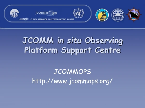
JCOMM in situ Observing Platform Support Centre. JCOMMOPS http://www.jcommops.org/. http://www.jcommops.org/. JCOMMOPS was established by JCOMM to combine international coordination efforts on the following ocean observation programmes:

E N D
JCOMM in situ Observing Platform Support Centre JCOMMOPS http://www.jcommops.org/
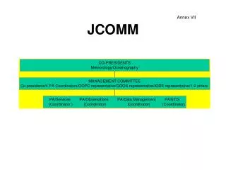
http://www.jcommops.org/ • JCOMMOPS was established by JCOMM to combine international coordination efforts on the following ocean observation programmes: • Data Buoy Cooperation Panel, DBCP (drifting and moored buoys) • Ship Observations Team, SOT (including its 3 panels – SOOPIP, ASAPP, VOS) • Argo, Profiling Float Programme. Data Buoy Cooperation Panel http://www.dbcp.noaa.gov/dbcp/ Argo Information Centre http://argo.jcommops.org/ Ship Observations Team http://www.jcommops.org/sot/
JCOMMOPS • Two Technical Coordinators – Mathieu Belbeoch (Argo) and Hester Viola (DBCP/SOT) • Provide support to programme planning, implementation, monitoring and operations, including: • observational requirements, data flow and data quality • technologies, instrumentation and costs • status of networks (maps, monitoring and analysis) • reporting from a global standpoint • support for platform operators especially with the Global Telecommunications System (GTS) • deployment opportunities (by ship and air) • community information – e.g. News, Meeting information, Contact information and mailing lists
Observational Networks - Maps Live, dynamic & interactive maps e.g. http://w4.jcommops.org/website/GOOS/viewer.htm http://w4.jcommops.org/website/Argo/viewer.htm http://w4.jcommops.org/website/Gloss/viewer.htm Observational Network maps (produced monthly)
Observational Networks - status • Web Mapping interfaces, Geographic Information Systems (GIS) and Google Earth can be used to visualise platform locations and query metadata. • Web Map Services (WMS) are available to “plug in” JCOMMOPS network metadata to existing GIS tools. DBCP network in ESRI ArcMap (Web Map Service) Argo network in Google Earth (.kml file)
JCOMMOPS website • Read news items about International Programmes • Platform Query – view details and locations e.g. based on unique identifier (WMO Number), all platforms owned by a programme/agency, within a geographical area … • View contact details for people or organisations participating in International Programmes • Search for meeting details and documents such as meeting reports or technical papers prepared by JCOMM • View images of platforms, community members or maps • Link to related websites and other information sources
Global Data Quality and Quantity • Weather and ocean data exchanged onto the GTS of WMO • Reporting and analyses on quality of data disseminated onto the GTS • JCOMMOPS collates - how much data is being collected and by which country and agency • Monthly statistics by meteorological centres • Quality Control Relay communication system
JCOMMOPS is a support centre, NOT a data centre • It provides information and metadata – not raw data (available from providers, archives or on the GTS of WMO) • It acts as a gateway/portal to find information on how to obtain data itself, for example: • Links to Meteorological centres and information about operators including contacts, news, meetings, mailing lists, documentation etc • Archived Buoy data and Ship based XBT data • Canadian Marine Environmental Data Services • USA NOAA/National Oceanographic Data Center • Argo Float data • Argo Information Centre http://www.argo.net • US GODAE server • French Coriolis Centre
Benefits for SIMORC/Metocean of working with JCOMM • Wider network of quality control of weather data, if shared onto the GTS • International recognition • Improvements in: • Local forecasting, by filling holes in existing data sets • Large-scale weather forecast models, ocean modelling (currents, waves) • Contribution to: • Long term climate, wave and sea-level modelling • Tests of new technologies and ocean observing platforms e.g. DBCP Iridium Communications Pilot Project, Wave buoys or Hurricane Buoys
Benefits for JCOMM of working with SIMORC/OGP • Improved access to Metocean data in remote areas with unique conditions(if data are shared on the GTS) • Deployment opportunities – directly from installations or from transport/supply boats • Support and resources fromindustry • Clarification of services required by industry
Comments or Questions? • http://www.jcommops.org • Contact Details: Hester ViolaJCOMMOPS8-10, rue HermèsParc Technologique du Canal31526 Ramonville Saint-Agne, FranceTel: +33 5 61 39 47 82Email: viola@jcommops.org