Download
1 / 1
10 likes | 139 Views
EGS-AGU-EUG Joint Assembly , 06 - 11 April 200 3 , Nice France Session G13, Geodesy: Impact of New and Planned Missions Poster No: G13-1WE3P-0673, Poster Area: Esplanade, (09 April, 2003). ENVISAT RA-2 Calibration / Validation.

E N D
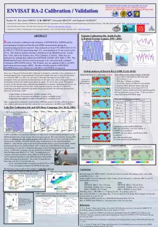
EGS-AGU-EUG Joint Assembly, 06-11 April 2003, Nice France Session G13, Geodesy: Impact of New and Planned Missions Poster No: G13-1WE3P-0673, Poster Area: Esplanade, (09 April, 2003) ENVISAT RA-2 Calibration / Validation Yuchan YI1, Kai-chien CHENG1, C.K. SHUM1,2, Alexander BRAUN2, and Stephan CALMANT3 1 Laboratory for Space Geodesy and Remote Sensing Research, Department of Civil and Environmental Engineering and Geodetic Science, The Ohio State University, USA. http://geodesy.eng.ohio-state.edu 2Byrd Polar Research Center, The Ohio State University, USA. http://www-bprc.mps.ohio-state.edu 3Laboratoire d’Etudes en Geophysique et Oceanographie Spatiales, Centre National d’Etudes Spatiales, France.http://www.ird.nc/ Lake Erie Calibration Site and GPS Buoy Campaign, Oct. 20-21, 2001) OSU Lake Erie Calibration Site at Marblehead Crossover Analysis Envisat-to-Topex relative bias Envisat RA-2 Altimeter SSH in the Great Lakes and in Lake Erie (Cycle 10-12) SSH Comparison between Altimeters (TSB and Jason)and Marblehead Tide Gauge in Lake Erie SSH difference atMarblehead: 38.3 cm Envisat (Cycle 12)minus TG Vanuatu Calibration Site, South Pacific (2 Bottom Pressure Gauges, 1999 - 2001) ABSTRACT Results of absolute calibration and validation of ENVISAT RA-2/MWR and the corresponding Geophysical Data Record (GDR) measurements during the commissioning period are reported. Data analyzed are from UTC 2002/10/4 0:23:36 to 2003/1/13 20:44:01 (processing stage ‘O’), corresponding to 35-day repeat cycles 10-12. The analysis includes absolute calibrations at the Marblehead site, in Lake Erie, USA, and at the Noumea sites, New Caledonia, S. Pacific. Both sites are dedicated for multiple RA calibrations (ENVISAT, JASON, GFO, ERS-2, T/P). The Marblehead site has a NOAA water level gauge to be collocated with a planned Continuous GPS (CGPS) station. The Noumea sites are equipped with in situ GPS, and bottom pressure gauges (BPG). Results of global analysis of ENVISAT RA2/MWR and cross-calibrations with ERS-2 and TOPEX are reported. Global analyses of Envisat RA-2 GDR (Cycle 10-11) Since one of the goals for Envisat RA-2 altimeter is intended to contribute to the continuation of an uninterrupted series of measurements of sea surface height (ssh) and ice-sheet elevation that was started by ERS-1 in 1991, it is necessary to determine the range bias and drift of the instrument, both to provided an absolute reference for the time series and to distinguish between instrumental artifacts and significant geophysical signals. To satisfy these needs, the required accuracy for the absolute range calibration determination is extremely challenging and set at 1 cm in bias error and 1mm/year in bias drift. Such required accuracies can only be achieved by employing an absolute calibration experiment design that includes the following characteristics (Envisat Cal-Val Team, 2000): A large number of measurements to reduce random errors, A diverse suite of measurement techniques to reduce systematic errors, Independent data analyses to reduce susceptibility to systematic errors. Thus, we present the preliminary results include GDR data analysis, absolute calibration from 2 sites, relative calibration in Lake Erie, and global cross-calibration with ERS-2 and TOPEX. Edited Data Plots (Red indicating bad data) Data editing criteria and percentage of bad data 1. fewer than 9 valid high-rate Ku-band range. 2. IB correction > 1 m. 3. SSB_Ku < -800mm or >50mm. 4. Ocean tide solution 1(CSR4.0) is unavailable. 5. Non-zero MCD altimeter surface type flag. 6. Ku-band peakiness not in range of 0.6-5.0. The first 5 criteria should remove the land data and the last one eliminates excessive rain. 73.86 cm offset is removed from the ENVISAT range. Data edit statistics (in percentage) Fewer than 9valid high-rateKu-band ranges IB > 1m SSB out of range Peakinessout of range First 5 criteria(mostly land) Corrections for Envisat RA2 SSH Data SSB, tides (including ocean tide solution 1), ECMWF dry troposphere, ECMWF wet troposphere, and IB all on GDR. In addition: JPL GIM ionosphere and TU Delft orbits based on GRIM5-C1 A GPS wave rider buoy (see below picture) was deployed in several locations in Lake Erie near Marblehead providing 6-min average lake level measurements. The main objective of using GPS buoy is to determine the lake surface gradient in the calibration area in order to provide surface information to spatially interpolate the tide gauge at Marblehead to the calibrated multiple altimeters. Since the tide gauge water level measurements refer to a local vertical datum, namely, International Great Lakes Datum (IGLD) 1985, with the use of the GPS buoy lake height measurements, it is possible to transform tide gauge water level measurements to the geocentric system. A GPS buoy campaign were also performed at Holland, Lake Michigan from March 21-23, 1999. Assuming there is aconstant offset between IGLD and the ITRF, the ENVISAT biascan be estimated using the average SSH differences between RAand the tide gauge measurements. The results of using Envisat data from cycle 10 to 12 in Lake Erie are: 30 cm, tide gauge heights averaged from 1992/10/22 to 2002/12/18. 71 cm, tide gauges averaged over ENVISAT data span. The Envisat-to-Topex relative bias estimate is: Lake Erie: 43.2 cm. All 6 criteria(include sea ice) Conclusions Ku-band range bias (SSH- CLS01): 521 mm (too short) for points after editing with 6 criteria plus ABS(SSH-CLS01) < 2m. Single satellite crossover difference: mean –6 mm, std. dev. 86 mm 10 ± 108 mm, ERS-2 cycle 78. Dual Satellite crossovers: SSHSWH ENVISAT–ERS-2: 381 ± 123 mm ENVISAT–ERS-2: 0.20 ± 0.96 m ENVISAT–TOPEX: 449 ± 124 mm ENVISAT–TOPEX: 0.07 ± 1.00 m ERS-2–TOPEX: 79 ± 81 mm ERS-2–TOPEX: -0.14 ± 1.04 m. Dual-Freq. Iono. – JPL GIM = 2 ± 77mm (cycle 10), -19 ± 26mm (cycle 11) Bias of Envisat SSH w.r.t. tide gauge data: 71 cm in Lake Erie (tide gauge data averaged over the time period of Envisat cycles 10-12) Bias of Envisat SSH (cycle12) w.r.t. Marblehead tide gauge data: 38.3 cm. Bias of TOPEX Side B SSH w.r.t. tide gauge data: 8 mm (in Lake Erie). References Yi, Y., A. Braun, C. Shum, and K. Cheng, Envisat RA2 Cal/Val Results, presentation, Envisat RA-2/MRW CCVT Sixth Plenary Meeting, ESA/ESRIN, Frascati, Italy, March 25-27 2003. Benveniste, J., and the RA-2/MWR Cross-Calibration and Validation Team, RA-2/MRW Cross-Calibration and Validation: Objectives, approach, results and recommendations, Envisat RA-2/MWR CCVT Fourth Plenary Meeting, Frascati, Italy, 2002. Envisat Cal-Val Team, Envisat Calibration and Validation Plan, European Space Anency, PO-PL-ESA-GS-1092, Rev., 0.2, 2000 Yi, Y., A. Braun, K. Cheng, and C. Shum, Initial Envisat RA-2 Cal/Val Results, presentation, Envisat RA-2/MWR CCVT Fourth Plenary Meeting, Frascati, Italy, 2002.


