Download
1 / 28
470 likes | 913 Views
THE GLOBAL NETWORK OF ISOTOPES IN PRECIPITATION GNIP. Pradeep Aggarwal Luis Araguás International Atomic Energy Agency Water Resources Programme Isotope Hydrology Section. Main objective of the Water Resources Programme of the IAEA.

E N D
THE GLOBAL NETWORK OF ISOTOPES IN PRECIPITATION GNIP Pradeep Aggarwal Luis Araguás International Atomic Energy Agency Water Resources Programme Isotope Hydrology Section
Main objective of the Water Resources Programme of the IAEA To improve the management of water resources by Member States with the use of isotope technologies • Improve understanding of the water cycle • Sustainable exploitation of water resources • Improved hydrogeological and hydrogeo- chemical data. • Capacity for monitoring the quantity and quality of water resources
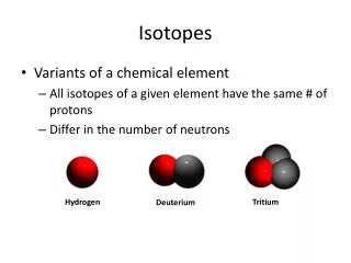
Fraction of remaining vapour Rain Rain 9 ‰ O 18 d 13 ‰ Vapor Vapour Cloud Temperature (°C) Isotopes in the Global Water Cycle:scientific background of isotope hydrology • Isotope fractionation of 18O and 2H occurs during evaporation, condensation, and vapor transport • Stable isotopes are fingerprints of water excellent tracers of the origin of water, and of changes in the hydrological cycle
GNIP Oxygen and hydrogen isotopes as tracers in the Water cycle and climate Joint activity IAEA/WMO since 1961 GNIP programme in hydrology, climatology and related fields
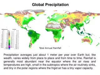
Main objective of GNIP Systematic collection of basic data on isotopic content in precipitation (monthly basis) on a global scale to determine temporal and spatial variations of environmental isotopes in precipitation
1990s New monitoring needs, besides “classical input function for hydrology” Global climate modelling requires broader spatial coverage AGCM Interest in: High latitudes and altitude areas Climate-sensitive areas Tropical zones
GNIP STATIONS 1953-2006, about 830 stations
0 - 10 11 - 20 21 - 30 31 - 40 41 - 50 0 - 10 11 - 20 21 - 30 31 - 40 41 - 50 ACTIVE GNIP STATIONS 18O and 2H RECORDS (in years)
Contents of the GNIP database • Monthly values: • Total amount of precipitation (mm) • Type of precipitation (rain, snow, both) • Mean air temperature (ºC) • Mean water vapour pressure (hPa) • Stable Isotope contents (O-18, H-2) (‰) • Tritium content and uncertainty (TU)
Status of the network About 210 active stations in 53 countries The IAEA´s Isotope Hydrology Laboratory is currently performing isotope analyses of about 40 % of the collected precipitation samples 30 other laboratories are analysing GNIP samples
Structure of the GNIP network • The network is composed of: • IAEA/WMO stations situated in climatically relevant locations • National Networks composed of stations and labs operated by national authorities • affiliated stations which are stations resulting from hydrological studies, often of short-term in nature
Operation of GNIP • International Atomic Energy Agency • Isotope Hydrology Section • Isotope Hydrology Laboratory • World Meteorological Organization • Link to the stations • Meteorological information • Cooperating institutes and laboratories (voluntary basis) • Scientific Steering Committee
Operational Problems • Collaboration with Member States is on voluntary basis • Sampling/storage protocols not always properly followed • Access to meteorological information • Insufficient communication with stations • Partial or incomplete isotope records • Uneven spatial coverage of stations • Need for data in remote areas • Automatic weather stations
Operational problems (cont.) • Difficulties to create new stations in remote and climate-sensitive areas • Identify “national co-ordinators” • Statistics: Incomplete records • Quality control of isotope analysis inter-laboratory exercises
Latest developments • GNIP data distributed into 3 categories • GNIP- monthly ~100.000 records ~780 st • GNIP- event ~25.000 records ~100 st • GNIP- vapour ~700 records ~6 st • Completion of ISOHIS-Map • Easier visualization to GNIP, GNIR, IGLASS • Statistical treatment of data • Yearly, monthly, long-term weighted means
Creation of National focal points • Link with national institutes coordinating activities related to isotope monitoring • Data compilation and quality control at national level submission to the GNIP database
Contact Luis Araguas (IAEA): L.Araguas@iaea.org
Initiatives to correct negative trend • Involvement of other groups/organizations • Collection Met. Services (WMO) • Analysis IH labs • Creation/continuity of National Networks • Long/term operation - GNS stations (?) • Remote or climate-sensitive areas • Links with other projects/programmes • (AMMA, TRACE, etc)
GCOS - CLIMAT reports by ca. 1000 monitoring reference stations
GNIP link to GCOS - GSN • Advice on operational aspects • IAEA request to stations to participate in the GNIP programme endorsed by WMO (GCOS) • Reactivation/establishment of long-term GNIP stations • Ensure availability of meteorological information
Isotopes help to define groundwater origin, dynamics and flow patterns
Santiago de Chile: Isotopes help to define sources of recharge, groundwater origin, flow patterns and pollutant transport Oxygen-18
Links of GNIP with intern. programs • GTN-H Global Terrestrial Networks – Hydrology • GCOS Global Climate Observing System • UNESCO-IHP • UNEP-GEMS Global Env Monitoring System • IGBP-PAGES Past Global Changes • World Data Centre-A for paleoclimatology • WMO - WCRP (GEWEX, CLIVAR)
National networks Argentina, Australia, Austria, Canada, China, Chile, Croatia, France, Germany, Morocco, Netherlands, Portugal, South Africa, Spain, Switzerland, Turkey, USA One station maintained in: Algeria, Egypt, Indonesia, Israel, Jordan, New-Zealand, Poland, Slovenia, U.K.