Download
1 / 17
170 likes | 293 Views
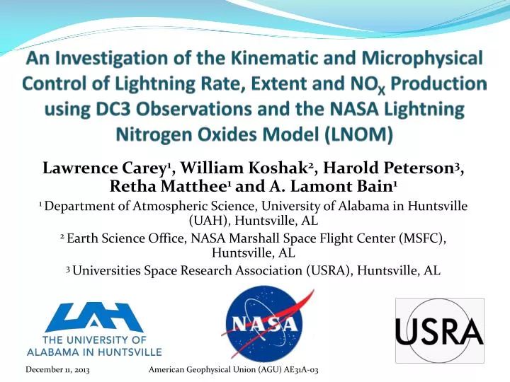
An Investigation of the Kinematic and Microphysical Control of Lightning Rate, Extent and NO X Production using DC3 Observations and the NASA Lightning Nitrogen Oxides Model (LNOM ). Lawrence Carey 1 , William Koshak 2 , Harold Peterson 3 , Retha Matthee 1 and A. Lamont Bain 1

E N D
An Investigation of the Kinematic and Microphysical Control of Lightning Rate, Extent and NOX Production using DC3 Observations and the NASA Lightning Nitrogen Oxides Model (LNOM) Lawrence Carey1, William Koshak2, Harold Peterson3, Retha Matthee1 and A. Lamont Bain1 1 Department of Atmospheric Science, University of Alabama in Huntsville (UAH), Huntsville, AL 2 Earth Science Office, NASA Marshall Space Flight Center (MSFC), Huntsville, AL 3 Universities Space Research Association (USRA), Huntsville, AL American Geophysical Union (AGU) AE31A-03
Outline • Deep Convective Clouds and Chemistry (DC3) Experiment - Alabama (AL) aircraft case on 21 May 2012 • Environment • Dual-Doppler and dual-polarization radar summary during peak lightning period • Lightning properties (rate, extent) vs. radar-inferred kinematic and microphysical characteristics • NASA Lightning Nitrogen Oxides Model (LNOM) • Lightning Segment Altitude Distribution (SAD) • Lightning NOx (LNOx) Production • LNOM SAD and LNOx Production for 21 May 2o12 case over AL • Comparison toradar
1200 UTC KQAG 21 May 2012 DC3 AL Sounding x x2037 UTC UAH RAOB Map of DC3 AL Domain Low-moderate CAPE, low shear ordinary multicell storms Environmental Conditions 21 May 2012 DC3 AL Aircraft Case 2037 UTC UAH RAOB
LNOM and Radar Analysis Domains • Initiation approximately around 1940 UTC nearly 80-85 km north of ARMOR • Multicellular with noticeable cell merger around 2015 UTC • Peak NA LMA Total Flash Rate ~ 5 flashes min-1 • Peak NLDN CG Flash Rate ~ 1 flash min-1 • Peak Vertical Velocity ~ 20 m s-1
5 km CAPPI at 2012 UTC • Cell Merger • Northern updraft congeals with southern updraft • Continued increase in wmax ~ 10 m s-1 • Pronounced Zdr column (5-6 dB) 0 °C Level 21 May 2012 (Rapid Intensification, Post Merger 2012-2023 UTC) A. 5 km CAPPI at 2012 UTC -10 °C Level -40 °C Level W 2, 4, 6, 8, 10 m s-1 X-Z x-Section at 2012 UTC (y=66 km) X-Z x-Section at 2012 UTC (y=66 km) Zdr > 0 dB • Cell Merger • Strengthening updraft supportive of lofting raindrops upward into MP region for freezing • Gradient in Zdr (Δ Zdr ~ 4 dB < 2 km depth) suggest transition from liquid to frozen particles
0 °C Level • Initial Lightning in “Merged” Cells • Along gradient of Zh and Zdr • Collocated with wmax > 8 m s-1 • Storm Scale particle (and thus charge) separation occurred between rimed graupel and ice • Resultant electrification and flashes 21 May 2012 (Lightning in Southernmost Updraft 2015 UTC) -10 °C Level -40 °C Level W 2, 4, 6, 8, 10 m s-1 X-Z x-Section at 2015 UTC (y=65) X-Z x-Section at 2015 UTC (y=65) • Zdr Column • High Zh(55-60 dBZ) and Zdr (> 5 dB) into 0 °C to -10 °C layer • Possible resonance impacts due to high density hail and/or graupel particles • Persistent Zdr column is coincident with strong updraft Zdr > 0 dB LMA flash initiation
A. 5 km CAPPI at 2023 UTC 0 °C Level 21 May 2012 (Peak Lightning, Post Merger 2023 UTC) -10 °C Level • Peak Lightning • Peak ~ 5 flashes min-1 • Peak likely associated w/ strong ‘w’ observed at 2015 UTC • Max 10 dB echo tops above 10 km • Strong front-to-rear flow (sloped ‘w’ contours). Efficient at transporting precipitation ice mass aloft for NIC • Predominately IC flashes aloft with relatively few CG’s -40 °C Level Large quantity of graupel given extension of modest Zh and low Zdr into -10 °C to -40 °C layer X-Z x-Section at 2023 UTC (y=65) X-Z x-Section at 2023 UTC (y=65) W 2, 4, 6, 8, 10 m s-1 4 NLDN CG Flash (2023-2032 UTC) Zdr > 0 dB LMA flash initiation
Flash Extent = (Convex Hull Flash Area) 1/2 Flash Extent (Convex Hull) vs. Flash Count vs. Radar Microphysics/Kinematic - Flash count correlated with MP precipitation ice and updraft. - Median flash extent increases as convection pulses - Largest flashes lag convective pulse but correlated to non-precipitation (anvil) ice - Flash count and extent opposed; most large flashes when flash rate low (e.g., Bruning and MacGorman 2013) Poster: Matthee et al. , AE33B-0342 (Today 1:40 PM)
NASA Lightning Nitrogen Oxides Model (LNOM) Koshak et al. (2013) • LNOM run in Lagrangian (i.e., storm following cylinder) mode for multi-cell cluster sampled by DC3 aircraft on 21 May 2012 over AL • Subjective radar- and LMA-based definition of multicell cluster, shown earlier • Variable LNOM cylinder radius size and location that change each ARMOR radar volume time
Max dBZ Time-Height Evolution NASA LNOM Lightning Segment Altitude Distribution (SAD) Ground Flashes All Flashes Cloud Flashes • Cloud flashes dominate SAD • Ground SAD Cloud SAD, especially aloft • Yet, LNOx production from Ground Flash significant fraction of overall LNOx production, especially but not exclusively at low levels NASA LNOM Lightning NOx(LNOx) Production
Storm Integrated ( 1-hour) LNOM Profiles21 May 2012 DC3 AL Aircraft Cluster LNOx Production All Flashes SAD All Flashes
LNOM Flash Extent [(SAD)]vs. Convex Hull Length vs. Radar SAD: “connect-the-dots” Convex Hull: “polygon wrapper” Flash Extent (LNOM, Convex Hull)=0.89 LNOM Flash (Rate, Extent) = 0.90
LNOM LNOx Production • Cloud LNOx production highly correlated to total cloud flash extent; • Ground LNOx production also correlated to total ground flash extent • Ground LNOx governed in part by other CG flash parameters (e.g., peak current) in LNOM • Radar microphysical parameters (e.g., graupel volume) somewhat correlated (=0.47) to Total LNOx Production • LNOx lags graupel (lag=0.64)
Summary • Dual-Doppler, dual-polarization radar, LMA and LNOM study of the 21 May 2012 DC3 aircraft case over Alabama • Coalescence-freezing, modest convective updrafts and subsequent graupel growth drives lightning production • Total lightning flash rate well correlated to kinematic (e.g., updraft volume) and microphysical properties (e.g., graupel volume) inferred from radar, as in past studies • To a somewhat lesser extent, LNOM flash extent and LNOx production also correlated to radar properties • LNOM SAD (“connect the dots”) flash extent well correlated to convex hull length scale of flash • Flash count and extent opposed; largest extent flashes lag the convective generator.
0 °C Level 5 km CAPPI at 2001 UTC Zdr > 0 dB 21 May 2012 Development Phase (1945-2001 UTC) -10 °C Level • Zdr Column • Zdr ~ 2-3 dB • Zh ~ 50-55 dBZ • raindrops -40 °C Level W 2, 4, 6 m s-1 • Warm Rain Coalescence • Zdr ~ 3-4 dB • Zh ~ 40-50 dBZ • raindrops X-Z x-Section at 2001 UTC (y= 77km) • MP Hydrometeor Region • Zdr 0-1 dB • Zh ~ 40-45 dBZ • wmax ~ 2-4 m s-1 • Depressed values of ρhv(not shown) suggest mix of freezing/frozen raindrops, graupel/small hail X-Z x-Section at 2001 UTC (y= 77km) • 6 m s-1 Updraft • Peaks into 0 °C to -10 °C layer • Sufficient to loft liquid drops into MP zone • Favors freezing of rain drops with time
0 °C Level • Northern Updraft • Zdr < 1 dB • Zh ~45-50 dBZ • Likely Graupel/Small Hail (PID Confirmed) Sufficiently strong vertical motion to loft rain into mixed phase (MP) where freezing by 2001 UTC, likely resulted in the northernmost updraft producing 3 LMA flashes by 2004 UTC. 21 May 2012 (Electrification of Northernmost Updraft 2004 UTC) -10 °C Level -40 °C Level A. 5 km CAPPI at 2004 UTC Zdr > 0 dB B. X-Z X-Section at 2004 UTC (y=75) LMA flash initiation • Southern Updraft • Strengthens • Zh decrease to 55 dBZ • wmax ~ 5-10 m s-1 • Northern Updraft • Short lived & decayed • Zh decrease to 50-55 dBZ • wmax ~ 2-4 m s-1 • First Lightning • First flashes are associated with northern updraft
21 May 2012 (Decay and Dissipation Stages 2106 UTC) A. 6 km CAPPI at 2106 UTC • Gradual Decay • Anvil (rich with ice crystals) extends nearly 40-50 km north of previous convection, but little to no graupel • Wmax < 4 m s-1 • TLFR decreases to ~1 flash min-1 • More extensive flashes in anvil region B. 7 km CAPPI at 2106 UTC • New Convection • Classic multicell evolution with additional cells developing along southwestward moving gust front