Download
1 / 33
330 likes | 488 Views
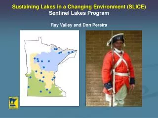
USGS Sentinel Lake Project with MN DNR Fisheries – Feb 2011. Richard L. Kiesling (kiesling@usgs.gov) Emily Resseger ( resseger@usgs.gov ) Jeff Ziegeweid (jrziege@usgs.gov) US Geological Survey, MN Water Science Center 2280 Woodale Drive, Mounds View, MN 55112.

E N D
USGS Sentinel Lake Project with MN DNR Fisheries – Feb 2011 Richard L. Kiesling (kiesling@usgs.gov) Emily Resseger (resseger@usgs.gov) Jeff Ziegeweid (jrziege@usgs.gov) US Geological Survey, MN Water Science Center 2280 Woodale Drive, Mounds View, MN 55112
Agenda for 2/2011 Status Briefing • Overview of Data Collection Activities • Summary of water quality data collections from USGS and MPCA • Update on inflow / outflow data activities • Status of modeling: water level & temperature data first • Discussion of Project Status • Determine data collect needs for 2011 field season • Discuss Data Gaps • Profiler vs. sondes at fixed depths vs. ecomapper • DNR / PCA zooplankton data • Freq. of water quality sampling
Sentinel watersheds and lakes as focal points of long-term monitoring and research USGS Objectives – • Primary object is to develop predictive, biophysical lake models for three super-sentinel lakes • Objectives will be accomplished by developing process-based in-lake water quality models • Models will address the interaction between nutrient cycling, primary production, and trophic dynamics in order to predict responses in deepwater thermal habitats for cold-water fish species • Models will be used to evaluate the response of super-sentinel lakes to land use and climate scenarios
USGS working • on three lakes: • Trout Lake • Elk Lake • Lake Carlos
Lake Monitoring: physical and chemical parameters USGS Objectives – Monitoring super-sentinel lakes • Monitoring of physical and chemical parameters • Collect chemistry data necessary to calibrate carbon-based lake metabolism model - monthly • Collected Nutrients, major ions, particulate carbon and nitrogen, alkalinity, chlorophyll a, and field parameters monthly April through August • Laboratory algal growth potential bioassays: July and August Lake sites • Collect continuous data • Thermistor chain buoys for all lakes • Continuous water level sensors – pressure transducers
Lake Carlos North (102) Temperature & Oxygen Lake Carlos South (101) Temperature & Oxygen
Stage/discharge Data Analysis • Stage/discharge rating curves • Quality Assurance • Mean Flow Values
Challenges • Changing control conditions: • Hard to assess weed growth in lakes • Large rock pile placed in front of weir at outflow to Carlos • Rating curves: • Few measurements to define ratings • Low gradients: lakes affected by boat traffic and wind • Small stage range = large error in rated discharges • Model output: • Variability of inflow ratings complicate mean daily discharge estimates for load calculations
Le HommeDieuInflow Stage vs Discharge Discharge (cfs) Stage (ft)
Future Work • Continued flow measurements • Another season of stage data • Continued WQ sampling • RTK-GPS to obtain true elevations at inflows/outflows
Sentinel Lakes Planning Matrix USGS Objectives – Table 3. Proposed data collection activities
USGS Current Action Items • Begin building model • Calibrate with water level & temperature data first • Determine data collect needs for 2011 field season • Finish analyzing USGS & MPCA chemistry data. Look for patterns, anomalies, and gaps. • Focus on high intensity, short collection periods vs. once monthly sampling? • Increased sampling of phytoplankton, zooplankton to fill biology gaps? • Profiler vs. sondes at fixed depths vs. Ecomapper
USGS Current Action Items • Begin building model • Calibrate with water level & temperature data first • Determine data collect needs for 2011 field season • Finish analyzing USGS & MPCA chemistry data. Look for patterns, anomalies, and gaps. • Focus on high intensity, short collection periods vs. once monthly sampling? • Increased sampling of phytoplankton, zooplankton to fill biology gaps? • Profiler vs. sondes at fixed depths vs. Ecomapper
Pressure Sensors, Compass, uplooking beam* Propulsion GPS/Wireless Antennae Water quality sensors (inside flow-through cap) 11 in. Depth Sounder, DVL/ADCP* Side Scan Sonar 60.1 in. EcoMapper AUV YSI EcoMapper Temperature/Conductivity Sensor Chlorophyll Sensor Turbidity Sensor • Autonomous Underwater Vehicle (AUV) • Capable of diving to 200 ft depth at up to 6.75 ft/s • Over 10 hours of run time • 1 Hz sampling rate Blue-Green Algae Sensor pH/ORP Sensor Not Shown: Rhodamine WT Fluorescence ROX® Dissolved Oxygen Sensor *New in 2010
Survey Modes The vehicle can be programmed to travel at a specified depth from surface, height above bottom, or undulate Depth from surface:monitored with YSI pressure transducer Constant Depth Undulation Constant Altitude Height from bottom:monitored with AUV depth sounder
Blue Green Algae (cells/mL) Temperature (Deg. C) Chlorophyll (mg/L) pH Rasmussen Lake July 14, 2009 Provisional Data Subject to Revision
Milwaukee Harbor Outer Harbor Lake Michigan Inner Harbor
Contact Information Richard Kiesling or Emily Resseger US Geological Survey 2280 Woodale Drive Mounds View, MN 55112 Richard (763) 783-3131 office Emily (763) 783-3128 office