Download
1 / 29
300 likes | 537 Views
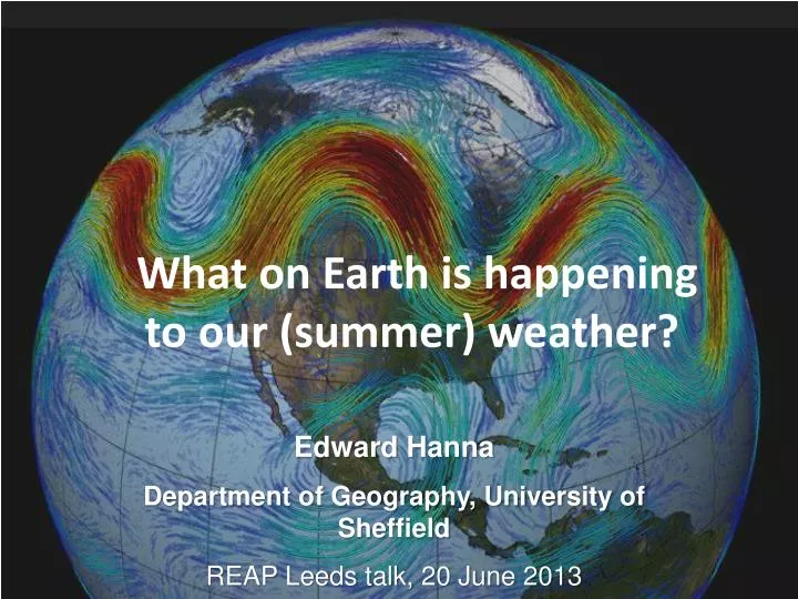
What on Earth is happening to our (summer) weather? . Edward Hanna Department of Geography, University of Sheffield REAP Leeds talk, 20 June 2013. Overview. Global warming and extreme weather The jet stream and the North Atlantic Oscillation

E N D
What on Earth is happening to our (summer) weather? Edward Hanna Department of Geography, University of Sheffield REAP Leeds talk, 20 June 2013
Overview • Global warming and extreme weather • The jet stream and the North Atlantic Oscillation • Recent jet stream changes and effects on UK and Greenland summer weather & climate
http://data.giss.nasa.gov/gistemp/maps Jim Hansen, NASA
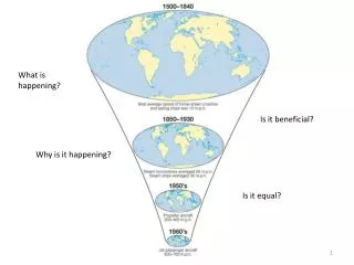
There is a surplus of heat in the tropics which is transported poleward by the atmosphere and oceans. Mid-latitude storms are eddies which stir up warm and cold air masses, and so move heat poleward. T. Woollings
The Polar Front Jet is associated with the winter NAO From National Weather Service Weather Forecast Office, http://www.srh.noaa.gov/hun/ • NAO response is due to latitudinal shifts in the jet stream (Woollings, 2010). • In winter, a positive NAO has a stronger south-north pressure gradient and stronger jet, shifted northwards. Warmer (and wetter) conditions over N and central Europe, Eastern U.S.A. and cooler over Mediterranean, E. Canada and Greenland. In summer jet stream is further north so positive NAO gives sunny, warm in NW Europe. • A negative NAO has a weaker pressure gradient and a more meandering jet.
Possible causes of jet stream variability • Sea ice extent changes • Snow cover • Atlantic sea surface temperatures • Solar variability • El Niño – Southern Oscillation • Tropical volcanic eruptions • The Quasi-biennial oscillation in the equatorial stratosphere (high-altitude jet stream) circulation.
http://svs.gsfc.nasa.gov/vis/a000000/a003900/a003998/Minimum_SeaIce_Area_2012_09_16.1080.tifhttp://svs.gsfc.nasa.gov/vis/a000000/a003900/a003998/Minimum_SeaIce_Area_2012_09_16.1080.tif
Sea Ice Cover (Perovich et al. 2012 Arctic Report Card) Decreasing trends of 2.6%/decade for March and 13.0%/decade for September relative to mean 1979-2000 values. Summers 2002-2012 had unprecedented series of extreme summer ice-extent minima.
Hot Arctic-Cold Continents Hot Arctic-Cold Continents Added Ocean Heat Storage and Heat Flux from New Sea Ice Free Areas
June 700 mb height anomaly 2007-2012Arctic Dipole and Greenland Blocking Ridge Loss of sea ice Poor weather Loss of Glacial Ice Early May-June snow melt Overland, Francis, Hanna and Wang GRL 2012
In Hanna et al. (2012 Int. J. Climatol. and other recent papers we use a more Greenland-specific (than the NAO) measure of air circulation changes, the Greenland Blocking Index (GBI) (Fang, 2004). Defined as the mean 500-hPa height over the Greenland area 60–80°N, 20–80 °W (Figure 1), “which is equivalent to the NAO/AO index but emphasizing more the northern centre of the NAO dipole pattern” (Fang, 2004, p. 131).
Greenland Blocking Index in summer (JJA) since 1948 is strongly (negatively) linked with NAO
Greenland coastal met station summer (JJA) mean surface air temperatures (Hanna et al. 2013, Int. J. Climatol. ).
http://www.nasa.gov/topics/earth/features/greenland-melt.htmlhttp://www.nasa.gov/topics/earth/features/greenland-melt.html
Simulated GrIS surface melt extent, 1960-2012 (Hanna et al. 2013)
Greenland Ice mass loss from GRACE (Box et al. 2012 Arctic Report Card) GrIS has contributed 8.0 mm to GSL since 2002, and its mass loss of 367 Gt/y between Sep 2008 and Sep 2012 was almost twice that for Jun 2002-Jul 2006 (193 Gt/y).
As the HIGH LATITUDES warm faster than the MIDDLE LATITUDES Jet stream animation from Francis and Vavrus, GRL 2012
Big difference (left) in polar vortex and jet stream configuration in last 6 Junes (2007-2012, left) compared with climatology (1981-2010, middle). Right shows difference between 2 plots. Overland, Francis, Hanna, Wang (2012) Geophys. Res. Lett.
Warm Arctic-Cold Continents (James E. Overland) We can say that loss of sea ice and snow adds additional heat to atmosphere which pushes toward a greater chance for north<->south flow (Blocking patterns) and weaker, more persistent jet stream at mid-latitudes with greater weather extremes: cold spells, heat waves, flooding, prolonged snowfall, and drought BUT: it will not happen the same way in every year and location due to mid-latitude chaotic natural variability Coarse resolution climate models do not capture Blocking Patterns very well
1) Wide Range of September Sea Ice Extent Hindcasts and Predictions 89 ensemble members from 36 CMIP5 models under strongest (RCP8.5) emissions scenario 2) Observed loss is faster than expected by models Mean never reaches sea ice free limit by 2100 Overland et al. (2013)
Summary * Human-driven global warming is not a uniform process and can spring surprises in regional climate change: may be linked with tendency for UK to have wetter, cooler summers (and for Greenland to have warmer, sunnier summers) in last 6 years. * Year-to-year persistence in recent unusual large-scale weather patterns. * May be influenced by earlier seasonal losses in Arctic sea-ice + snow cover, & changes in soil moisture. * More high-pressure blocking systems in early summer on N American side of (sub-) Arctic in recent summers (2007-2012). These blocks (although transient phenomena) appear to contribute to more persistent, stationary and north<->south jet stream flow. * Mountain terrain may have greater influence on an already weakened jet stream, which may increase blocking effect, e.g. of Greenland in splitting the jet stream. More southerly jet or far northward branch from around top of Greenland may increase cyclone formation on ‘lee side’ over UK.