Download
1 / 15
150 likes | 274 Views
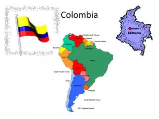
Colombia. Paige Wienczkowski . Geography. Capitol City- Bogota Colombia is located in Northern South America, bordering the Caribbean Sea and North Pacific Ocean. The fourth largest country in South America About 440,000 sq. miles; the size of Texas and California combined.

E N D
Colombia Paige Wienczkowski
Geography Capitol City- Bogota Colombia is located in Northern South America, bordering the Caribbean Sea and North Pacific Ocean. The fourth largest country in South America About 440,000 sq. miles; the size of Texas and California combined. Climate- Tropical on coast and eastern grasslands, but cooler in highlands.
Geography Terrain: Flat coastal lowlands, central highlands, three parallel mountain chains, and flat eastern grasslands. Natural Resources: Petroleum, Natural Gas, Coal, Iron Ore, Nickel, Gold, Copper, Emeralds, Hydropower. In highlands there are volcanic eruptions, occasional earthquakes, and periodic droughts.
People Ethnic Groups: mestizo 58%, white 20%, mulatto 14%, black 4%, mixed black-Amerindian 3%, Amerindian 1% Population in Major Cities: Bogota 8.262 million, Medellin 3.497 million, Cali 2.352 million, Barranquilla 1.836 million Indira lives here Religions: Roman Catholic 90% Other 10% Official Language: Spanish Population: 44,725,543
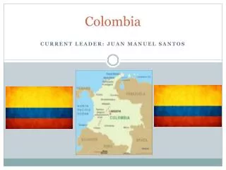
Government/Economy Government type: Republic In 2010, Juan Manuel Santos was elected president of Colombia. Independence from Spain- July 20, 1810 Agricultural Products: Coffee, rice, bananas, corn, sugarcane, cocoa beans, oilseed, vegetables. Colombia produces 12% of the coffee in the world! (Second to Brazil) Industries: Textiles, food processing, oil, clothing and footwear, beverages, chemicals, cement; gold, coal, emeralds
Current Events-Flood in Barranquilla Barranquilla has no rainwater drainage systems. This means that when it rains, the entire city floods and replaces roads with really fast running rivers. For nearly a year Colombia has suffered from heavy rains and floods, killing hundreds. On May 15, 2011, a flood took place in Barranquilla, flipping over cars due to the rapid water flows. Those who could, climbed out of their vehicles and rode on top of it. Those in buses were swept down the street, trapped. Nobody was killed in the incident, although it was considered by President Juan Manuel Santos as the worst natural disaster in Colombia’s history.
Video of Floods in Barranquilla • http://www.bbc.co.uk/news/world-latin-america-13406664 • http://globalvoicesonline.org/2009/06/25/colombia-living-with-flooding-in-barranquilla/
Current Events-Volcanic Eruptions The Galeras volcano is one of Colombia’s 15 active volcano’s, it is located southwest of Bogota. On August 26, 2010 more than 8,000 people were evacuated from their homes, near the Galeras volcano. The eruption began with an earthquake of 4.6 on the Richter scale near the top of the 4,276 meter volcano. Following the earthquake was about 400 aftershocks. Only about 300 people agreed to be relocated to a safe area. The volcano erupted three times last year and did not cause any deaths or injuries, but it sparked forest fires.
Volcanic Eruptions-Nevado del Ruiz The Nevado del Ruiz stands at 16,200 feet and is locally known as “The Sleeping Lion.” It had not erupted in 150 years until 1985 when it killed 23,000 people. The city that was affected the most was called Armero, about 50 miles from the capital. The city was completely destroyed and buried by mud and rubble. The incident happened in the middle of the night when the residents were all in bed, so there was no warning or evacuation.
Nevado del RuizFun Facts! • Nevado means “snow-covered” in Spanish • It is part of the Andes mountain range. • It covers an area of over 77 sq miles, stretching 40 miles from east to west. • It’s poorly forested because of it’s high elevation • Lower elevation consists of well-developed forestry with animals such as the spectacled bear and mountain tapir; both threatened. • The volcano is home to 27 different species of birds
Nevado del Ruiz Bird^ Spectacled Bear Before 1985 eruption July 2007
Works Cited- Research • https://www.cia.gov/library/publications/the-world-factbook/geos/co.html • http://www.state.gov/r/pa/ei/bgn/35754.htm • http://www.theweathernetwork.com/news/storm_watch_stories3&stormfile=hundreds_more_homeless_after_150511 • http://en.rian.ru/world/20100826/160344246.html • http://news.bbc.co.uk/onthisday/hi/dates/stories/november/13/newsid_2539000/2539731.stm
Works Cited- Pictures • http://www.lib.utexas.edu/maps/colombia.html • http://en.rian.ru/world/20100826/160344246.html • http://evesale.blogspot.com/2010/08/arroyos-of-barranquilla.html
Jeopardy!!! http://www.jeopardylabs.com/play/colombia11