Download
1 / 11
110 likes | 186 Views
Characterization of the Hydrological Cycle over South America, using analisis and regional models. Pablo Spennemann, Ph.D. student Advisor: Dra. Celeste Saulo Centro de Investigaciones del Mar y de la Atmósfera (CIMA) pspennemann@cima.fcen.uba.ar . Objectives.

E N D
Characterization of the Hydrological Cycle over South America, using analisis and regional models Pablo Spennemann, Ph.D. student Advisor: Dra. Celeste Saulo Centro de Investigaciones del Mar y de la Atmósfera (CIMA) pspennemann@cima.fcen.uba.ar
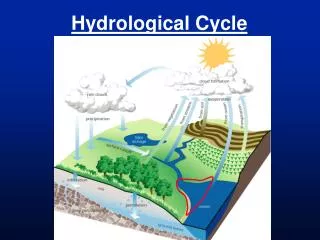
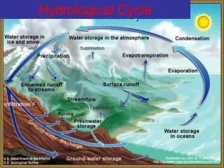
Objectives • The overall goal of my work is to understand the role between the land surface-atmosphere interactions and the summer circulation over South America in order to improve their representation in regional models. • A characterization of different components of the hydrological cycle over South America will be done, with emphasis on soil moisture, using GLDAS (Global Land Data Assimilation System, Rodell et al. 2004) data set. • An assessment on how they are represented in short-term forecasts (up to 96 hs) with the WRF-ARW model (Skamarock et al. 2005).
Motivation • The sensitivity of the climate system to given soil state depends not only on the geographical region, but also on the models. Temperature and evaporation sensitivity to soil moisture content Uncertainty associated with different soil model Betts, 2009 Santarem, Brasil
Motivation • The detection of errors in the models to represent the soil variables, would be key to maximizing predictability in those scales / regions where the coupling between soil and atmosphere is significant. • It is desirable, therefore, to evaluate how the WRF-ARW model represents the various components of the hydrological cycle as an important element to detect the origins of the deficiencies in the quality of prediction.
Methodology • Representation of the soil moisture/precipitation in the WRF-ARW model, for the 2002-2003 summer season. • Spatial domain used for this study. • The variables were compared against GLDAS, because of the advantage of this data sets respect to others soil models, and because both of them use the same soil model (NOAH).
Results Soil moisture mean field Daily mean preciptation Importance of precipitation on the spatial distribution of soil moisture
Results Diference of the mean soil moisture fields (GLDAS – WRF-ARW Initial Condition)
Results BIAS for the WRF 24 hs. forecast Diference 96 - 24 hs. forecast
Results Soil moisture averaged over: SESA SACZ
My motivation for this course is: • Learn what satellite data sets or satellite products exist in order to be assimilated in numerical models, for improve the initial condition / the predictability, because it seems that remote sensing is the best way to complement what is already available through land data assimilation techniques (largely driven by soil models).