Download
1 / 9
90 likes | 204 Views
SNOW COVER MONITORING OVER SOUTH AMERICA USING PASSIVE MICROWAVE AND VISIBLE/INFRARED OBSERVATIONS Peter Romanov, Dan Tarpley and Bruce Ramsay Office of Research and Applications, NOAA/NESDIS, Camp Springs, MD. Objectives.

E N D
SNOW COVER MONITORING OVER SOUTH AMERICA USING PASSIVE MICROWAVE AND VISIBLE/INFRARED OBSERVATIONS Peter Romanov, Dan Tarpley and Bruce Ramsay Office of Research and Applications, NOAA/NESDIS, Camp Springs, MD
Objectives • Assess potentials for snow cover mapping over South America using satellite data • Improve characterization of snow cover and provide accurate high-resolution data on snow areal extent and variations for use in meteorological and climate models
NOAA/NESDIS automated snow products for South America DMSP/SSMI (microwave) - Daily - 30 km resolution, global - All weather - Available since 1987 (SMMR since 1978) GOES Imager (visible/mid-infrared/infrared) - Daily - 4 km resolution, South America - Cloud clear observations - Available since 2000 NOAA-16 AVHRR (visible/mid-infrared/infrared) - Daily - 4 km resolution - Cloud clear observations - Under development, expected later this year
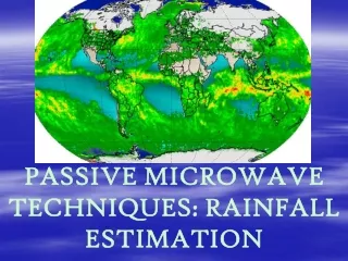
Issues addressed: • Snow cover monitoring using a new snow-mapping system based on GOES Imager data (visible, mid-infrared, infrared) • Comparison of snow products derived from satellite observations in the microwave (DMSP SSM/I) and in vis/mir/ir (GOES Imager) • Correspondence between satellite-derived snow cover and surface observations of snow and precipitation • Long-term variability of snow cover in South America from available time series of satellite observations in the microwave
Snow cover monitoring using GOES Imager data Winter 2000 Summer 2001 Snow season duration
Satellite vs surface observations of snow cover 46.51 S 71.01 W SSM/I Snow fall GOES Snow depth Snow fraction is estimated within 1x1 degree area centered at the location of the station Satellite snow fraction Surface observations
February 2001 July, 2000 GOES-8 Imager DMSP SSM/I GOES-8 Imager DMSP SSM/I Monthly frequency of snow cover GOES Imager vs DMSP SSM/I
Snow cover over Patagonia (from SSM/I data) The area of reliable SSM/I-based snow retrievals
Conclusions GOES Imager observations are promising for monitoring large-area variation of snow cover in the mid-latitude portion of South America. However, they cannot be used for monitoring tropical glaciers and ice fields because of insufficient spatial resolution of the measurements and due to persistent orographic cloud cover. The NESDIS operational microwave snow product over South America has several problems which mostly result from physical limitations of the microwave method. These problems should be addressed when using SSM/I snow retrievals in meteorological and climate applications. Snowfalls typically produces a noticeable increase of the snow cover extent (or fraction) identified form satellite observations. Therefore the results of satellite snow cover monitoring can probably be used to improve the analysis of solid precipitation.