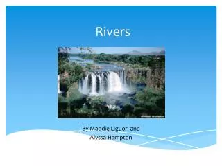
Download

1 / 6
60 likes | 245 Views
RIVERS. Floodplains. When water regularly overflows from a river, it can create a flood plain. A flood plain is a flat land with fertile soil, often found on the banks of rivers. Floodplains. River Deposition. As rivers travel over land it collects nutrients and minerals all the way.

E N D
Floodplains When water regularly overflows from a river, it can create a flood plain. A flood plain is a flat land with fertile soil, often found on the banks of rivers.
River Deposition As rivers travel over land it collects nutrients and minerals all the way. When the river ends at a large body of water it drops or deposits all of these minerals, nutrients and sediment. All of this sediment builds up to create a delta.
Delta China’s Yellow River (seen below) is the most sediment-filled river on Earth. The soil is easily eroded, and millions of tons of it are carried away by the river every year. Some of it reaches the river’s mouth, where it builds and rebuilds the delta.
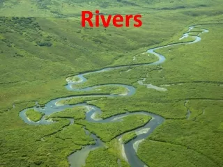
Meanders • http://images.google.com/imgres?imgurl=http://www.geo.umn.edu/courses/1001/Summer_Session/Oxbow.jpg&imgrefurl=http://www.geo.umn.edu/courses/1001/Summer_Session/CourseReview.htm&usg=__Plt1BEH9E_3Y_ISAy1jeYnDOBzg=&h=377&w=944&sz=126&hl=en&start=18&sig2=fVe0VBt_zFK1W_ytpWUIGQ&tbnid=i-yfBB8ezD_GyM:&tbnh=59&tbnw=148&ei=w8U-SbKiJ56eecPXrckM&prev=/images%3Fq%3Dox%2Bbow%2Blake%26hl%3Den%26safe%3Dactive%26rlz%3D1T4GGLL_en • http://en.wikipedia.org/wiki/Meander • http://images.google.com/imgres?imgurl=http://cgz.e2bn.net/e2bn/leas/c99/schools/cgz/accounts/staff/rchambers/GeoBytes%2520GCSE%2520Blog%2520Resources/Images/Rivers/Meander_bend.jpg&imgrefurl=http://geobytesgcse.blogspot.com/2006_11_01_archive.html&usg=__Kc438wM3k5cBcd-I3XarIYlludM=&h=378&w=491&sz=59&hl=en&start=10&sig2=WQApqob3yY4Hmx2Pa4EiTw&um=1&tbnid=fo8QdobnQjSrKM:&tbnh=100&tbnw=130&ei=WAs_SYiQGIKJmQf5-MTpDA&prev=/images%3Fq%3Dmeanders%26um%3D1%26hl%3Den%26rlz%3D1T4DKUS_enUS252US253%26sa%3DX • http://images.google.com/imgres?imgurl=http://www.naturephoto-cz.com/photos/sevcik/meanders--meandry.jpg&imgrefurl=http://www.naturephoto-cz.com/meanders:air-photo-2109.html&usg=__sOfMtEUHjNBsW6KZ6HU43wh9acM=&h=398&w=600&sz=81&hl=en&start=1&sig2=3splDO2fc2EvtAfKHzsmBA&um=1&tbnid=MXbqyWYeUonuKM:&tbnh=90&tbnw=135&ei=WAs_SYiQGIKJmQf5-MTpDA&prev=/images%3Fq%3Dmeanders%26um%3D1%26hl%3Den%26rlz%3D1T4DKUS_enUS252US253%26sa%3DX • http://images.google.com/imgres?imgurl=http://www.stacey.peak-media.co.uk/Year7/7-7Rivers/7-7Meanders/341.jpg&imgrefurl=http://www.stacey.peak-media.co.uk/Year7/7-7Rivers/7-7Meanders/7-7Meanders.htm&usg=__fMHu5RlEiZ_YyAF6fN6GTA5v1ds=&h=471&w=340&sz=50&hl=en&start=4&sig2=5uOQb7kYlZsuRvuGsVW5iw&um=1&tbnid=OSUyXRhtLWE_dM:&tbnh=129&tbnw=93&ei=WAs_SYiQGIKJmQf5-MTpDA&prev=/images%3Fq%3Dmeanders%26um%3D1%26hl%3Den%26rlz%3D1T4DKUS_enUS252US253%26sa%3DX • http://images.google.com/imgres?imgurl=http://www.geo.wvu.edu/~jtoro/geol101/streams/meanders.jpg&imgrefurl=http://www.geo.wvu.edu/~jtoro/geol101/Outline-3.html&usg=__b9d3pF46zVierUeC6Kvohgp9UcE=&h=719&w=959&sz=81&hl=en&start=8&sig2=1P_--4S95JpiBolXlR7w4Q&um=1&tbnid=0FK9_ML-QrPs4M:&tbnh=111&tbnw=148&ei=WAs_SYiQGIKJmQf5-MTpDA&prev=/images%3Fq%3Dmeanders%26um%3D1%26hl%3Den%26rlz%3D1T4DKUS_enUS252US253%26sa%3DX • http://www.gly.uga.edu/railsback/FieldImages/ElkCreekMeanders.jpeg