Download
1 / 22
240 likes | 590 Views
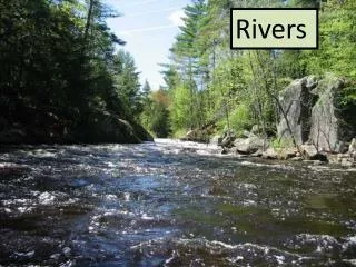
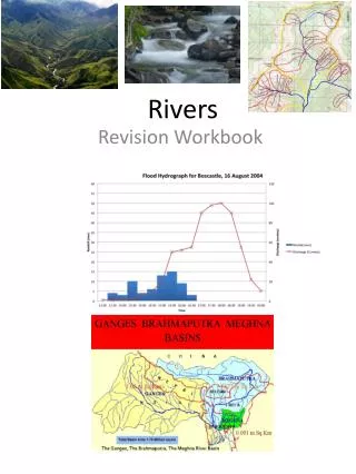
Rivers. I. Drainage Networks and Watersheds II. Erosion, Transport, and Deposition III. Flooding. I. Drainage Networks and Basins. As a stream flows downhill, it merges with other streams. The smaller of the two merging streams is known as a tributary .

E N D
Rivers I. Drainage Networks and Watersheds II. Erosion, Transport, and Deposition III. Flooding
I. Drainage Networks and Basins • As a stream flows downhill, it merges with other streams. The smaller of the two merging streams is known as a tributary. • A branching network of streams known as a drainage system forms where the merging tributaries form progressively larger streams. • The bottom image shows a tributary network on the surface of Mars. • Tibesti Mtns, Chad • Mars
The upper part of the drainage system is called the headwaters (sometimes called the source). • One important characteristic of a drainage system is the large number of tributaries in the headwaters. • The lower part of the drainage system where it empties into an ocean or lake is known as the mouth.
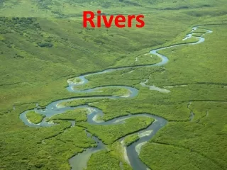
Headwater tributaries are found in narrow, steep valleys. • As the stream gets closer to the mouth, the river and the valley that it occupies becomes wider and the steepness of the channel decreases. • One characteristic of a mature stream (after it has exited the headwaters) is the development of tight S-shaped curves known as meanders.
The stream gradient is the grade or the drop in elevation of a stream (as a ratio) and is usually expressed as feet/mile or m/km. • Generally streams have a steeper slope or higher gradient at the headwaters and a higher water velocity. • Toward the mouth of a stream, there is a lower gradient and lower water velocity.
A watershed (drainage basin or catchment) is the area of land where water from precipitation converges to a single point where it may exit the basin to the ocean. In the continental US, there are 2,110 watersheds. Drainage basins are separated from one another by topographic features (geographical barriers) such as a mountains.
The map shows the major drainage divides in North America. These divides represent drainage networks that terminate in different oceans (or the Great Basin). • A large scale example is the Continental Divide that separates drainage networks that terminate in the Pacific from the rest of the continent.
The Mississippi River has the world's fourth largest watershed (3,220,000 km2). It is found in 32 U.S. states and two Canadian provinces and empties into the Gulf of Mexico. 40% of the landmass of the continental United States is covered by the Mississippi watershed. • Any precipitation that falls in the Mississippi watershed will move into one of the river’s tributaries, eventually enter the Mississippi River and finally discharge into the Gulf of Mexico.
World’s Largest Rivers Ranked by Discharge Note that the discharge from the Mississippi River is only ~8% of that of the Amazon River.
II. Erosion, Transport, and Deposition A stream is any size channelized body of running water (small creeks to giant rivers). Fastest flow is usually toward the center of the channel. • Related to frictional resistance along the sides of the channel. • With straight channels the fastest water is in the center of the stream. • Fastest water is on the outside of a river-bend, slower on the inside.
Since the highest velocity water flow is on the outside of a bend in the channel, erosion occurs on the outer bank of the bend. The lowest velocity occurs on inside bank where deposition of sediment occurs. Point barsare deposits that form on the inside curve of meanders, where the water velocity is lower.
Point barsaccumulate on the inside and erosion occurs on the outside of river bends, causing the channel to migrate. The ultimate effect is for the river to abandon the channel (rivers, like people, are lazy) - forming an oxbow lake. Click here for an animation showing the development of meanders and an oxbow lake. Wikipedia
point bar point bar Note that the previous channels of the river can be seen in this meander.
The top image shows a map of the Mississippi River’s channels (produced in 1944). Below is a satellite image of the same region. The modern river channel is superimposed on channels from 1880, 1820, 1765 and prehistoric channels. An oxbow lake remains from 1785 channel. In the 20th century, the rate of change on the Mississippi slowed due to engineering to maintain towns, farms, roads and shipping routes. Levees now prevent the river from changing its course so often. NASA Earth Observatory 14
Erosion on the outer bank of a meandering stream. Now you know what side of the river to build your home.
Deltas form at the mouth of a stream where it terminates in a lake or ocean. When the gradient and velocity drop, sediment is deposited in the ocean or in a lake. • Deltas are ephemeral structures and change rapidly with time. • The top image shows how Mississippi River delta has changed its location in the last 4600 years. Wikipedia Modern delta NASA
Hydraulic sorting results in different size particles being deposited in different locations on the delta. • The brown colors represent coarser sand and silt particles falling out of suspension. • The light blue colors represent finer clay particles that settle further offshore in a less energetic environment.
Alluvial fans form at the mouth of a stream where it empties into a valley. When the gradient and water velocity drop, sediment is deposited in a fan-shaped structure on the valley floor. • Alluvial fans form in arid regions in a terrestrial setting.
Alluvial fans and deltas are similar structures, and differ mainly by being deposited either above or below water. They are formed from the deposition of the sediment carried by the river as the flow enters a canyon or flatter plain (fan) or an ocean or a lake (delta). • Alluvial fan USGS • Delta NOAA
III. Flooding • Hydrologists refer to the height or stage of a river relative to some reference plane (commonly sea level). • Flood stage is the height of the river when it overflows its banks. • The amount of flooding is often termed as the height of the river above flood stage. NOAA
Flooding is dependent upon weather events. The National Weather Service monitors weather and issues flood and other weather warnings based on current weather conditions. • National Weather Service • Local news organizations get their data from the NWS to issue flood and other weather warnings.
Due to the random occurrence of weather events, predictions about flooding (in the medium- and long-term) are based on statistical probabilities. • Projections about major floods are based on historical data over a long period of time. • The table shows the probability/frequency of maximum discharge (height of flood stage) to the recurrence interval and %probability.