Download
1 / 13
130 likes | 206 Views
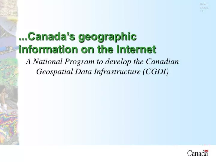
...Canada’s geographic information on the Internet. A National Program to develop the Canadian Geospatial Data Infrastructure (CGDI). GeoConnections. GeoConnections is a National Program to develop:

E N D
...Canada’s geographic information on the Internet A National Program to develop the Canadian Geospatial Data Infrastructure (CGDI)
GeoConnections... • GeoConnections is a National Program to develop: • the Canadian Geospatial Data Infrastructure (CGDI) -- delivering Canada’s geographic information on the Internet.
Five key thrusts 1. client centeredaccessto government information, 2. which is built onacommon national framework 3. using international standards, 4. collectedby agenciesin cost-efficient partnerships, and 5. provided seamlessly to users within a co-ordinated supportive policy environment
Seven GeoConnections programs • National Access-- building common access window • National Framework -- standard geographic foundation to enable applications and value-added • GeoPartners -- Secretariat to support national partnerships • GeoInnovations -- industrial technology development through partnerships • National Atlas -- national entry point for perspectives on data themes and issues • Sustainable Communities -- community-driven and focused pilot applications • Skills Network -- development of knowledge workers
CGDI Partnerships ‘Way of operating’ as much as policy thrust open consultations • data sharing and collaboration • federal-provincial-territorial agencies have adopted a Statement of Principles on partnerships • gather data in partnerships • only once, closest to source • share and use many times
CGDI Policy Environment Seamless distribution and use of government geographic information • easing policy issues • government viewing itself from its clients’ perspective, and developing access: • from any department • from any level of government • with simpler, common sales and licensing agreements
Shared leadership • Open and consultative • consortium approach to decision making • federal, provincial, territorial agencies • private sector and academia • collective leadership among the participants • responds to the need find new ways to manage horizontal issues • recognizes multi-participants and activities across different user communities
Mgmt Board GeoConnections Secretariat Organizational structure NRCan Minister • 17 members • chaired by NRCan • 5 federal depts • 5 provinces • 1 municipal • 3 industry • 2 academic • 1 aboriginal community Access - GeoExpress Framework Data Program Advisory Network Geo-Partners GeoInnovations Sustainable Application Areas 1. Sustainable Development - Environment 2. Resource Management 3. Transportation/Road Applications 4. Emergency/Disaster Response 5. Marine Federal Provincial/territorial Industry Academia NGOs Communities Program Geomatics Advisory Skills Network Network National Atlas of Canada Technology Advisory Panel Policy Standards
Support in the Federal Budget Allocated $60 million over 5 years • key part of knowledge and innovation strategy • links with ‘Connecting Canadians’ to disseminate knowledge • National resource for economic and social goals • driven by applications: emergencies-- 911, disaster response, resource management, transportation, communities, and many others • Based on matching investments by partners • Majority of work contracted to private sector • firms and expertise developed across Canada
Infrastructure Characteristics • Loose federation of external heterogeneous suppliers coupled through open, common services. • Provides discovery, evaluation and access to: data collection metadata; distributed individual product listings; data order and access; interactive services. • Different levels of ‘buy-in’ representing different benefits and costs to suppliers. • Public interfaces to common infrastructure services made available to any supplier or developer to provide multiple, custom views.
Provincial / Subject SDI Other National SDI CEONet Open Scaleable Infrastructure Land Information Ontario LandDataBC Marine Geospatial Data Infrastructure Environmental Monitoring and Assessment Network etc ... US FGDC Clearinghouse International Directory Network NASA EOSDIS Australian Spatial Data Infrastructure … Global Spatial Data Infrastructure
Directory Suppliers Products Services ... ... ... … ... Reusable Components Distributed Search Database A Database B … Current Access Components Distributed Search Consumer Web Updates Other Spatial Data Infrastructures Distributed Search Consumer WebAPI Application Distributed Search Supplier Reusable Components Reusable Components Supplier Toolkits
Content and Usage • 1400+ Organisations registered in the directory. • 7000+ Data collections described in the directory. • 150+ online search connections to remote, distributed databases/inventories. • 13,000 user sessions per month.