Download
1 / 16
160 likes | 328 Views
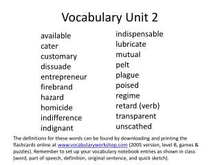
Unit C Vocabulary. Howard Middle School Earth Science 6 th grade. Inference – To conclude by reasoning from evidence. Landform – A feature of the earth’s surface such as a lake, stream, valley, canyon, hill, ridge, or mountain. Marsh – An area of low-lying wet land; swamp or bog.

E N D
Unit C Vocabulary Howard Middle School Earth Science 6th grade
Inference – To conclude by reasoning from evidence. • Landform – A feature of the earth’s surface such as a lake, stream, valley, canyon, hill, ridge, or mountain. • Marsh – An area of low-lying wet land; swamp or bog.
Wetlands – An area characterized by a high proportion of water and watery land, such as a swamp, marsh, or bog. • Contour Interval – The elevation difference represented by the difference between two adjacent contour lines on a topographical map.
Contour Line – A line on a topographical map that indicates places of equal elevation. • Key – An explanatory table, such as that explaining colors and symbols on a map. • Scale – The size of a diagram or model in proportion to the actual size of the object.
Topography – The shape of the land, or the collection of landforms, in an area. • Topographical Map – A map that uses contour lines to represent the elevation of land surfaces. • Stability – The tendency of a landform to resist erosion or other change.
12. Average - The central, or typical, value of a numerical data set. 13. Mean – The central value of a numerical data set calculated by adding up all the data points in the data set and dividing this sum by the total number of data points in the data set.
14.Median – The middle value in a data set arranged in numerical order. 15.Mode – The most frequently occurring data point of a numerical data set. 16.Sample size – The number of data points in a data set.
17.Delta – A fan-shaped area that develops in the flat, low area where a river empties into a large body of water. 18.River Channel – The depression in the land through which a river flows. 19.Earth Processes – Dynamic actions that occur both on earth’s surface and inside the earth.
20.Constructive – A force or earth process that builds up earth material to create landforms. 21.Deposit – Earth materials that have been left in a particular location as a result of an earth process that drops sediments that were previously suspended in air, water, or ice.
22.Deposition – The earth process that results in a deposit of earth materials. 23.Destructive – A force or earth process that breaks down or removes earth material. 24.Erode – To remove earth materials from one place and transport them elsewhere, commonly by moving water or wind.
25.Erosion – The earth process by which earth materials are removed from one place and transported elsewhere. 26.Floodplain – The relatively level area on either side of a river that becomes covered with water when the water level in the river rises above its banks and overflows.
27.Weathering – The breakup of rock caused by mechanical or chemical processes. 28.Ecologist – Scientist who studies the interactions between organisms and their environment. 29.Engineer – A professional who uses science to solve practical problems, make equipment, and build structures. 30.Geologist – Scientist who studies the earth and the changes that take place on and beneath its surface.
31.Controlled Variable – A variable in an investigation or experiment that is held constant. 32.Tested Variable – A variable that is changed in a systematic way in an experiment in order to determine its effect. 33.Uncontrolled Variable – A variable in an experiment or investigation that the experimenter either ignores or is unable to hold constant.
34.Advantage – A property that, in your opinion, is good. 35.Breakwater – A rock structure parallel to the shore that is used to slow erosion by reducing wave energy hitting the shore. 36.Disadvantage – A property that, in your opinion, is not good.
37.Dredging – Removing earth material from under water. 38.Jetty – A rock structure built perpendicular to the shore that prevents deposition in a particular area, such as a harbor. 39.Longshore Current – A stream of water in the ocean that runs parallel to the shore.
40.Seawall – A wall made of rock, concrete, or similar material built along a cliff or shoreline to reduce erosion.