Download
1 / 39
390 likes | 486 Views
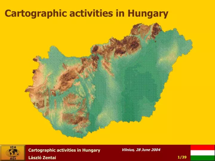
Cartographic activities in Hungary. Overview. Tasks and organization of Hungarian national mapping Map publishing enterprises Map collections Institutes of Higher Education in Cartography The Hungarian National Committee of ICA. 1. Tasks and organization of Hungarian national mapping 1.

E N D
Overview • Tasks and organization of Hungarian national mapping • Map publishing enterprises • Map collections • Institutes of Higher Education in Cartography • The Hungarian National Committee of ICA
1. Tasks and organization of Hungarian national mapping 1 • The scope of state mapping, charting and geodesy (MC&G) tasks and issues on the implementation of them are provided in Act 76 of 1996 on Surveying and Mapping Activities. According to this act, the following tasks are to be considered as state base ones: • supplying the country with state maps; • supplying the defence forces with maps; • handling, storing, maintaining and providing state base data; • fulfilling the tasks arising from international commitments; • determining and filing geographical names as well as providing data from them; • MC&G related technical R+D activities.
Tasks and organization of Hungarian national mapping 2 • State base works are as follows: • creating and continuous updating of state surveying base maps and their index maps; • creating and continuous updating of state topographic maps; • creating and maintaining of control point networks; • surveying of national borders; • determining and filing geographical names according to special acts and in co-operation with the Hungarian Committee on Geographical Names.
Organisation of civilian mapping 1 The civil surveying and mapping activities and the land affairs are administered by a governmental institutional network and a public non-profit company, all being supervised by the Department of Lands and Mapping at the Ministry of Agriculture and Regional Development (DLM/MARD). This administration is responsible for establishing, maintenance and supplying of the geodetic control networks, the large scale base maps including the cadastral ones, the land registry, land protection and valuation, the topographic maps of selected scales and the remote sensing.
Organisation of civilian mapping 2 The DLMas supervising body is organised into four divisions with the following main responsibilities: Division of Surveying: tasks relating to control point networks, national cadastral and topographic maps as well as regulations and rules on national mapping and surveying. Division of Land Registration: real property registration, land area data supply, legal measures pertaining the dept, and revises the appeals against land office decisions. Division of Land Protection and Land Valuation: tasks relating to licensing of non-agricultural use of croplands, control of utilisation obligation of croplands, support of land restoration and land use as well as supervision of measures on land consolidation. Division of Land Control and Development: control of land administration activities, technical upgrade of the land offices IT development, developments in GIS, spatial data infrastructure (SDI), remote sensing.
Organisation of civilian mapping 3 • The above mentioned works are carried out by the following organisations: • Institute of Geodesy, Cartography and Remote Sensing (FÖMI) as governmental organisation with nation-wide competence, • 19 County Land Offices (CLO) and the Budapest Land Office as governmental organisations with territorial competence, • 116 District Land Offices (DLO) and the Capital Districts Land Office as governmental organisations with territorial competence, • Office for National Cadastral Programme, as non-profit organisation.
Organisation of military mapping The independent Hungarian military mapping dates back to 4 February, 1919. As of January 2001, the military MC&G tasks are implemented by two independent military organisations. The basic task of the Mapping Service of the Hungarian Defence Forces is to plan state base tasks and works in the responsibility of the minister of defence and having them implemented as well as carrying out official tasks in its sphere of authority. The Mapping Service of the Hungarian Defence Forces provides for the execution of the tasks necessary for defence map supply and professionally co-ordinates other sectors' defence related surveying and mapping activities including standardisation and regulation issues.
Topographic mapping Civil Topographic Analogue Maps • The recent status of the analogue topographic map sheets of the civil Lands and Mapping Administration is as follows: • at scale 1: 10 000: 4092 EOTR sheets (100%) • at scale 1: 25 000: 267 EOTR sheets (25%) (Terminated production), • at scale 1:100 000: 84 EOTR sheets (100%), • at scale 1:200 000: 23 EOTR sheets (100%). • The production of EOTR topographic maps at scale 1:25 000 earlier was terminated. • At scale 1:10 000, the production and updating has been finished and restarted in 2000. Updating the scales 1:100 000 and 1:200 000 is continuous from 1995 – in digital form. The products at scales 1:10 000 and 1:100 000 have been supplied for the users continuously.
Digital Topographic Map Products of the Civil Lands and Mapping Administration In the frame of the governmental base tasks and the EU-Harmonisation Programme the Ministry of Agriculture and Rural Development supported the scanning and georeferencing of 1:10 000 scaled topographic sheets (more than 4000 sheets). This task was carried out in 2000 for the whole area of Hungary. The 1:100 000 scaled topographic sheets of Hungary are available in digital (raster and vector) format, too.
Recently, the following products of the 1:10 000, 1:100 000 and 1:200 000 Digital Topographic Map series of EOTR are available: • DTA-10: Digital Topographic Map in scale 1:10 000 • raster • vector • preliminary high-resolution digital elevation model • DTA-100: Digital Topographic Map in scale 1:100 000 • raster • vector • digital elevation model of Hungary • DTA-100: Digital Topographic Map in scale 1:100 000 • raster
1:25,000 to 1:250,000 scale military topographic maps1 Topographic maps belong to the most important products of military MC&G. Classification of these maps were 'secret' until 1992, having made the civilian utilisation of them difficult to a great extent. This restriction has been fully lifted by now, thus anyone can have free access to military topographic maps. The latest updating process of the 1:25,000; 1:50,000; 1:100,000 and 1:200,000 scale topographic maps began in 1983 and finished in 1997. The completed map sheets have full country coverage at all scales. Updating of the content has been carried out on the basis of aerial photographs and field verification. Smaller scale maps have been created by derivation and generalisation.
1:25,000 to 1:250,000 scale military topographic maps2 A revision of content and conversion into digital form of the 1:50,000 scale maps as well as re-editing of them onto WGS-84 datum and in UTM projection finished in 2003.
Digital military topographic maps • DTA-200 (1:200,000): since 1988 • Digital Elevation Models (DDM-10 and DDM-50) • Digital Mapping Database (DTA-50)
Gazetteer of Hungary The gazetteer-database under the responsibility of FÖMI contains 39 types of geographical names, including the names of settlements, parts of the settlement, the landscape, large units of the land woods, nature conservation areas, relief and hydrography, names of remarked points as well as the names of the most important objects of traffic. The database has two versions. The first one (FNT1) corresponds in quantity of names approximately to the scale 1:40,000. This database was produced by the use of 300 sources (maps, geographical literature, statistical sources), and each municipality had the chance to complete, modify the database reflecting the local use of name. FNT1 covers the whole territory of Hungary, and changes are continuously updated. The second version (FNT2) corresponds in quantity and in the types of names used roughly to the topographic map scale 1:10,000, with a readiness of 35%. The two parts of the database comprise 105,000 records.
Remote Sensing for National Economy • National Crop Monitoring and Production Forecast Programme (CROPMON 1997) • Area-based Subsidy Control by Remote Sensing (1999-) • Development of the Physical Block based Hungarian Land Parcel Identification System for the Integrated Administration and Control System on Pilot Areas • CORINE Land Cover 1:50 000 • Aerial photography in civilian mapping: Aerial Photography of Hungary 2000
Aerial photography in military mapping Internet catalogue of aerial photographs of the Mapping Company of the Ministry of Defence
2. Map publishing enterprises The competition in the map publishing business is as fierce as ever. Maps of Hungarian territories using state base data have to be preceded by a government license issued by either of the two national mapping agencies as stipulated by the 1996 Act on surveying and mapping. Computer technology is now prevailing in both larger and smaller cartographic firms; in a viable mapping company almost all phases of map production are now computerized.
Cartographia Cartographia of Budapest, celebrated its 50th year of foundation in 2003 in private ownership (it was state-owned previously). Number of employees is about 130.
GiziMap GiziMap (virtually a one-person enterprise), finished her degree in cartography in 1969 and she has been working in mapmaking ever since. She had worked for Cartographia of Budapest for almost two decades on various map projects before deciding to establish her own publishing company. The opportunity came with the end of the state planning system and the return to market economy in Hungary in the early nineties. Following her first maps of Estonia, Norway, she nowadays concentrates on such Eurasian areas and countries like Kosovo, Macedonia (FYROM), the Caucasus, Central Asia, Kazakhstan, Tibet, Northwest China, the Silk Road Countries and Iraq.
3. Map collections, events on map history The Map Collection of the National Széchényi Library This collection, presently numbering approximately 192,000 items, is based on the original donation of Count Ferenc Széchényi. The original collection consisted primarily of 18th century maps depicting Hungary, the neighbouring countries and castles. The Map Collection was made into an independent unit of the Library in 1939. It now contains 151,000 printed maps, 5,000 atlases, 58 old globes and celestial spheres and 1,800 explanatory volumes. The most important item among the printed maps is the oldest map of our country, the woodcut "Tabula Hungariae ad quatuor latera..." [sic] by Lazár, published in 1528.
The Cartographic Collection of the Maproom of the Hungarian Institute and Museum of War History One of the most important parts of the collection of the Maproom is made up of the military series based on detailed field surveys, showing both Hungarian and foreign territories. In Hungary only the Maproom possesses complete series of the so-called first (1772-1784), the second (1806-1869) and the third military surveys (1869-1884). The scales were 1:28,800 and 1:25,00 (third survey). The original coloured manuscript sheets of the first and second military surveys are kept in the Kriegsarchiv in Vienna. Our Maproom has the colour copies of the originals in the same size. Usefulness, aesthetic value of these copied maps are ail but identical with those of the original ones.
4. Institutes of Higher Education inCartography Dept. of Cartography, Eötvös University • Changed the name to Dept. of Cartography and Geoinformatics; • Moved from Faculty of Science to Faculty of Informatics (2003); • The chief of department (István Klinghammer) was elected the Rector of the university. • He became the member of the Hungarian Academy of Science (2004) – the first Hungarian cartographer ever. The Honorary member of ICA title was given to him in 2003. • 50th Anniversary of the department (2003), the total number of graduated cartographers in about 380. • Organize ICA events (see later).
Other institutes • The Department of Geoinformatics, College of Surveying and Land Management at the University of West Hungary (Székesfehérvár) • a college-level institute of higher learning training surveyors for both the government and the profession in general • Budapest University of Technology and Economics
5. Major Cartographic Events and News in Hungary in the last 5 years • The Hungarian Cartographic Association, an alliance of Hungarian cartographic business people, was set up in 1999. Its primary aim is to ensure fair practice among actors of map publishing, and good public-private partnership. • The 6th Global Spatial Data Infrastructure (GSDI) Conference (GSDI6), entitled “From global to local”, was held in Budapest in September 2002 with 220 participants. • Eötvös Loránd University, Budapest, served host to the IMTA (International Map Traders Association) EAME (Europe, Africa and the Middle East) Annual Conference and Trade Show, 28 February-1 March 2003. Budapest 2003 • In June 2003 the Hungarian government decided to provide a loan for the production in 2003-2007 of digital (vectorized) cadastral maps covering the entire country. • The Mapping Service of the Hungarian Defence Forces stops producing Gauss-Krüger maps from July 2004.
6. The Hungarian National Committee of ICA President: Dr. Árpád Papp-Váry, director Cartographia HU-1590 Budapest, P.O. Box 80. Hungary E-mail: apappvary@cartographia.hu Secretary: Béla Pokoly Department of Lands and Mapping Ministry of Agriculture and Rural Development HU-1860 Budapest 55, P.O. Box 1. Hungary E-mail: pokolyb@posta.fvm.hu
ICA events in the last years in Hungary • ICA Commission Education and Training met in Budapest in February 2000 on the Department of Cartography on Eötvös University. • Within the international conference "Teaching Maps for Children” the ICA Commissions Cartography and Children and Gender in Cartography also met in Budapest’s Eötvös Loránd" University, in September, 2000. • Hungary was proud to host the ICA Executive Committee which held a meeting on 2-4 May 2003 and discussed preparations for the 12th General Assembly of ICA and the 21st ICC. The meeting coincided with celebrations marking the 50th anniversary of setting up the Department of Cartography at the university.
Hungarian cartographers in ICA (2003-) László Zentai: Chairman of the Commission on Education and Training Jesús Reyes: Vice-chairman of the Commission on Children and Cartography Zsolt Török: Chief organizer of the Conference on History of Cartography (2005, Budapest) Hungary nominated 25 members to 17 ICA Commissions.
The unexpected visit of the ICA President on our department (June 2004)
Thank you for your attention László Zentai Eötvös Loránd University Department of Cartography and Geoinformatics Budapest - HUNGARY 1117 Pázmány Péter sétány 1/A laszlo.zentai@elte.hu http://lazarus.elte.hu