Download
1 / 20
200 likes | 339 Views
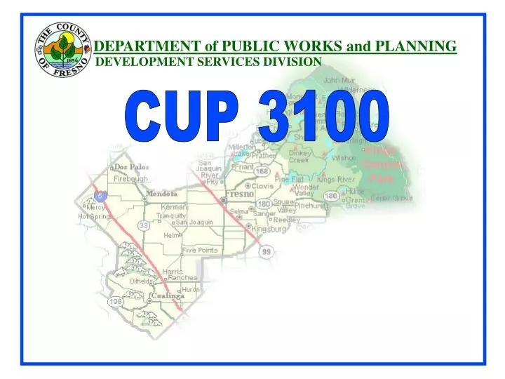
DEPARTMENT of PUBLIC WORKS and PLANNING. DEVELOPMENT SERVICES DIVISION. CUP 3100. Reduced Alternative 4 - History.

E N D
DEPARTMENT of PUBLIC WORKS and PLANNING DEVELOPMENT SERVICES DIVISION CUP 3100
Reduced Alternative 4 - History • May 2011, the Applicant proposed and endorsed a reduced version of the Draft EIR Alternative 4, which incorporates additional reductions in the size of the mining surface disturbance area, as well as substantially shortening the life of the project, and reducing both annual and total production levels. Specific data was still needed at this time to initiate a full analysis. • May 2011 to October 2011 Applicant submitted additional specific data to the County fully describing the Reduced Alternative – County EIR consultant and County staff analyze the reduces alternative for compliance with CEQA and potential impacts – completed November 2011. • Upon analysis - Reduced Alternative 4 was included in the FEIR and formally announced in the Notice of Availability December 2011. • Reduced Alternative 4 would not preclude mining on the face of Jesse Morrow Mountain, this Alternative would avoid excavation on the ridgeline (excavation on the face would be limited to a point approximately 500 feet below the ridgeline). Under the proposed project, excavation from the Jesse Morrow Mountain ridgeline allows the project to achieve 2:1 slopes at final contour. Under this Alternative, overall slopes would be 1:1.
Table 1 (see staff report Page 9) Proposed Project and Reduced Alternative 4 Summary Comparison
Planning Commission Hearing Summary February 9, 2012 • The Commission considered this item on February 9, 2012 • The Commission received/considered staff presentation, County Consultant, Applicant, public in favor of the proposal and public in opposition. • Upon consideration, the Commission Chair closed the public testimony portion of the hearing. • The Commission voted seven to one to continue the hearing to a date uncertain and to allow for applicant rebuttal and project opponent sur-rebuttal.
Issues raised at previous Planning Commission Hearing February 9, 2012 Biological Survey: Specifically related to general procedures and Mountain Lion habitat. Hydrology: Analysis of any potential loss of groundwater recharge and impact on groundwater levels, groundwater use during dry years and impact on groundwater levels, and the potential of blasting impact on wells and the canal. Air Quality: NOx/Ozone Relationship, Project Impact, and Explanation of ATC/PTO Permit Process, Explanation of NOx Emissions Sources and Comparison between Proposed Project and Reduced Alternative 4, PM Emissions Control Measures (Regulation VIII), and PM Emissions Threshold Response to SJVAPCD. Traffic: Clarification of proposed Mitigation Measure related to CalTrans facilities - Opening Day Improvements/ Fair Share Contribution. Geology and Soils/Zoning Exception Provision: Concern regarding Core Samples, Slope Stability of Reduced Alternative 4 Reclaimed Slopes and clarification pertaining to the Zoning Ordinance Exception. Clarification regarding the State Department of Conservation (DOC) review process (and their response) Blasting Procedures and Process: Operational Statement Clarification : Clarification based on specific questions regarding the maximum daily tonnage produced at the facility. Supply and Demand of Aggregate Material. Whether the Department of Conservation’s reports regarding supply and demand of aggregate material considered the recent recession. Selma Rail Facility: Whether the Selma Rail Facility should be considered a feasible alternative to the Project.
State Department of Conservation (DOC) & County staff Review • Department of Conservation Office of Mine Reclamation Conditions of Approval for the Jesse Morrow Mountain Reclamation Plan • Site Plan • 1. Prior to the commencement of mining activities, the operator shall submit the following information to the Department of Public Works and Planning for incorporation into the approved surface mining and reclamation plan in accordance with the provisions of the Surface Mining and Reclamation Act (SMARA) of 1975: • A Site Plan identifying in further detail the locations of structures and facilities to be utilized by the mining • operations. Such structures and facilities may include but not be limited to office buildings, parking areas, rock crushers, rock separators, etc... The Site Plan may be submitted independent of or as part of the mandatory Site Plan Review Application that must be filed and approved prior to the commencement of mining activities. The reclamation plan shall be supplemented with only those elements of the Site Plan subject to the provisions of the Surface Mining and Reclamation Act. Site Plan details supplementing the Reclamation Plan shall not be considered a substantial deviation of the approved reclamation plan under SMARA section 3502(d). • (b) An Engineered Grading and Drainage plan shall be submitted to the Department of Public Works and Planning demonstrating how surface runoff and drainage will be controlled in accordance with Fresno County Standards. The plan must include calculation of runoff quantities generated by this development and capacity of proposed facilities. The plan must also include detailed erosion control measures designed for not less than the 20 year/1 hour intensity storm event. The reclamation plan shall be supplemented with those elements of the Engineered Grading and Drainage plan subject to the provisions of the Surface Mining and Reclamation Act. Engineered Grading and Drainage plan details supplementing the Reclamation Plan shall not be considered a substantial deviation of the approved reclamation plan under SMARA section 3502(d). • Note: Upon receipt and deeming the materials complete, the information shall be processed as a plan amendment to allow the incorporation of these documents into the reclamation plan. As part of the review process, the County shall provide the Department of Conservation/Office of Mine Reclamation the opportunity to review the amended reclamation plan in accordance with the provisions of Public Resources Code Section 2774.
State Department of Conservation (DOC) & County staff Review 1(c). An engineering analysis that demonstrates The initial stability of the proposed 1.5:1 (H/V) pit slopes. The proposed treatment of slopes shall take into account the physical properties of the slope material (i.e., rock fracture orientations) and its probable maximum water content, be limited to a maximum of 1.5:1 (H/V) until such time as the operator causes to be conducted, but no Nolater than completion of the first bench, the operator shall cause to be conducted a supplemental geotechnical analysis by a professional with expertise in this field to support a steeper design. The analysis shall include factors of safety of 1.3 or greater for both bench-scale and large-scale slope failures as outlined in the Preliminary Slope Stability Analysis (GEOCON September 2011) provided in the Reclamation Plan and shall demonstrate stability under static and seismic conditions. If analysis is performed in support of a steeper slope, the project proponent shall submit to the Department of Public Works and Planning a report for review and approval. Approval of a steeper slope up to a 1:1 (H/V) shall not be considered a substantial deviation of the approved reclamation plan under SMARA section 3502(d). The County shall have 90 days to review and approve/deny the request based upon the information provided. Note: Upon receipt and deeming the materials complete, the information shall be processed as a plan amendment to allow the incorporation of these documents into the reclamation plan. As part of the review process, the County shall provide the Department of Conservation/Office of Mine Reclamation the opportunity to review the amended reclamation plan in accordance with the provisions of Public Resources Code Section 2774. 2(d). Monitoring and mitigation of areas of observed instability of the active mine and reclaimed slopes shall be conducted annually by a registered engineer or geologist. The annual reports shall be submitted to the Department of Public Works and Planning by the end of the calendar year . If, after three consecutive years, the geotechnical analysis can demonstrate mine and reclaimed slopes are stable and meet the design factor of safety annual monitoring shall cease and be modified to occur every three years until expiration of the CUP term or completion of mining.
State Department of Conservation (DOC) & County staff review Slope Stability Analysis for Overburden Pile 1(e). The rationale and assumptions used to determine that the overburden pile slopes, to be constructed at a slope angle of 2:1 (H/V) (maximum), will have a factor of safety that is suitable for the proposed end use. shall be limited to a maximum of 2:1 (H/V). Once the excavation activity has been in operation for one year the Theslope stability and factor of safety of the overburden pile shall be verified, with site-specific data obtained from representative samples, by a professional with expertise in this field, and a report submitted to Department of Public Works and Planning, within a period not to exceed one year from the commencement of earth moving activities at the site.. The County shall have 90 days to review and approve/deny the request based upon the information provided. If any revisions are necessary to the overburden pile design slope per the supplemental analysis the County shall require that they be instituted at that time. Minor changes to slope angle or factor of safety as a result of this initial geotechnical analysis shall not be considered a substantial deviation of the approved reclamation under SMARA section 3502(d). Note: Upon receipt and deeming the materials complete, the information shall be processed as a plan amendment to allow the incorporation of these documents into the reclamation plan. As part of the review process, the County shall provide the Department of Conservation/Office of Mine Reclamation the opportunity to review the amended reclamation plan in accordance with the provisions of Public Resources Code Section 2774.2. 2(f). Annual monitoring and mitigation of areas of observed instability of overburden pile slopes shall be conducted by a professional with expertise in this field. The annual reports shall be submitted to the Department of Public Works and Planning by the end of the calendar year . If, after three consecutive years, the geotechnical analysis can demonstrate overburden pile slopes are stable and meet the design factor of safety annual monitoring shall cease and be modified to occur every five years until expiration of the CUP term or completion of mining.
State Department of Conservation (DOC) & County staff review Department of Conservation Office of Mine Reclamation Conditions of Approval for the Jesse Morrow Mountain Reclamation Plan Background information: The reclamation plan incorporates the EIR findings that assert groundwater inflow and precipitation are insufficient in quantity, relative to evaporation, to cause accumulation and persistence of surface and groundwater in the pit under average annual conditions. Because accumulation of water can result in adverse water quality under certain conditions, the accuracy of conclusions is important. The following conditions isare designed to ensure that surface and groundwater will be protected from siltation and pollutants which may diminish water quality as required by the Federal Clean Water Act, the Porter-Cologne Act, County anti-siltation ordinances, the Regional Water Quality Control Board or the State Water Resources Control Board. Additionally, the conditions are designed to verify the conclusions and validity of the reclamation plan prior to creating the potential for such conditions by mining at depth and creating a basin with no surface water exit. Groundwater Analysis 1. 1. Before mining, the proponent shall submit all data used to form the conclusions of the May 16, 2012 EMKO Environmental, Inc. Technical Memorandum, which may include, but not be limited to, copies of original geologic boring logs prepared by a qualified and licensed professional, well construction details (screened intervals of wells, annular seal thickness and material), and all pumping test data and any hydrogeological evaluations prepared in association with well pumping test to the Department of Public Works and Planning. Note: The County shall provide the Department of Conservation/Office of Mine Reclamation the opportunity to review the above technical information. 2. Before mining below the elevation of 480 amsl, at least three exploratory wells shall be completed within the pit floor area to a depth below the ultimate pit floor elevation to gather data regarding groundwater conditions. The well locations shall be based on a fracture-trace analysis and theThedrilling program shall be prepared and directed, under a scope of work approved by the Department of Public Works and Planning, by a qualified and licensed professional, with experience in evaluating groundwater conditions within fractured bedrock. The wells shall be constructed in compliance with state of California Water Well Standards and Fresno County well permit requirements.
State Department of Conservation (DOC) & County staff review 23. After the wells are installed and properly developed, if groundwater is encountered, the wells shall be sampled and the samples analyzed at a California-certified laboratory for the same parameters shown in Table 3.8-2 Water Quality Analytical Results in the Final EIR. Should those conditions differ substantially from the conclusions in the Final EIR, supplemental analysis shall be completed to determine if annual retention of surface water within the pit could adversely affect groundwater quality. 34. After the wells are installed and properly developed, if groundwater is encountered, pumping tests shall be conducted and evaluated, under a scope of work approved by the Department of Public Works and Planning, by a qualified and licensed professional, to determine if the quantity would change the pit water balance calculations (see May 16, 2012 EMKO Environmental, Inc. Technical Memorandum). Should the analysis conclude that pit water would remain year-around under average annual conditions, the reclamation plan shall be amended, including consideration of the potential for degradation of the quality of surface and groundwater water. 45. In addition to the exploratory wells, at least three monitoring wells shall be completed down gradient from the pit floor area to a depth below the ultimate pit floor elevation to gather water samples for water quality impacts. The monitoring program shall be prepared and directed, under a scope of work approved by the Department of Public Works and Planning, by a qualified and licensed professional with experience in groundwater monitoring and shall include a monitoring schedule for sampling. Should those conditions differ substantially from the conclusions in the Final EIR, supplemental analysis shall be completed to determine if groundwater quality is being adversely affected by mining operations. i “Scope of Work” is defined as a work program that defines the parameters of subsequent studies to confirm findings identified in the EIR. The Scope of Work shall include, but is not limited to, description of the work program, onsite monitoring activities, reporting obligations, and timeframes for which work program, monitoring, and reporting shall be completed. Note: Upon receipt and deeming information materials complete, the information shall be processed as a plan amendment to allow the incorporation of these documents into the reclamation plan. As part of the review process, the County shall provide the Department of Conservation/Office of Mine Reclamation the opportunity to review the amended reclamation plan in accordance with the provisions of Public Resources Code Section 2774.
DEPARTMENT of PUBLIC WORKS and PLANNING DEVELOPMENT SERVICES DIVISION CUP 3100