Download
1 / 18
180 likes | 258 Views
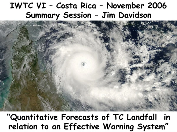
Evaluating the Effectiveness of Warning Systems IWTC-6, Costa Rica. Woo-Jin Lee Korea Meteorological Administration. Working group 5.1.

E N D
Evaluating the EffectivenessofWarning SystemsIWTC-6, Costa Rica Woo-Jin Lee Korea Meteorological Administration
Working group 5.1 Mr. Peter J. Bowyer (Canadian Hurricane Centre)Mr. Wenjie Dong (China Meteorological Administration) Mr. Charles Guard (US National Weather Service)Mr. Edwin S.T. Lai (Hong Kong Observatory) Mr. Woo-Jin Lee (Korea Meteorological Administration) Rapporteur Mr. Nobutaka Mannoji (Japan Meteorological Agency)Mr. M Alimullah Miyan (SADMC, Bangladesh) Ms. Rosa Perez (PAGASA, Philippines) Mr. T. Prasad (Office Of ADGM, India) Mr. Alan Sharp (Bureau of Meteorology, Australia) Mr. J. Weyman (US National Weather Service)
Background(1) Total warning systems were discussed at IWTC-5 (2002) • Forecast accuracy and reliability; encouraging special effort on landfalling TCs • Warning dissemination and presentation; • Warning response, public education, disaster management; • Internation and regional cooperation.
Background(2) • Improved accuracy and quantification of uncertainty; WMO Expert Meeting on Effective Early Warnings of Tropical Cyclones (Kobe, 17- 18 Jan. 2005) • Adequate resources for disaster mitigation; • Qualified personnel; • Sufficient attention to non-structural (public awareness, information sharing, etc.) mitigation measures; • Adequate institutional and infrastructure practices for coordination and capacity-building at national, regional and international levels; • Adequacy of a national disaster management policy; • Community consciousness.
Forecasting Techniques(1) • Structure analysis for weak TCs to be harmonized among neighbouring countries. • Model guidance on intensity need to be improved • Analysis of ET varies from center to center • Much to be learned for the interaction of TC with other circulation systems such as monsoon, topography, mid-latitude troughs • Application of consensus (and/or EPS) yet challenging from case to case • Nowcasting tools to be improved for landfalling cyclones
Forecasting Techniques(2) • Continuity and consistency is no less important attribute for operational center Availability of dynamical and statistical tools/ model products, and familiarity of the forecasters on those products Verification to be extended to consider the continuity among different centers, initial conditions (incl.bogusing), times periods Predictability of track and intensity for 6-12 hours range before landfalling have to be evaluated Communication channels have to be maintained among forecasters at neighboring countries to exchange views on formation and transition stage in particular
Warning Presentation(1) Actions to take to protect → DISASTER SCALES • Saffir-Simpson Hurricane Scale • Saffir-Simpson Tropical Cyclone Scale(STiCKs) Extended use at Southwest Pacific and south east Indian ocean Weakness with storm surge values • Australian scale • 5 categories covering weak storms and severe TCs based on max. gust wind (3sec) • Philippines scale • Boundary issue • Interaction with monsoons and slow moving depression • Bangladesh • Numbering of signal confusing • Maritime bias • Separate warnings may be used for heavy rain, strong wind, storm surges, etc.
THE SCALE From slide of Mr. C. Guard TYPHOON CATEGORIES TYPHOON CATEGORY 1: MINIMAL TYPHOON. Max Sfc Wind 74-95 mph (64-82 kt) Peak Gusts 95-120 mph (82-105 kt) TYPHOON CATEGORY 2: MODERATE TYPHOON. Max Sfc Wind 96-110 mph (83-95 kt) Peak Gusts 121-139 mph (106-120 kt) TYPHOON CATEGORY 3: STRONG TYPHOON. Max Sfc Wind 111-130 mph (96-113 kt) Peak Gusts 140-167 mph (121-144 kt) TYPHOON CATEGORY 4: DEVASTATING TYPHOON. Max Sfc Wind 131-155 mph (114-135 kt) Peak Gusts 168-197 mph (145-170 kt) TYPHOON CATEGORY 5: CATASTROPHIC TYPHOON. Max Sfc Wind 156-194 mph (136-170 kt) Peak Gusts 198-246 mph (171-216 kt).
Warning Presentation(2) • Heavy rain Orographically induced rainfall before landfall Interaction with other circulation systems (convergence line, upper level troughs, etc.) • Strong wind, • Asymmetry under ET • High waves • Swells in front of moving storm • Uncertainties and probabilistic information • Position error and gust wind Conduct a survey on existing disaster scales Understand the needs and interest of users Extend probabilistic expressions on other TC parameters
Typhoon Nida 13 to 22 May 2004 Source: RSMC Tokyo-Typhoon Center
Warning Dissemination(1) Multiple and diverse approaches • Internet is limited to access warnings • Satellite communication efficient, • Robust in adverse weather conditions • Customized warnings to activate loud sirens • RANET(RAdio interNET) digital satellite radio broadcast • New media, • Mobile phones • Digital multimedia broadcasting (DMB), internet portal sites • Cable TVs • Other issues • Door to door notification is most effective (volunteers in Bangladesh) • Commercial sector could play some role • Tourists be accessible
Warning Dissemination(2) Disseminate warnings through multiple and diverse channels with varieties of high and low technology with backup capabilities to facilitate users to respond to the warnings in a timely manner
Public Awareness(1) • Storm surge Various mixture of tide, surge, wave runup • Specific details • Rain? Wind? Waves? • Parameters • Position and radius of influence • Probabilistic circles and intensity • Uncertainty of track and intensity forecasts • Position fix • Track errors particularly under landfalling (sensitivity on approaching angles to the coast line) • Structure or process dependency • TD, TC, ET? Catrina case……
Public Awareness(2) • Various source of information available Internet access to various centers on position, track, structures (formation, weakening to tropical depression, ET) • Public confused • Particularly when storm pass between neighbouring countries of surrounding oceans • Often over warning to reduce risk in case of forecast failure • Media interest and criticism • Reasons behind the discrepancy in case of severe conditions Conduct research to find out what people understand and not understand
Public Awareness(3) Accuracy and timeliness is not sufficient – false alarms, rare occurrence, “It won’t happen here” • Physical vulnerability at locality counts • Curriculum of primary and secondary school • Guam, 45 hours of instruction • Outreach program • Large investment for small audience (Guam) • Community based approach (Philippines) • Year round activities, campaigns • Cooperation required among decision makers, emergency managers, media, stakeholders at community level
Int’l Cooperation The resource and information is limited in the developing countries for the warning service • satellite data (some access through Internet only) • rain gauge obs station • EPS products and high resolution model output Regional Cooperation in application of model output and other forecasting guidance, and enhancement of communication capabilities
Summary Statistical and dynamical guidance need to be improved particularly for landfalling TCs, weak TCs, for unusual track behaviors, and for ET cyclones Increased investment is required in public awareness to reap the full benefit of significant progress made in TC forecasting through very large investment of fund and dedicated efforts of scientists on a worldwide scale International cooperation need to be strengthened to share the information and analysis tools among the research/ operational centers