Download
1 / 46
460 likes | 587 Views
Deepening, Lengthening and Widening of Berth 203 to 205, Container Terminal, Pier 2, Port of Durban. PUBLIC OPEN DAY - EIA : 31 October 2012. WELCOME & INTRODUCTION. WELCOME!

E N D
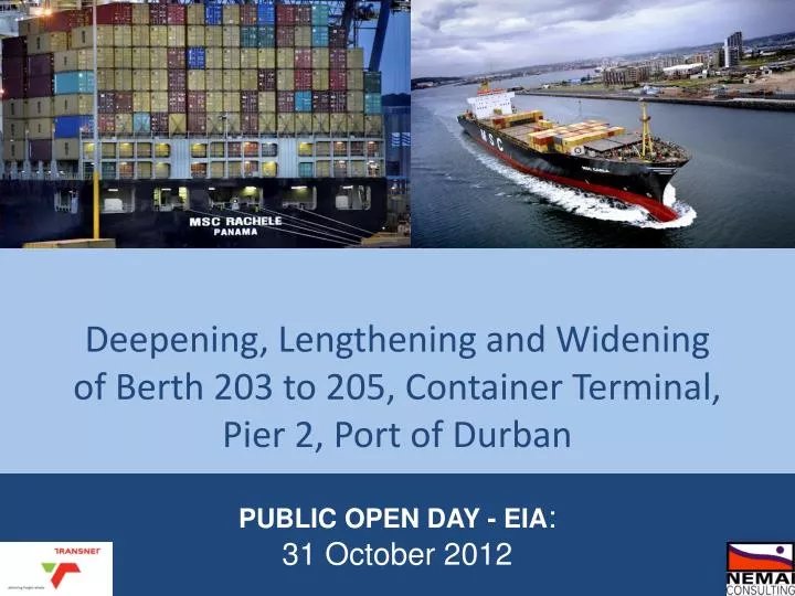
Deepening, Lengthening and Widening of Berth 203 to 205, Container Terminal, Pier 2, Port of Durban PUBLIC OPEN DAY - EIA: 31 October 2012
WELCOME & INTRODUCTION WELCOME! Thank you for taking the time to attend the Public Open Day. Your presence is appreciated . Please take a seat and watch the presentation. After the presentation you will have an opportunity to ask the technical and environmental teams questions. Should you have any comments please complete a reply form. We value your contribution to the EIA process. There are maps at the back of the hall should you want to view them. We look forward to your contribution. 2
MEET THE PROJECT TEAM Proponent Consultants 3
WHY HAVE A PUBLIC OPEN DAY??? To provide feedback since the Scoping Phase; To present the findings of the EIA study which is informed by the various specialist studies; and To provide an opportunity for you to submit and raise your comments for consideration by the project team. 4
WHY HAVE A PUBLIC OPEN DAY??? In addition, a Public Open Day allows, you, the I&AP to participate in the EIA process at your convenience. The project team will be available throughout the day for you to ask questions and raise queries. 5
RECAP SINCE THE SCOPING PHASE – WHY IS THIS PROJECT NECESSARY??? The current quay walls at Berth 203 to 205 are over 50 years old and is beyond its original design limits. Hence, the quay walls are considered unsafe and need to be upgraded. At the same time the Port of Durban has experienced a steady growth in container numbers and vessel sizes. Therefore, the design for the upgrade to the existing quay walls needs to take into account the larger vessels entering the Port. As the berth channel is not deep enough, large vessels can only enter and leave the Port at high tide which negatively impacts the efficiency of the Port. Further, the Port of Durban is considered a ‘hub’ port and to maintain this status, it needs to accommodate the larger vessels which will improve its efficiency. Hence, the upgrade of the unsafe quay walls presents an opportunity to improve the safety and efficiency of the Port of Durban. 6
WHERE IS THE PROJECT LOCATED??? FOCUS OF THE PROPOSED PROJECT IS PIER 2 PIER 2 PIER 1 DURBAN CONTAINER TERMINAL COMPRISES OF 15 BERTHS CAN ACCOMADATE 8 POST PANAMAX VESSELS
WHERE ARE BERTHS 203 to 205 LOCATED? 203 204 205 WATER DEPTH -12.8m CDP EXISTING CRANE ASSEMBLEY AREA TOTAL EXISTING BERTH LENGTH OF 914m EXISTING SANDBANK
EXTENSIONS 170m Extension of Berth 205 100m Extension of Berth 203
WHAT IS THE PROBLEM WITH THE EXISTING QUAY WALLS??? • It was built in the 1960s and does not meet the minimum Eurocode 7 Safety Standards; • The berth channel is not deep enough as a result scour holes have formed which has undermined the structural stability of the existing quay wall; • The berths are only 914m long and it needs to be 1190m to accommodate three Super Post Panamax vessels; and • The current quay wall cannot safely accommodate the larger Ship to Shore cranes.
VESSEL SIZES AT DCT DCT is presently operating vessels of 6000 TEU and greater The original quaywall was designed to accommodate a 1000 TEU vessel with wharf cranes
WHAT EXACTLY IS THIS PROJECT ABOUT??? The project involves: The westward lengthening of Berth 205 by 170m; The eastward lengthening of Berth 203 by 100m; The widening of Berths 203 to 205 by 50m; The deepening of the Berth channel, approach channel, and vessel turning basin from the current -12.8m CDP to -16.5m CDP; Excavating the trench for the new quay wall structure from -12.8m CDP to -19m CDP (for caisson option only); The offshore disposal of dredge material; The offshore sand winning for infill material; and The installation of new Ship to Shore (STS) cranes and associated infrastructure. 12
WHAT ALTERNATIVES WERE CONSIDERED? The EIA Regulations require that we consider different alternatives. Initially, three technological alternatives were presented in the Scoping Report. These were: • Caisson, • Sheet Pile; and • Deck on Pile. Further, two alternative offshore sand winning sites were presented. These were: • Area 1; and • Area 2 Only one dredge footprint was presented. However, impacts on the Central Sandbank was one of the main concerns raised by I&APs. This led to process whereby alternatives dredge footprints were considered Initially, the specialist met to discuss the original dredge footprint. In addition, the engineering team had to consider ways in which the dredge footprint could be decreased without impacting on the safety of vessels. This led to various dredge footprint alternatives. The CSIR then modelled the impacts of these dredge footprints in terms of bed shear stress and likelihood of erosion. A specialist integration meeting then took place where the findings of the specialist studies were presented. Based on this meeting, the dredge footprints were further refined and assessed by the specialists. This resulted in the final preferred alternative, Option 3G. 13
OFFSHORE SAND WINNING ALTERNATIVES • Two alternative offshore sand winning sites were assessed: • Area 1; and • Area 2. 15
AREA 1 16
AREA 2 17
DREDGE FOOTPRINT ALTERNATIVES • Six dredge footprints were assessed. • Option 3B • Option 3C • Option 3D • Option 3E • Option 3F • Option 3G • As explained earlier these were modified based on the findings of the specialist studies and discussions between the project team. 18
OPTION 3B Original dredge footprint including large amount of scour protection along western edge of Berth 205 19
OPTION 3C Provision of Caisson wall along western edge to minimise loss of Sandbank habitat 20
OPTION 3D Includes Sandbank Expansion. This option results in a net loss of -4.6% of sandbank habitat 21
OPTION 3E Includes Sandbank Expansion. There is only a small difference between this and Option 3D. This option results in a net loss of -3.8% of sandbank habitat 22
OPTION 3F Includes Sandbank Expansion. In this option the expanded sandbank area is increased. . This option results in a net loss of -0.1% of sandbank habitat 23
OPTION 3G Option 3G also includes the Sandbank Expansion. In this option the expanded sandbank area is increased. This option results in a net GAIN of 0.03% of sandbank habitat. 24
SPECIALIST STUDIES A number of specialist studies were undertaken to determine the potential impact of the proposed development. These include: • Estuarine Biodiversity Specialist Study: • Marine Biodiversity Specialist Study – Offshore Sand Winning Sites • Avifauna Specialist Study • Underwater Heritage Impact Assessment (Sand Winning Sites and Port of Durban) • Economic Impact Assessment • Sediment and Chemical Analysis of Dredge Material • Potential Long Term Impacts to Sandbank Habitats, Water and Sediment Quality • Modelling of potential environmental changes in the port marine environment • Dredging Turbidity and Physical Impact Study • Assessment of Alternative Design Options 25
SPECIALIST STUDIES – ASSESSMENT OF ALTERNATIVES The following conclusions and recommendations are made for the Berth 203 to 205 Expansion (ZAA, 2012a): • The Caisson Option is substantially preferable to the other options on a wide range of the issues considered, including: • Cost • Potential life without high maintenance costs • Greater risks and complexity during construction • Potential stability of the existing quay wall • It was recommended that Option 3G should form the basis of the final design due to its decreased impact on the sandbanks compared to the original options, but subject to confirmation of its suitability and safety in respect of the vessel navigation requirements (ZAA, 2012a). 26
SPECIALIST STUDIES – DREDGING TURBIDITY AND PHSYICAL IMPACT STUDY ZAA (2012b) makes the following conclusions and recommendations: • No significant negative environmental impacts in regards to increased turbidity and erosion have been identified; • The physical extent of the proposed works is too limited to have any significant impact on the surrounding coastlines and beaches; • In all cases, the calculated suspended sediment concentrations have been found to be low (peak values less than 45mg/l); and • Maximum concentrations from the offshore disposal site have been estimated to be low (less than 5mg/l) after four hours and will not reach the shoreline at concentrations above the low risk levels. 27
SPECIALIST STUDIES – Estuarine Impact Assessment The following recommendations and conclusions were made: • All three quay wall options have similar impacts. • Negative impacts include the destruction and disturbance of intertidal and subtidal soft bottom habitat and associated invertebrate and fish communities. • These effects may be reduced only by strict adherence to a suite of proposed mitigation measures that include refilling/backfilling and enlarging of the Central Bank sand flat in addition to strict operating rules pertaining to dredging such that the extent of any turbidity plumes are minimised and do not exceed specified threshold levels. • Overall impact significance can be reduced to low levels for most aspects of the proposed development, except habitat loss due to the mattresses which are likely to have a medium impact. • A monitoring program to determine the actual impacts of the widening of the Berths on the biodiversity of Durban Harbour is recommended and described, from pre-construction and into the operational phase of the Berths. • In addition, monitoring of the backfilled part of the Central Bank sand bank and the artificially enlarged portion of this sand bank is recommended. • Monitoring of turbidity levels during dredging is also prescribed to ensure that threshold limits are not exceeded. 28
SPECIALIST STUDIES – Offshore Sand Winning Impact Assessment The following recommendations and conclusions were made: • Monitoring of turbidity levels is to be undertaken at the sites indicated in (blue dots) with measurements taken at the surface, mid-water and at the bottom. • Turbidity levels at these stations are to be monitored continuously for at least two months prior to the start of the the sand winning and dredge spoil disposal operations and should continue for a minimum of two months after • At no point should the turbidity levels exceed the established maximum threshold of 20 mg/L. • Sand Winning activities should be restricted to Area 1 (the southernmost of the two sites proposed) in order to avoid disturbing Site 2 (the northernmost site) as this area is largely pristine (Miller & Leuci, 2001). 29
SPECIALIST STUDIES – Avifauna Impact Assessment The following recommendations and conclusions were made: • Sandbank expansion as proposed in Option 3G should be undertaken as it will result in a net gain of 0.03% of intertidal sand flat • Undertake all dredging within 100 m of the Central Sandbank intertidal-sand flats during winter when bird abundances are lower and Palearctic migrants are away. • As far as possible construct the artificial extension of Central Sandbank during winter when migrant waders are absent. • When dredging within 100 m of Central Bank intertidal-sand flats, do not dredge at multiple sites concurrently, but only at one area at a time with a single dredger. • No dredging operations should be conducted between sunset and sunrise within 100 m of Central Bank intertidal-sand flats including the infilling of sand up to the new quay wall of Berth 205 and southward enlargement of Central Bank. • Monitoring protocol as explained in Avifauna Impact Assessment to be followed. 30
SPECIALIST STUDIES – Potential Long Term Impacts to Sandbank Habitat, Water and Sediment Quality The following conclusions and recommendations were made (CSIR, 2012a): • The habitat loss of the Central Sandbank does not result in a loss of connectivity between the Sandbanks, Mangroves and Little Lagoon. • Losses in habitat from some tidal elevations do occur but are mainly from deep subtidal and high intertidal habitat. The development of the Sandbank Expansion results in the creation of significant area of new low intertidal and shallow subtidal habitat. Development Option 3G is therefore preferable. • Most of the habitat lost with Option 3G is of deep subtidal and high intertidal sandbank area which have the lowest ecological value in terms of estuarine nursery function. • Development option 3G is the only design layout that does not result in a net loss of habitat when all tidal elevation zones are considered. Indeed a slight gain in habitat is achieved through the Sandbank Expansion (623m2 or 0.03% of total Sandbank habitat). 31
SPECIALIST STUDIES – Potential Long Term Impacts to Sandbank Habitat, Water and Sediment Quality • The long term stability of sandbank habitat to be created as part of Option 3G is essential to successful mitigation. • Monitoring of ecological succession on the sandbank to be created as part of Option 3G is also recommended. • Changes in current velocities over ecological habitats will generally be very low. • Numerical modelling has demonstrated that the development will not significantly alter current strengths, circulation fluxes or flushing rates in Durban Bay. • Overall the report found that Option 3G would have a neutral impact taking into account the extension of the Central Sandbank. • An optional additional mitigation measure would be to create additional shallow subtidal habitat in the Sandbank Expansion and attempt to establish Zostera capensis seagrass in this area. 32
SPECIALIST STUDIES – Wave Modelling Study The following conclusions were made (Van Ballegooyen et al., 2012): • Given the small loss of sandbank habitat associated with development Options 3B to 3D and the potential for further erosion between berth 205 and Little Lagoon, two further design iteration were undertaken to both ensure no net loss of sandbank habitat. • This results in Option 3G. • The changes in tidal prism are limited as are any localised changes in surface and bottom velocities. • No major change in seiching behaviour in the port was identified. Changes in areas of concern such as the Yacht basin are negligible. 33
SPECIALIST STUDIES – Sediment and Chemical Analysis Based on the low concentrations of metals and organic chemicals in sediment within and near the dredging footprint there is a very low probability that chemicals released from the sediment during the dredging and spoil disposal processes will be present in the water column at toxic concentrations. There is also a low probability that contaminants translocated to the spoil disposal ground will be present at concentrations that will adversely affect bottom-dwelling organisms 34
SPECIALIST STUDIES – Underwater Heritage Impact Assessment From a heritage point of view, work can continue in the harbour as long as the mitigation and measures are implemented; and; • Sand Winning at the specific portion of either Area 1 or Area 2 is recommended (see map) 35
SPECIALIST STUDIES – Economic Impact Study If the expansion does not occur there will be a significant loss of handling capacity of 284 108 TEU’s carried on vessels too large to be berthed at Berth 203 to 205 This has a direct spend loss impact of R1961 million, induced spend of R1569 million, port related employment loss of 852 jobs and total employment loss of 3530 over the period of 2016 – 2020. 36
SPECIALIST STUDIES – Geotechnical Study Based on the geotechnical results, ZAA (2012a) has made a number of recommendations: • Due to the existing poor soil condition at the quay walls, Caissons are the preferred option; • Soft piling is required as a form of soil improvement • Sand Winning Area 1 is preferred. 37
BEST PRACTICABLE ENVIRONMENTAL OPTION (BPEO) Based on the recommendations of the specialists, technical considerations and the comparison of the impacts associated with the three quay wall options, five dredge footprint options and two offshore sand winning options, a combination of alternatives was selected. • The Caisson quay wall alternative was selected due to the following factors: • Poor soil conditions along the quay wall; • Safety considerations; • Low maintenance requirements; • No cathodic protection or specialist coating requirements; • Caissons built within the Port of Durban (at Lot 10) and can be floated into position and thus no insitu casting of piles is required. • Dredge material from the dredge footprint can be used for the infill of the Caissons and behind the quay wall at Berth 205 and thus reduces the volume of dredge material to be disposed of; and • Environmental specialists did not have a preference in terms of quay wall alternatives. 38
BEST PRACTICABLE ENVIRONMENTAL OPTION (BPEO) The Caisson quay wall will be used in combination with Dredge Footprint Option 3G. This option was selected for the following reasons: • The provision of the Caisson quay wall along the western edge of Berth 205 prevents long term erosion between the Little Lagoon and western edge of Berth 205. • The provision of the Central Sandbank Expansion results in a 0.03% net gain in Central Sandbank habitat. This increases the area of shallow subtidal and interidal habitats, which are ecologically important, by 49.7% and 4.1% respectively. • The use of dredge material in the creation of the Central Sandbank Expansion decreases the volume to be disposed at the Offshore Disposal Site. Offshore Sand Winning will still be necessary. This will take place within Area 1 as recommended by the Marine Biodiversity Specialist. Further, dredging will be contained within a sub-area within Area 1 as suggested by the Maritime Archaeologist (Area 1a). This option was selected for the following reasons: • Area 1 is more disturbed than Area 2 and the overall impact is likely be less significant as this site has been used for dredge disposal in the past. • Although Area 1 has a known wreck, dredging will be contained to the northern strip (Area 1a) as shown above and thus there is a lower probability of uncovering potential Underwater Heritage Sites. • . 39
IMPACT STATEMENT With the selection of the BPEO for the quay wall alternatives, dredge footprint and offshore sand winning site, the adoption of the mitigation measures included in the EIA Report and the dedicated implementation of the suite of EMPrs, it is believed that the significant environmental aspects and impact associated with this project can be suitably mitigated. With the aforementioned in mind, it can be concluded that there are no fatal flaws associated with the project and that authorisation can be issued, based on the findings of the specialists and the impact assessment, through the compliance with the identified environmental management provisions 40
RECOMMENDATIONS The following key recommendations, which may also influence the conditions of the Environmental Authorisation (where relevant), accompany the EIA for the Berth 203 to 205 Expansion: 1. The mitigation measures contained in the suite of EMPrs must be adhered to at all times. 2. The Central Sandbank Expansion must be undertaken at least 6 months prior to the construction of the western portion of Berth 205 3. Monitoring must be undertaken two months prior to the Sandbank Expansion and at least 6 months after the expansion. 4. The feasibility of creating Zostera capensis seagrass bed habitat in this sandbank extension area should be further assessed. If possible, the relevant environmental specialists should be appointed to oversee the permit process for translocation of Zostera capensis into Durban Bay as well as the actual habitat creation process. 5. Turbidity monitoring stations must be placed as recommended by Anchor Environmental (2012a and b). 6. The results of the monitoring must be provided to the ECO, EMC and DEA. 7. Dredging must be stopped in turbidity levels increase above 50mg/l within the Port of Durban or 20mg/l at the Offshore Sand Winning sites; 8. The location of shipwreck in Area 1 as well as the exact extent of the Sand Winning Area 1a must be noted by the dredge operator. Plotted coordinates of the location of the dredger throughout the dredging activity must be provided to the ECO. 9. If the dredge uncovers any underwater heritage, dredging must stop and SAHRA must be notified. A qualified maritime archaeologist must be then called to further assess the site 41
ENVIRONMENTAL AUTHORISATION PROCESSES 42
ENVIRONMENTAL AUTHORISATION PROCESSES Proposed Approach NEMA - EIA Proposed Approach MPRDA – Offshore Borrow Pits Proposed Approach NEM: ICM – Dumping at Sea Permit 43
PUBLIC PARTICIPATION PROCESS TO DATE To date the following as been undertaken: • Scoping Phase • The landowner (Transnet) was notified; • A focus group was convened; • A random survey was conducted; • Adjacent landowners within 100m were notified; • On site notices and adverts were placed; and • A project specific website domain was registered. • EIA Phase • On site notices were placed; • Adverts were placed in the Chatsworth Rising Sun, Southlands Sun, Isolezwe and the Mercury • BIDs were delivered to tenants within 100m • Registered I&APs were notified by email and sms • The Draft EIA report was made available at two public venues and uploaded on the project specific website (www.berth203to205expansioneia.co.za). 44
OTHER LICENSING PROCESSES • A Mining permit for the offshore borrow pit will be made to DMR in terms of the MPRDA. • A Dumping At Sea Permit for the offshore disposal site for the dredge material will be made to the DEA in terms of the NEM:ICM. 45
This brings us to the end of the presentation. We trust that you have sufficient information on the project. Please raise all questions at the technical station. We encourage you to complete a reply form before you leave if you have any comments. Should you prefer, please free to comment anonymously. THANK YOU FOR YOUR TIME. 46