Download
1 / 23
230 likes | 235 Views
C oastal zone management in Pärnu, Estonia. Hannes Tõnisson Are Kont Kaarel Orviku Reimo Rivis Ülo Suursaar Valdeko Palginõmm. Acknowledgements :

E N D
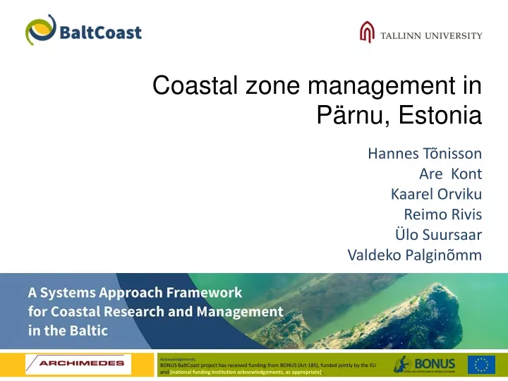
Coastal zone management in Pärnu, Estonia Hannes Tõnisson Are Kont Kaarel Orviku Reimo Rivis Ülo Suursaar Valdeko Palginõmm Acknowledgements: BONUS BaltCoast project has received funding from BONUS (Art 185), funded jointly by the EU and [national funding institution acknowledgements, as appropriate].
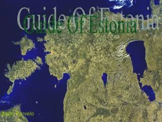
Pärnu Bay study area Valgeranna Pärnu city Lottemaa Pärnu Bay study area including City of Pärnu, Lottemaa and Valgeranna summer resort (arrows are indicatingthedirection of sediment transport)
General information (Pärnu and Pärnu Bay): • Area (Pärnu Bay) ca 400 km2 • 20km long and up to 11.5 km wide bay, max depth 12 m; • Largest sea-level fluctuations in Estonia (-130..+275 cm). • Port of Pärnu in the mouth of River Pärnu, the most important harbour in the region, 4th biggest cargo harbour in Estonia 1 800 000 t/year; • Over 40 000 inhabitants, most important summer resort in Estonia; over 50 000 tourists on the Pärnu bay beaches in one day (official record).
What istheproblem? • Occasional, extreme storm events in autumn or early winter – itisnotregular, people are notusedtoit. Higheconomicallosses, threattolife • Such storms may cause storm surges of 2-3 m height in the practically tideless Pärnu Bay = largeareasinundated, includingresdidentialareas; • Resultingerosion in surroundingbeaches and siltation of Harborchannel – themostimportantharbor in theregion
Character of the problem Variations in monthly maximum sea levels at Pärnu (see also Mäll et al. 2017). Please note that 150 cm is critical level for Pärnu!
Most important impacts are:1. Inundation of the City – affected people, infrastructure and real estate2. Rapid sediment re-distribution - Erosion (damage and loss of infrastructure) and accumulation (again damage to infrastructure – siltation of harbour channels)
Pärnu Beach (during winterstorm) Pärnu Postimees
Pärnu Bay study area conceptual model City of Pärnu Valgeranna and Lottemaa Natural hazard – storm surge Inundation of city center Erosion of sandy beach Siltation of navigation channel Loss of sunning and swimmingarea Damaged dwellings, infrastructure, tourist facilities Lostprofitfrom tourist and cargo service Disturbances in transport and communication Responses and adaptations Smartsolutions Raising of awareness, warning of people Health and rescue services Regulations of constructing in areas at risk Changes in coastal and marine spatial planning Compensationsystem (combined)
Conceptualmodel– Rapid sedimentdistribution Natural hazard – storm surge Siltation of navigation channel Erosion of sandybeach Lostprofitfrom tourist and cargo service Loss of sunning and swimmingarea Damaged dwellings, infrastructure, tourist facilities Compensationsystem (lessdredging, cheaper nourishment) Buildingdunes Nourishingbeaches (withdredgedsand) Smartsolutions Inundation of city center Responses and adaptations
Conceptualmodel – inundation of City centre City of Pärnu Valgeranna Natural hazard – storm surge Inundation of city center Disturbed economical activities Damaged dwellings, infrastructure, tourist facilities Disturbances in transport and communication Smartsolutions Health and rescue services Responses and adaptations Compensation system (combined) Hard defence measures Changes in coastal and marine spatial planning Regulations of constructing in areas at risk Raising of awareness, warning of people
Solutions - Scenarios for solving the problem: • 7.35 km longdamalongthecoast and 3.06km alongtheriverbank. Protectingcentralpart of Pärnu only. • Totalcostwithoutmaintenance, redesign of sewagesystem, newmeliorationsystem and enviornmentalimpactassessment = 48 mln Eur. • Totalprognosedlossesduring 100 yris ca 35 mln eur = notcosteffective + loss of identityfor Pärnu 1. Building the dam scenario (based on oldproject)
2. DISSIPATION Scenario: We tried to apply our dissipation model for the 2005 storm replay. We must admit that the results were more than disappointing: No further analyses
3. Adaptation scenario: • Critical level for the Pärnu city was established, commission was formed and general action plan was compiled to react for different surge levels. Proper risk assessment has been carried out and new equipment for rescue services has been bought. All these actions allow to help inhabitants in most effective manner during large storm surges. • Changes and clarifications in legislation –Minimum level for floor is 3.0 meters. • Public web-page with sealevel monitoring data and sea-level prognoses for next 48 hours + flood risk maps created for densely populated area – Pärnu city.
Adaptation and raising awareness scenario chosen + supporting parallel scenarios (beach nourishment). The following measures proposed: • Serious games at local schools and kindergartens teaching how to escape from storms – knowledge on how to act during crisis; • To draw inundation levels on the local pedestrian roads (blue, wavy pattern and inundation levelon the pedestrian walk) – increasing awareness. • Stickers indicating different inundation levels on the street signs, electric poles, traffic lights and gardens – raising awareness. • Public emergency “lifting service” to help the aged people to lift their electronic equipment and furniture to higher elevation in their homes – Reducing losses. • Total cost for 100 years is ca 1 mln eur!
Parallel (supporting) activitites – Beach nourishment. • Rapid erosion in neighbouring municipalities (1500 m3/yr); • Loss of high-valued recreational sandy beaches (9500 eur/yr is the cost of lost land) –> ,lost ecosystem services and increased recreation pressure to the central Pärnu beach; • Damage to tourism infrastructure (no sandy beaches, destruction of trees and adventure track, damage to the tourism facilities (Lottemaa, etc.);Loss of sand from valuable nearby beaches • Accumulation nearby harbour channel = 3500 m3/yr
Actions taken so far_- Inundation of the City: • Estonian Water Act, Chapter 51 on the assessment and management of flood risks. Based on this, the document “The preliminary assessment of flood risks” has been compiled and approved by the Ministry of the Environment in 2012; • densely populated areas are regarded as risk areas, for these areas, maps with a different likelihood for floods have been compiled, which are available at the respective map application of the Estonian Land Board; • emeregncy act re-newed (For the whole Estonia); • emergency commission established and action procedure and diferent actions for diferent flood levels; • First response (sandbags for smaller events to protect lower buildings); • Preliminary closure of streets that will be affected (no extreme weather tourists); • Affected dwellings, infastructure and residential areas for each level were defined); • Insurance companies have ordered their own inundation maps, more detailed than public ones and not only for densely populated areas – cooperation between rescue and insurance
Further actions needed (Gaps and solutions): • Informing inhabitants is not up the task yet (there is storm warning and prediction of flood level but information is not translated to „normal people language“) – application of previously described measures?; • Clear and throughout information (also for less densely inhabited areas) on flood levels belongs to insurance companies only – how to inform public? Urgent need for delivering such an information to public; • Affected infrastructure and real-estate is known for different flood levels, however, for most of them, there is no plan how to tackle with increasing flood levels and how to protect these and compensate the costs.Number of public buildings (over 20% of 1/10 year inundated buildings are public buildings) will be also affected – co-operation with insurance companies?! • Redesign of sewage and melioration system?
Rapid sediment re-distribution (Actions, gaps solutions) Reduced land-loss, practical use of dredged sediments, less need for harbour dredging: • Onlysmallscaleprojectstoprotectbeaches (buildingdunes, harddefence) = Highcosts and no generaleffect and coordination; • Siltation of theharbourchannel (Port of Pärnu, mostimportantharbour in theregion, 4th biggest cargo harbour in Estonia 1 800 000 t/year) – sedimentstakentothedeeper sea, outfromthecoastalsystem and causingproblemsforfishermen. Solutions and gaps: • Dredgedsedimentsbacktothebeach- indicative costs for trasportation of thesedimentsforbeach nourishment in nearbybeacheswascalculated = ca 3000 eur/yr • Commonpracticedoesnotallowtoreplacedredgedmaterial on thebeach – expensive, timeconsumingprocess, problemswithlegislationinterpretation. Good (pilot) practices and generalactionplans are needed.
How BONUS Batcoast may help? • Drwaing attention and starting discussion on the topic – dredging and using this material for nourishing. How to break common practice barrier, needs to change legislation? Strating from other regions (extreme hot spots) and drawing parallels with our study area? • How can we solve the problem that crisis communication is only on the paper – Going to the school and mobile? • How to use the fact that we are in the process of administrative reform? Drawing attention to new municipal politicians just after the elecetions – there is urgent need for homogenization of legislation in united municipalities, general action plans fpor protection and icreasing awareness!