Download
1 / 19
190 likes | 325 Views
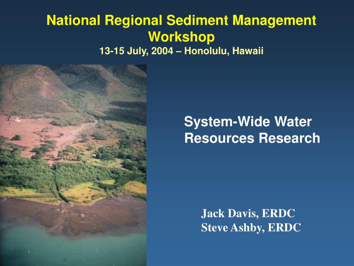
National Regional Sediment Management Workshop 13-15 July, 2004 – Honolulu, Hawaii. System-Wide Water Resources Research. Jack Davis, ERDC Steve Ashby, ERDC. Overview. Describe Proposed GI R&D Structure for Systems Emphasize Upland to Coastal Connections

E N D
National Regional Sediment Management Workshop13-15 July, 2004 – Honolulu, Hawaii System-Wide Water Resources Research Jack Davis, ERDC Steve Ashby, ERDC
Overview • Describe Proposed GI R&D Structure for Systems • Emphasize Upland to Coastal Connections • Solicit Field Input for RSM/Ecological Demos • Solicit Field Input on R&D Needs • Data Collection, Information Management • Geospatial, Remote Sensing, Mapping/Survey • Others?
General Problem • The Nation’s water resources are impacted by watershed, coastal, and CE activities • Technologies for system-wide assessments for sustainable management are not readily available
Current GI R&D Program Flood and Coastal Navigation Environment Project oriented Discipline oriented Disconnected
System-Wide Water Resources Program USACE/National Water Resource Needs Corps Business Lines • Regional • Water Management • Water Processes & Assessments • Watershed Hydrology Simulation • Riverine & Estuarine Simulation • Coastal Simulation • Regional Sediment • Management • River Basin Morphology, Modeling, & Management • Coastal Morphology, Modeling, & Management • Sediment Management Methods • Sediment Processes Studies • Ecosystem Assessment & Management • Ecosystem Processes & Assessment • Ecological Modeling • Ecosystem Response Forecasting • Unifying Technologies • Decision Support • Geospatial Applications Development • Model Integration • Regional Measurement and Monitoring • Data Management • Frameworks • Knowledge Management
HEC Tools • HEC-HMS, HEC-ResSim, HEC-RAS, HEC-FIA, HEC-FDA, & HEC-EFM, & outside software • CWMS • database of physical data • precipitation • Streamflow • model parameters • spatially referenced maps and displays • internet/web-sight links • Watershed Analysis Tool • Ecosystem Function Model
Sub basin loadings determined Capability being built into HEC-RAS. Reaches defined hydraulically Sediment Impact Assessment Model Goal: Balance sediment system when sub-basin loadings change (e.g. due to grade control, bank stabilization) & predict resulting instabilities/stability in downstream channel reaches. POC David Biedenharn ERDC CHL
River-basin Morphology Modeling/management System Watershed loads… …to 1-D river models… …with capability to zoom in for detailed work.
Cascade Also: fluvial input, offshore inputs, submarine canyon losses, etc. flood shoal Main Land cliff erosion flood shoal wetland wind-blown sand; washover ebb shoal groin field regional shoreline trend Nav. channel Offshore regional contour local shoreline Shape; beach fill ebb shoal
GMS WASH123D ADH WMS GSSHA CEQUALW2 HSPF XMS Current Sediment Models • SMS • SED2H • ADH • CEQUAL-ICM • STWAVE • CGWAVE • ADCIRC • CASCADE • DOER FATE models • HEC-RAS
WMS Supported Models • NFF • TR-20 • TR-55 • HEC-1/HEC HMS • HSPF • Rational Method • MORDAT • GSSHA • CE-QUAL-W2
Loading and Response Evaluations Carroll County, MD (NAB) ConceptualModel Watershed Downstream Reservoir Internal Loading Algae P P N P N N Precipitation Runoff Withdrawal Discharge Sedimentation Tools Runoff Loading Reservoir Response Tailwater HSPF FLUX BATHTUB TWQM GSSHA HEC-RAS CEQUALW2 HEC-RAS POC David Soballe - ERDC EL
Ecological Modeling Current Research Topics • Process based models and linkages - HSPF/GSSHA CEQUAL-W2 • Informatics, integration, decision support – Common delivery framework
Urban Growth Models LEAM – Land use and Evolution impact Assessment Model
Linked Models for Watershed Management View of projected urban growth around Fort Benning showing increase (yellow and orange) in on-post areas where activities may generate noise complaints. Proposed for Atlanta (multi-county) – LEAM – HSPF – CE-QUAL-W2 Urban – Runoff – Lake Response
Modeling Approach • Graphical user interface (GUI) • Common visualization and data manulipation tools • Multiple computational models and modeling approaches supported • Empirically based, lumped parameter models • Physically-based, distributed spatial parameter models • Single event models • Continuous models • Integrates multiple data sources to automate model parameter definition • Integrates directly with GIS through ArcObject
Example of a System-wide Application Riverine Models • Restoration Projects • Project Operations • Activities of Others System-wide Links Watershed Models Reservoir Models NED and NER Connections Biological Models Estuarine And Coastal Models EcologicalModels
RSM/Eco Example - Apalachicola River, Florida Battle Bend Slough Dredged Material Disposal Areas • Environmental Considerations: • Permanently connect selected sloughs to river • Avoid T&E mussels POC Drew Miller - ERDC