Download
1 / 54
540 likes | 676 Views
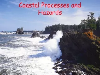
Methods of Coastal Hazards Assessment. David M. Bush Risk Assessment GEOL 4093. Island-scale mapping 1990’s. Originally done by hand on clear plastic overlays and tracing paper We didn’t know at the time that it was GIS Andy and R/V Bicycle Elevation Forest Cover.

E N D
Methods of Coastal Hazards Assessment David M. Bush Risk Assessment GEOL 4093
Island-scale mapping 1990’s • Originally done by hand on clear plastic overlays and tracing paper • We didn’t know at the time that it was GIS • Andy and R/V Bicycle • Elevation • Forest Cover
Island-scale mapping1990’s • Analog GIS • Andy--R/V • Bicycle • Elevation • Forest Cover
B Zone A Zone V Zone Jekyll Island flood zones
Forest No Forest Jekyll Island forest cover
Water Low Hazard Moderate Hazard High Hazard Extreme Hazard Jekyll Island preliminary hazard assessment
Mainland Mapping Tracy Rice developed this using fetch instead of SLOSH
Elevation Vegetation Tidal range Bluff configuration Evidence of historical storm impacts Type of structures Density of structures Site relative to stream mouth Soil and drainage Other surrounding features Geo-indicators
Puerto Rico Coastal Hazards Maps • Shoreline-setting hazards (long-term problems) • Marine hazards (short-term impacts of storms) • Earthquake and slope hazards (ground shaking, landslides, liquefaction) • Riverine hazards (historical floods) • Development hazards (high-density or dangerous settings) • Engineering hazards (stabilization, nourishment, sand mining)
Methodology, conclusion Each coastal stretch is designated a relative hazard rating based on the following: E = Extreme—more than 4 identifiable hazards H = High—3 to 4 identifiable hazards M = Moderate—at least 2 hazards L = Low—1 or no hazard
Culebra Puerto Rico Vieques
Mitigation • Engineering • Strengthen or move buildings • Armor the coast • Land Use Planning • Limit or reduce development density • Can help implement new techniques such as clustered housing • Easiest with new developments
Our Approach to Mitigation • Coastal landform protection, restoration, augmentation • Mostly low cost • Many things individuals can do • Environmentally sensitive • Considers geologic/oceanographic processes
PAR For the Shore • Preserve, Augment, Restore • Dunes (frontal and interior) • Coastal barriers of all types • Mangroves • Shoals • River mouth bars • Maritime forest • Add new sand to island
Harrison County, Mississippi Topographic Map of Study Area