Download
1 / 29
290 likes | 438 Views
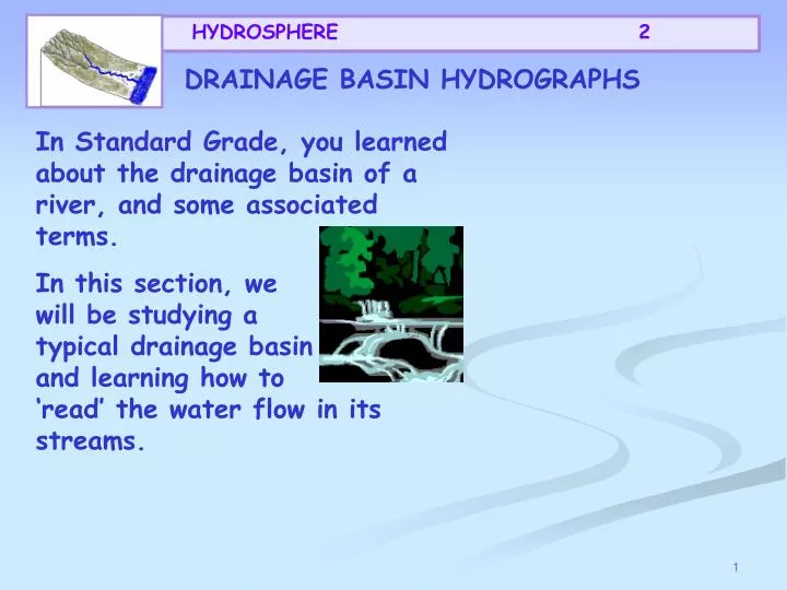
HYDROSPHERE 2. DRAINAGE BASIN HYDROGRAPHS. In Standard Grade, you learned about the drainage basin of a river, and some associated terms.

E N D
HYDROSPHERE 2 DRAINAGE BASIN HYDROGRAPHS In Standard Grade, you learned about the drainage basin of a river, and some associated terms. In this section, we will be studying a typical drainage basin and learning how to ‘read’ the water flow in its streams.
HYDROSPHERE 2 Construction and Analysis of hydrographs A hydrograph is a special kind of graph that records the speed that a river system removes the water that enters it. It consists of a small bar graph showing the precipitation and a line graph showing the amount of water flowing past a point on the river. When you look at a hydrograph, you should ask yourself certain questions- see the next slide.
HYDROSPHERE 2 2. When it started was it heavy or light? 1. When did the precipitation start? 5. How long was it after the highest ( peak) precipitation until the river was at its highest? 3. How long did it precipitate for? 4. Did it stop suddenly or tail away? 7. How quickly did it return to base ( normal) flow? 6. How quickly did the river rise? 8. What was peak river flow?
HYDROSPHERE 2 Basin lag time This is what a hydrograph looks like. Peak flow 3 Rising limb Overland flow Recession limb 2 mm Discharge(m3/s) 4 Through flow 1 3 2 Base flow 0 12 24 36 48 30 72 Hours from start of rain storm
HYDROSPHERE 2 3 2 Discharge (m3/s) 1 0 12 24 36 48 30 72 Hours from start of rain storm The next slides will demonstrate the hydrographs elements. With each new element there is a term and its definition to copy.
HYDROSPHERE 2 Rainfall shown in mm, as a bar graph 3 2 mm Discharge (m3/s) 4 1 3 2 0 12 24 36 48 30 72 Hours from start of rain storm
HYDROSPHERE 2 Discharge in m3/s, (cumecs), as a line graph 3 2 mm Discharge (m3/s) 4 1 3 2 0 12 24 36 48 30 72 Hours from start of rain storm
HYDROSPHERE 2 Rising limb The rising flood water in the river 3 Rising limb 2 mm Discharge (m3/s) 4 1 3 2 0 12 24 36 48 30 72 Hours from start of rain storm
HYDROSPHERE 2 Peak flow Peak flow 3 Maximum discharge in the river Rising limb 2 mm Discharge (m3/s) 4 1 3 2 0 12 24 36 48 30 72 Hours from start of rain storm
HYDROSPHERE 2 Peak flow Recession limb 3 Falling flood water in the river Rising limb Recession limb 2 mm Discharge (m3/s) 4 1 3 2 0 12 24 36 48 30 72 Hours from start of rain storm
HYDROSPHERE 2 Basin lag time Basin lag time Peak flow Time difference between the peak of the rain storm and the peak flow of the river 3 Rising limb Recession limb 2 mm Discharge (m3/s) 4 1 3 2 0 12 24 36 48 30 72 Hours from start of rain storm
HYDROSPHERE 2 Basin lag time Peak flow 3 Base flow Normal discharge of the river Rising limb Recession limb 2 mm Discharge (m3/s) 4 1 3 2 Base flow 0 12 24 36 48 30 72 Hours from start of rain storm
HYDROSPHERE 2 Basin lag time Peak flow (of storm flow) Overland flow* 3 + Through flow* + Rising limb Overland flow = Recession limb 2 Storm Flow mm Discharge (m3/s) 4 Through flow 1 3 2 Base flow 0 12 24 36 48 30 72 Hours from start of rain storm *See next slide for definitions
HYDROSPHERE 2 Through flow Overland flow Volume of water reaching the river through the soil and underlying rock layers Volume of water reaching the river from surface run off
HYDROSPHERE 2 Basin lag time Peak flow 3 Rising limb Overland flow Recession limb 2 mm Discharge (m3/s) 4 Through flow 1 3 2 Base flow 0 12 24 36 48 30 72 Hours from start of rain storm The completed hydrograph !
HYDROSPHERE 2 Analysis
HYDROSPHERE 2 Interpretation of Storm Hydrographs Basin lag time You need to refer to: Peak flow 3 • Rising Limb Rising limb Overland flow 2 Recession limb mm • Recession Limb Discharge (m3/s) 4 Through flow 1 3 • Lag time 2 Base flow • Rainfall Intensity 0 12 24 36 48 30 72 Hours from start of rain storm • Peak flow compared to Base flow • Recovery rate, back to Base flow Copy this list
HYDROSPHERE 2 Read and discuss the next few slides as a class. The following are some theoretical interpretations of influencing factors BUT………… when interpreting hydrographs all factors must be considered together !
HYDROSPHERE 2 Area Large basins receive more precipitation than small therefore have larger runoff Larger size means longer lag time as water has a longer distance to travel to reach the trunk river Shape An elongated basin will produce a lowerpeak flowand longerlag timethan a circular one of the same size- can you explain why?
HYDROSPHERE 2 Slope Channel flow can be faster down a steep slope therefore steeperrising limband shorterlag time Rock Type Permeable rocks mean rapid infiltration and little overland flow therefore shallowrising limb, less channel-fill and a long lag time. Impermeable rocks meanfaster channel-fill, steeper rising limband ashorter lag time.
HYDROSPHERE 2 Soil Infiltration is generally greater on thick soil, although less porous soils (eg. clay) act as impermeable layers The more infiltration occurs the longer thelag timeand shallower therising limb Drainage Density ( number of stream channels) A higher density will allow rapidoverland flow
HYDROSPHERE 2 Land Use Afforestation - intercepts the precipitation, creating a shallowrising limband lengthening thelagtime Urbanisation - concrete and tarmac form impermeable surfaces, creating a steeprising limband shortening thelag time. Tidal Conditions High spring tides can block the normal exit for the water, therefore extending the length of time the river basin takes to return tobase flow
HYDROSPHERE 2 The effects of urbanisation on lag times.
HYDROSPHERE 2 Compare the lag times of the two land uses receiving the same rainstorm!
HYDROSPHERE 2 Precipitation and temperature Short intense rainstorms can produce rapidoverland flowand steeprising limb Snow on the ground can act as a store producing a longlag timeand shallowrising limb. Once a thaw sets in therising limbwill become steep If there have been extreme temperatures, the ground can be hard (either baked or frozen) causing rapidsurface run off NOW TRY THE EXERCISE ON THE NEXT SLIDE !
HYDROSPHERE 2 Gives reduced dischargegives short lag timegives longer lag time Read pages 9 and 10 of the booklet. Draw up a table like the one shown below- take a whole page, layout in landscape. Fit the phrases from the handout into the correct place in the table. This should take no more than half a lesson! The items down the side are the headings of the factors in the booklet
HYDROSPHERE 2 There is a homework exercise to do for one week today. Take copies of the handouts and listen to the instructions carefully!
HYDROSPHERE 2 Remember;theseinfluencing factorswill- Influence each other Change throughout the rivers course
HYDROSPHERE 2 END OF PART TWO