Download
1 / 9

E N D
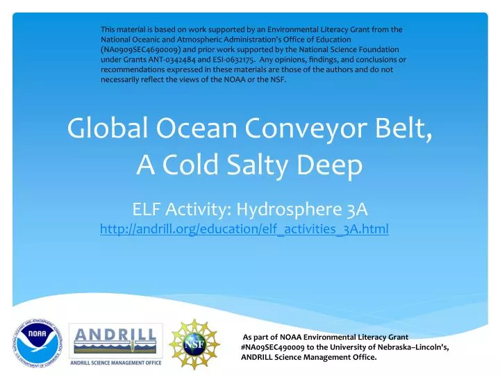
This material is based on work supported by an Environmental Literacy Grant from the National Oceanic and Atmospheric Administration's Office of Education (NA0909SEC4690009) and prior work supported by the National Science Foundation under Grants ANT-0342484 and ESI-0632175. Any opinions, findings, and conclusions or recommendations expressed in these materials are those of the authors and do not necessarily reflect the views of the NOAA or the NSF. Global Ocean Conveyor Belt,A Cold Salty Deep ELF Activity: Hydrosphere 3Ahttp://andrill.org/education/elf_activities_3A.html As part of NOAA Environmental Literacy Grant #NA09SEC490009 to the University of Nebraska–Lincoln's, ANDRILL Science Management Office.
There is only one ocean and the waters are not still. www.noaa.gov In the above picture notice how the waters of all the oceans are connected.
Due to winds and surface currents, the waters continually move and mix. www.noaa.gov This map shows the movement of surface water due to the action of the winds.
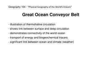
Cold, salty, dense water sinks under warmer fresher water. The sinking of cold water at the poles and its replacement by warmer water from the equator creates a current. This is called a thermohaline circulation because it is based on temperature and water density due to salt content. thermo = temperature haline = salt Image: national academy of sciences
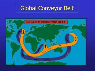
The Great Ocean Conveyor Belt www.noaa.gov Red = warm surface water Blue = cold salty deep water
Warm water carried north away from the Equator provides Europe with mild winters. Satellite image showing water temperatures along the eastern U.S. Images: www.noaa.gov
A Polar View of the Global Ocean Conveyor Belt www.wikipedia.com
In these two activities (Cold Salty Deep and GlobalOcean Conveyer Belt), students create models of ocean currents to demonstrate the thermohaline circulation of water throughout the Earth’s system.
This material is based on work supported by an Environmental Literacy Grant from the National Oceanic and Atmospheric Administration’s Office of Education (NA09SEC4690009) and prior work supported by the National Science Foundation under Grants ANT-0342484 and ESI-0632175. Any opinions, findings, and conclusions or recommendations expressed in these materials are those of the authors and do not necessarily reflect the views of the National Oceanic and Atmospheric Administration or the National Science Foundation. http://andrill.org/education/elf/activities