Download
1 / 32
320 likes | 453 Views
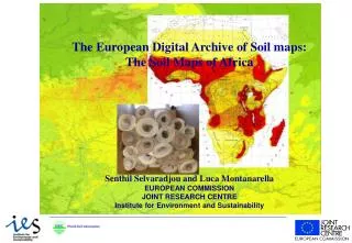
Integration of Turkish Soil Database into European Soil Database. Ece AKSOY. OUTLINE:. Beginning Data Deliverables Explaining how to develop SMU/STU structure for Turkish soil data S oil database for Turkey according to the ESDB’s SMU/STU structure

E N D
Integration ofTurkish Soil DatabaseintoEuropean Soil Database Ece AKSOY
OUTLINE: • Beginning Data • Deliverables • Explaining how to develop SMU/STU structure for Turkish soil data • Soil database for Turkey according to the ESDB’s SMU/STU structure • Explaining data transformation and acquisition • Thematic maps • Future Works
Beginning Data 1.MAP: • Turkey Soil Map, shapefile, polygon: 544 polygons. • Cities of Turkey, shapefile, point: Coordinates and population data of 6 cities of Turkey.
Beginning Data Example of Maps:
Beginning Data 2. ATTRIBUTE DATA:
Beginning Data 2. ATTRIBUTE DATA:
Deliverables • Developing an SMU/STU structure for Turkish soil data • Soil database for Turkey according to the ESDB’s SMU/STU structure • Explaining data transformation and acquisition • Thematic maps
Developing SMU/STU Structure • Soils of Turkey comprise 32 soil associations according to ESB/WRB soil classification . • Each soil associations contain least 2, usually 3 STU. • Leptosols are the dominant soils, and followed by the Calcisols, Fluvisols, Cambisols, Vertisols, Kastanozems, Regosols, Arenosols, Alisols and Acrisols.
Developing SMU/STU Structure • Calculation of percentage of each STU in each SMU
Soil database for Turkey • SOIL.PAT, STU.ORG and STU tables were prepared according to desired format.
Soil database for Turkey • MEASURED PROFILES TABLE is also prepared for 31 soil profile according to desired format.
Data Transformation • WRB and FAO90 transformations were done from beginning data for each polygon by looking at codes for suitable soil major type according to instruction guide. • Parent Material (PAR-MAT-DOM and PAR-MAT-SEC) Codes also transformed from beginning data by looking instruction guide. • Percentages of clay silt and sand proportion of soil were transformed into texture code of Soil Geographical Database Version 4.0 for each polygon by using texture class’s triangle. Because of there is no information about secondary texture of surface, the value of TEXT-SRF-DOM also be entered for TEXT-SRF-SEC. Same method was implemented for TEXT-SUB-DOM and TEXT-SUB-SEC again.
Data Acquisition • Dominant and secondary SLOPE class were acquired from DEM.
Data Acquisition • ZMIN and ZMAX values were acquired from DEM.
Data Acquisition • Turkey part cut from Global Land Cover. • Studied for deciding legend because Global land cover and European soil database legends were really different from each other.
Data Acquisition • Soil map were patched into Google Earth. • Simultaneously worked on land cover map and google image for deciding land use for each polygon.
Future Works for Turkey • Obtaining lacking soil data • Preparing detailed landuse map • Enriching measured soil profiles • Interpolation of measured soil data