Download
1 / 50
510 likes | 670 Views
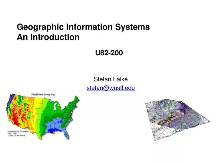
Geographic Information Systems An Introduction. U82-200. Stefan Falke stefan@wustl.edu. Pop vs Soda vs Coke. http://www.popvssoda.com/. Pop vs Soda vs Coke by County. 2004 Presidential Election Results. Popular. Electoral. 62,040,606. Bush. 286. 252. Kerry. 59,028,109.

E N D
Geographic Information SystemsAn Introduction U82-200 Stefan Falke stefan@wustl.edu
Pop vs Soda vs Coke http://www.popvssoda.com/
2004 Presidential Election Results Popular Electoral 62,040,606 Bush 286 252 Kerry 59,028,109
States size are adjusted to be proportional to number of electoral votes http://www-personal.umich.edu/~mejn/election/ States size are adjusted to be proportional to population
What is GIS? • ‘GIS’ is Geographic Information System • Traditional definition is that GIS is a set of computer tools for accessing, processing, visualizing, analyzing, interpreting, and presenting spatial data. • GISystems: Emphasis on technology and tools • GIScience: Fundamental issues raised by the use of GIS, • such as: Spatial analysis • Map projections • Accuracy • Scientific visualization • Implementation and application of GIS • covers a wide spectrum: • Simple maps • Overlaying multiple map “layers” • Comparing data sets (simple data analysis) • Complex statistical analysis gis.com
Geospatial Information Science & Technology Spatio-Temporal Data Analysis Geospatial Policy & Standards Remote Sensing Visualization Interoperability GIS&T Reusable Tools Location-based Services Data Creation, Management, and Integration GPS Spatial Mapping (GIS) Web Info Systems
Geospatial Information Science and Technology “…acquires, manages, interprets, integrates, displays, analyzes, or otherwise uses data focusing on the geographic, temporal and spatial context.” (GeoSpatial Workforce Development Center at the University of Southern Mississippi) • According to a recent Department of Labor report, the three most important emerging and evolving fields are: • Biotechnology • Nanotechnology • Geospatial technology • (Gewin, V., Mapping Opportunities, Nature, 427 (6972) 376-377, Jan. 2004)
Spatial Data Analysis • Turns raw data into useful information • by adding greater informative content and value Wisdom Knowledge Evidence Data Information Adapted from Bolstad, 2005
The John Snow Map • A classic example of the use of location to draw inferences • 1854 cholera outbreak in London • Point data map indicated some spatial clustering • Overlaying a map of water pump locations showed many cases were concentrated around a single pump
GIS Software Architecture User Interface Viewers, Controls Tools / Functions Display, Analysis, Manipulation Data Management Data Access, Conversion Data
Software People Data Network Management Hardware Components of GIS • Organized collection of • Hardware • Software • Network • Data • People • Management “GIS should be viewed as a process rather than as merely software or hardware.” (Malczewski, 1999)
Views to a GIS Map view: Focus on cartographic (mapping) aspects of GIS Thematic GIS layers Input map => Output map GIS is "a powerful set of tools for collecting, storing, retrieving at will, transforming and displaying spatial data from the real world for a particular set of purposes" (Burrough and McDonnell, 1998) Database view: Focus on database management system Simple queries to retrieve and overlay data GIS is “a database system in which most of the data are spatially indexed, and upon which a set of procedures operated in order to answer queries about spatial entities in the database” (Smith et al., 1987) Spatial analysis view: Focus on analysis and modeling Views GIS more as information science “The true potential value of Geographical Information Systems lies in their ability to analyze spatial data using the techniques of spatial analysis" (Goodchild, 1988) Organizational (Enterprise) view: An approach to managing an organization’s data, information, and knowledge “ a decision support system involving the integration of spatially referenced data in a problem-solving environment” (Cowen, 1988)
A Brief History of GIS • GIS is relatively young but mapping and spatial analysis preceded it by thousands of years • Manual map overlay as a method was first described comprehensively in a 1950 textbook • Mathematics for spatial analysis were developed in the 1930s and 1940s • GIS evolution parallels that of general information technology http://www.gisdevelopment.net/history/
A Brief History of GIS – 1960s • The 1960s saw the advent of geographic data and mapping software • First GIS was the Canada Geographic Information System developed for land resource measuring and inventory analysis • The Harvard Laboratory for Computer Graphics and Spatial Analysis established • Aeronautical Charting and Information Center in St. Louis • US Defense Mapping Agency in St. Louis (then NIMA – National Imagery and Mapping Agency, now (as of 11/03) NGA – National Geospatial Intelligence Agency)
A Brief History of GIS – 1970s • Gridded data analysis programs • Rudimentary graphics • ESRI (Environmental Science and Research Institute) established • Intergraph founded • Increased GIS use by government agencies • Satellite imagery (Landsat) • Dual Independent Map Encoding (DIME) for census areas • GIS Functions for points and polygons
A Brief History of GIS – 1980s • ESRI ArcInfo • Global Positioning System (GPS) • GIS Journals and Conferences • MapInfo • TIGER (Topographically Integrated Geographic Encoding and Referencing) Census project • Academic GIS courses • Widespread acceptance across disciplines • Increased availability of satellite imagery
A Brief History of GIS – 1990s Migration to PC Open GIS Consortium National Spatial Data Infrastructure (NSDI) Web GIS GIS Day (annual event in November)
A Brief History of GIS – 2000s • WebGIS • Wireless (PDAs, cell phones) • Embedded Sensor Networks • Distributed Databases • GIServices
Special Spatial Nomenclature Geographic – Limited to phenomena and problems relating to Earth’s surface and near-surface Spatial– Any space, including geographic, but not restricted to geographic coordinate space, e.g. medical imaging, Mars Geospatial– A recent term to represent the subset of spatial applied specifically to the Earth’s surface. (synonymous with geographic)
Course Objectives • Understand the fundamental principles of GIS • Gain background and hands-on experience with software tools for working with spatial data. • Appreciate the complexities involved in data processing, analysis, and mapping
Course Outline Problem Set #1 PS #1 due PS #2 PS #2 due
Texts Bolstad, Paul GIS Fundamentals: A First Text on Geographic Information Systems, 2nd Edition, Eider Press, 2005. (http://www.paulbolstad.net/gisbook.html) Longley, Paul; Michael Goodchild; David Maguire and David Rhind Geographic Information Systems and Science, 2nd Edition, John Wiley & Sons, 2005 Gorr, Wilpen and Kristen Kurland GIS Tutorial: Workbook for ArcView 9, ESRI Press, 2005 All are on reserve at the Earth & Planetary Science Library
Project • The project involves working through a GIS application using data of interest to you. Key aspects of the project are to bring in data into GIS and use GIS to gain new insight into the data. • Paper describing the project data, methods, tools, and results. (3-5 pages) • Presentation summarizing the project. (about 5 minutes) • Paper and Presentation are both due on October 19.
Grading Problem Sets 30% Exam 30% Project 30% Class participation 10% Late Policy: Problem sets are due two weeks after they are assigned. They should not be late.
Information Request Please send an email to stefan@wustl.edu with the following: Name: Email: Department/Organization: Level/Position: Interest in course: Previous experience with GIS:
Telesis http://capita.wustl.edu/ENVE424/ • Webpage will contain: • Class syllabus • Lecture slides • Online links to resource materials
Homework • Determine your logistics for this course • Buy or use library copies of texts? • Next week we will go through Tutorials 2&3 in Gorr • Where to use ArcGIS outside of class? • Begin thinking about your project topic
Autodesk ESRI Intergraph MapInfo Manifold Viewer AutoCAD LT ArcReader GeoMedia Viewer ProViewer Custom Desktop World ArcView GeoMedia MapInfo Professional Manifold GIS Profess-ional AutoCAD / Map ArcEditorArcInfo GeoMedia Pro MapInfo Professional Manifold GIS Hand-held OnSite ArcPad IntelliWhere MapXtend -- Database Server Design Server ArcSDE Uses Oracle Spatial SpatialWare SQL Server Component Modeling In several products Map Objects Part of GeoMedia MapX, MapJ Manifold Object Model Internet MapGuide ArcIMS GeoMedia Web Map, GeoMedia Web Enterprise MapXtreme, MapXSite Manifold IMS GIS Software Packages
GIS Market Estimated 2004 revenue - $2 Billion (10% growth over 2003) Software (64%) Services (24%) Data Products (8%) Hardware (4%) Market Share (2003) ESRI - 34% Intergraph - 13% Autodesk - 9% IBM GIS Business Unit- 9% GE Energy - 8% Leica Geosystems- 7% Mapinfo - 4% Other - 16% Largest market for GIS Software: Utilities industry (21%), followed by state and local governments Others: Idrisi GRASS Manifold
ArcGIS Main Components ArcCatalog ArcMap
ArcMap Central ArcGIS application Handles map-based tasks
ArcToolbox Contains the tools for geoprocessing
ArcCatalog Organizes and manages GIS data
Spatial Analyst Raster and Vector Analysis
Geostatistical Analyst Advanced spatial analysis
ESRI ArcGIS Username: U82-200 Password: Ge0graphic Create a directory with your name under “My Documents” Copy data for tutorial 1 to your directory To start ArcMap: - Select Start Button - Go to Programs-> ArcGIS -> ArcMap