Download
1 / 33
330 likes | 441 Views
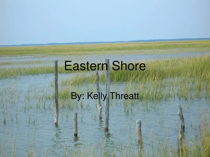
Eastern Shore. By: Kelly Threatt. Wachapreague, VA. General Description. Location: Wachapreague, Virginia (Eastern Shore) Date: September 14, 2007 2 land sites (Barrier Islands): Paramore Island and Cedar Island 4 water sites: Inlet, Clubhouse Point, Hummocks Channel, and Nikawampus Creek.

E N D
Eastern Shore By: Kelly Threatt
General Description Location: Wachapreague, Virginia (Eastern Shore) Date: September 14, 2007 2 land sites (Barrier Islands): Paramore Island and Cedar Island 4 water sites: Inlet, Clubhouse Point, Hummocks Channel, and Nikawampus Creek
Collecting Water depth Dissolved oxygen Temperature Salinity pH Nutrient Collecting/ Analyzing Sea floor sediment grain size Sea floor sediment composition Goals • Describing/ Collecting • Planktonic life • Nektonic life • Benthic life *Introduce topics that will be covered in more detail later in the semester *
Tools Trawl-used to collect nektonic life Dredge-used to collect benthic life Secchi Disk-used to find the depth of the photic zone
More Tools Plankton Net-used to collect plankton from the surface water YSI-used to measure dissolved oxygen, salinity, depth, and temperature Ponar Grab-used to collect sediment off of the sea floor Niskin Bottle-used to collect water samples below the surface water
Field Results Inlet Clubhouse Point Hummocks Channel Nikawampus Creek
Inlet • Between two barrier island: Cedar Island and Paramore Island • GPS Location: N 37º 34.848” W 75º 37.81” • Total Water Depth: 80ft • Photic zone depth: 1m 3.5cm
Inlet Data 1-Temperature (˚C) 2-Salinity (ppt) 3-Dissolved Oxygen (mg/L) 4-pH Blue-0.0m Red-2m
Clubhouse Point • GPS Location: N 37º 35.35” W 75º 37.80” • Total Water Depth: 12ft • Photic zone depth: 1m Sea Floor Sediments • Color: gray, black, brown • Texture: shelly bottom • Compaction: hard shells
Clubhouse Point Data Blue-0.0m Red-2m Yellow-3m 1-Temperature (˚C) 2-Salinity (ppt) 3-Dissolved Oxygen (mg/L) 4-pH
Hummocks Channel • GPS Location: N 37º 36.472” W 75º 38.671” • Total Water Depth:15ft • Photic zone depth: 1.5m Sea Floor Sediments • Color: green, gray, black • Texture: more mud than shells • Compaction: muddy, soupy
Hummocks Channel Data Blue-0.0m Red-2m Yellow-3m 1-Temperature (˚C) 2-Salinity (ppt) 3-Dissolved Oxygen (mg/L) 4-pH
Nikawampus Creek • Mud flat • GPS Location: N 37º 37.648” W 75º 40.813” • Total Water Depth: 5.2ft • Photic zone depth: 25cm Sea Floor Sediments • Color: black • Texture: mud • Compaction: soft and soupy
Nikawampus Creek Data Blue-0.0m Red-.5m 1-Temperature (˚C) 2-Salinity (ppt) 3-Dissolved Oxygen (mg/L) 4-pH
Comparing Surface Water Data Temperature Salinity Dissolved Oxygen pH
Temperature Site: 1-Inlet 2-Clubhouse Point 3-Hummocks Channel 4-Nikawampus Creek
Salinity Site: 1-Inlet 2-Clubhouse Point 3-Hummocks Channel 4-Nikawampus Creek
Dissolved Oxygen Site: 1-Inlet 2-Clubhouse Point 3-Hummocks Channel 4-Nikawampus Creek
pH Site: 1-Inlet 2-Clubhouse Point 3-Hummocks Channel 4-Nikawampus Creek
Observations Tree were burned Dry Lake on Island -Dried up (cracks in lake bed) -A week prior it had more water -Salinity was 44 or 45 and the DO was .1 which is to low for the fish to live. The fish were at the different levels around the pond indicting that the water level had dropped recently. It’s eroding on the ocean side and depositing on the bay side the Italian Ridge (one ancient dune) Shaped like a drum stick Different from Cedar Island Maritime Forest-more vegatation More life-insects, animals (raccoon and deer dropping seen) Muddy ground and sand Marsh side and shore side Only one dune Paramore had a very short shoreline that was not very flat Paramore Island
Observations Fish and crabs in surrounding waters Atlantic side had more waves than bay side Bay side was calmer and had a really strong current Was thought to have been marsh land because of all of the oyster shells that were ancient A lot dead horseshoe crabs from babies to full grown on the ocean side Different from Paramore Island Less vegetation More shells, “a graveyard of shell” Smaller More dunes Wide and round. Birds such as seagulls and pelicans At the ocean the shoreline was a flat beach. Dune grass and sea grass with prickly barbs found more in the center of the island Cedar Island
Deep Sea Location Atlantic Ocean-Gulf Stream
Salinity -Around 36.5 ppt -Higher than the highest site (Nikawampus Creek with 33.4 ppt)
Temperature -Between 22-24°C -Our sites were between 25.2°C and 25.8°C
pH -Around 8.10 -Our sites were between 8 and 8.5
THANKS FOR A GREAT SEMESTER!!!! HAVE A GOOD HOLIDAY!!!!