Download
1 / 18
180 likes | 280 Views
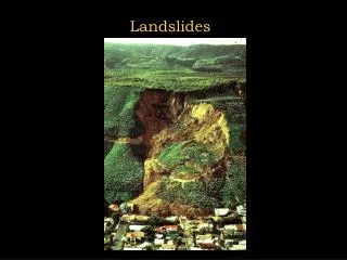
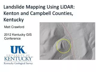
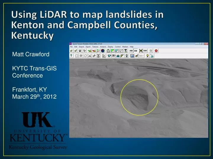
Using LiDAR to map landslides in Kenton and Campbell Counties, Kentucky. Matt Crawford KYTC Trans-GIS Conference Frankfort, KY March 29 th , 2012. Kentucky Landslide Locations. database. Kenton and Campbell Counties, KY. The problem.

E N D
Using LiDAR to map landslides in Kenton and Campbell Counties, Kentucky Matt Crawford KYTC Trans-GIS Conference Frankfort, KY March 29th, 2012
Kentucky Landslide Locations database
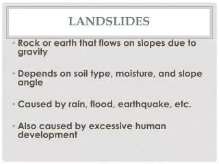
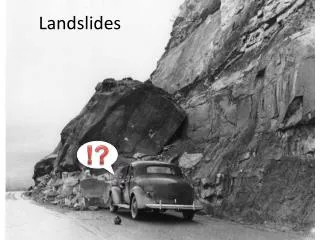
The problem • Natural geology, topography, and decades of slope modification make this area susceptible to landslides…recurring landslides • Example costs: • KYTC Maintenance Database total costs, 2003-2009 – approx. $1.4 million • 68 KYTC Landslide Geotechnical Project Reports (1973-present) in Kenton and Campbell – unknown cost • April-May 2011 storms cost KYTC District 6 over $4 million • FEMA is about to submit a letter of intent for a 2.5 million dollar stabilization project in Bellevue, Ky. Campbell Co.
From Potter, 1996 From the Newport and Withamsville quadrangle by Gibbons (1973): “The shale of the Kope Formation slumps readily when wet. Structures built on the Kope should be provided with adequate drainage and oversteepened slopes should be avoided.”
LiDAR Project • Purpose: develop a methodology for using LiDAR data in the geologic setting of Kenton and Campbell Co. and document preexisting landslides. • Modeled after other states: • OR, WA • LiDAR data provided by the NKAPC • Grant from the USGS • Landslides Hazards Program
Methodology • Used Quick Terrain Modeler to create hillshade DEM’s from the LAS files • Add DEM’s to ArcMap for visualization, spatial analysis, and digitization • Systematic panning looking for • Hummocky surface • Steep scarp, flanks • Thick toe • Concavity • Reexamined potential landslides in QTM • Performed field checking
Other useful data sets • Topographic contours • 1:24,000-scale geology • Slope • Leaf-off aerial photography • Roads • Bing!
Landslide example: LiDAR derived hillshade DEM with 2ft contours ~450 ft down axis of slide
Landslide example: LiDAR derived hillshadeDEM ~750 ft down axis of slide
Landslide example: LiDAR derived hillshade DEM with 2 ft contours ~280 ft down axis of slide
Landslide example: Reexamination of landslide with QT Modeler
Results • 230 potential landslide extents digitized (polys) • Approximately 10% were initially attributed with high confidence, rest were questionable • LiDARhillshade geomorphology, geology, and proximity to urbanized areas dictated classification…subjective • 20% (about 45) of these landslides were field checked • 20 were confirmed • 18 were likely or observed but could not be determined • 7 were not accessible
Conclusions / discussion • Project successfully used LiDAR for identifying potential landslide extents • Able to map potential slides in areas not accessible by roads. • Urbanization of Kenton and Campbell Counties made visualization difficult and probably masked many existing slides • Project was limited by time and ability to field check landslides identified
Conclusions / discussion (cont.) • Indication of future failure!!?? • As Kentucky acquires more LiDAR, similar projects will be very beneficial in other landslide prone parts of the state.
Thanks! Matt Crawford mcrawford@uky.edu