Download
1 / 11
120 likes | 127 Views
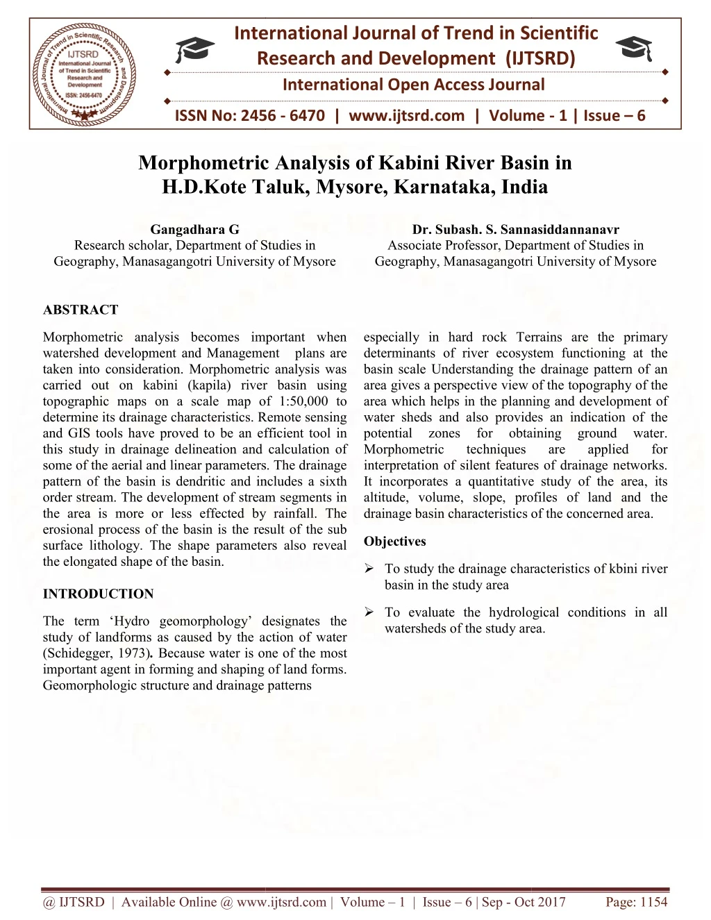
Morphometric analysis becomes important when watershed development and Management plans are taken into consideration. Morphometric analysis was carried out on kabini river basin using topographic maps on a scale map of 1 50,000 to determine its drainage characteristics. Remote sensing and GIS tools have proved to be an efficient tool in this study in drainage delineation and calculation of some of the aerial and linear parameters. The drainage pattern of the basin. Gangadhara G "Morphometric Analysis of Kabini River Basin in H.D.Kote Taluk, Mysore, Karnataka, India" Published in International Journal of Trend in Scientific Research and Development (ijtsrd), ISSN: 2456-6470, Volume-1 | Issue-6 , October 2017, URL: https://www.ijtsrd.com/papers/ijtsrd5777.pdf Paper URL: http://www.ijtsrd.com/humanities-and-the-arts/geography/5777/morphometric-analysis-of-kabini-river-basin-in--hdkote-taluk-mysore-karnataka-india/gangadhara-g<br>

E N D
International Research Research and Development (IJTSRD) International Open Access Journal Morphometric Analysis of Kabini River Basin H.D.Kote Taluk, Mysore, Karnataka, India H.D.Kote Taluk, Mysore, Karnataka, India International Journal of Trend in Scientific Scientific (IJTSRD) International Open Access Journal ISSN No: 2456 ISSN No: 2456 - 6470 | www.ijtsrd.com | Volume 6470 | www.ijtsrd.com | Volume - 1 | Issue – 6 Morphometric Analysis o H.D.Kote Taluk, Mysore, Karnataka, India f Kabini River Basin in Gangadhara G Gangadhara G Dr. Subash. S. Sannasiddannanavr Associate Professor, Department of Studies in Geography, Manasagangotri University of Mysore eography, Manasagangotri University of Mysore Sannasiddannanavr Research scholar, Department of Studies in Geography, Manasagangotri University of Mysore eography, Manasagangotri University of Mysore Studies in ciate Professor, Department of Studies in ABSTRACT Morphometric analysis becomes important when watershed development and Management plans are taken into consideration. Morphometric analysis was carried out on kabini (kapila) river basin using topographic maps on a scale map of 1:50,000 to determine its drainage characteristics. Remote sensing and GIS tools have proved to be an efficient tool in this study in drainage delineation and calculation of some of the aerial and linear parameters. The drainage pattern of the basin is dendritic and includes a sixth order stream. The development of stream segments in the area is more or less effected by rainfall. The erosional process of the basin is the result of the sub surface lithology. The shape parameters also reveal the elongated shape of the basin. INTRODUCTION Morphometric analysis becomes important when watershed development and Management plans are taken into consideration. Morphometric analysis was carried out on kabini (kapila) river basin using on a scale map of 1:50,000 to determine its drainage characteristics. Remote sensing and GIS tools have proved to be an efficient tool in this study in drainage delineation and calculation of some of the aerial and linear parameters. The drainage f the basin is dendritic and includes a sixth order stream. The development of stream segments in the area is more or less effected by rainfall. The erosional process of the basin is the result of the sub surface lithology. The shape parameters also reveal especially in hard rock Terrains are the primary determinants of river ecosystem functioning at the Understanding the drainage pattern of an area gives a perspective view of the topography of the area which helps in the planning and development of water sheds and also provides an indication of the potential zones for obtaining Morphometric techniques interpretation of silent features of drainage networks. es a quantitative study of the area, its altitude, volume, slope, profiles of land and the especially in hard rock Terrains are the primary determinants of river ecosystem functioning at the basin scaleUnderstanding the drainage pattern of an area gives a perspective view of the topography of the area which helps in the planning and development of water sheds and also provides an indication of the potential zones for obtaining Morphometric techniques interpretation of silent features of drainage networks. It incorporates a quantitative study of the area, its altitude, volume, slope, profiles of land and the drainage basin characteristics of the concerned area. drainage basin characteristics of the concerned area. ground ground applied applied water. water. for for are are Objectives To study the drainage characteristics basin in the study area characteristics of kbini river To evaluate the hydrological conditions in all watersheds of the study area. ogical conditions in all The term ‘Hydro geomorphology’ designates the study of landforms as caused by the action of water (Schidegger, 1973). Because water is one of the most important agent in forming and shaping of land forms. Geomorphologic structure and drainage patterns eomorphologic structure and drainage patterns The term ‘Hydro geomorphology’ designates the study of landforms as caused by the action of water Because water is one of the most important agent in forming and shaping of land forms. watersheds of the study area. @ IJTSRD | Available Online @ www.ijtsrd.com @ IJTSRD | Available Online @ www.ijtsrd.com | Volume – 1 | Issue – 6 | Sep - Oct 2017 Oct 2017 Page: 1154
International Journal of Trend in Scientific Research and Development (IJTSRD) ISSN: 2456-6470 Study Area The kabini (kapila) river originated in northern wynad regions of Kerala at an elevation of 2140meters.it had a length 230km, drainage areas 7808km2 it is a perennial river.The kabini (kapila) river, a tributary to Cauvery river, These river basin located between 11° 37' 10'' - 12° 50' 30'' North latitudes and 75° 22' 25'' - 76° 58' 02'' East longitudes. Covered under the Survey of India Toposheet numbers are 57D/7, 57D/11, 57D/4, 57D/8, 57D/12, 58A/1, 58A/5 and 58A/6 on scale of 1:50,000. Physiographical, H.D.Kote taluk is an undulating land with igneous and metamorphic rocks of Precambrian age. The study area forms the southern part of the Mysore district. The general elevation of the Area ranges from 700-950 meters AMSL. The mountain ranges in the study area originate from the Nilgiri hills along its southern borders and runs in northwest and northeast direction. The study area is almost entirely surrounded by Western Ghats, which at places are on the elevation of more than 1200 meter AMSL. The climate of the area may be described as essentially tropical monsoon type which is a product of the interplay of the two opposing air-masses of the southwest and northeast monsoons. Summers are @ IJTSRD | Available Online @ www.ijtsrd.com | Volume – 1 | Issue – 6 | Sep - Oct 2017 Page: 1155
International Journal of Trend in Scientific Research and Development (IJTSRD) ISSN: 2456-6470 languorously warm and winters bracingly cool. By and large the area is endowed with a delightful or salubrious climateand hence the region faces shortage of water in dry seasons. MATERIAL AND METHODS and 5) height parameters. All the parameters have been discussed in detail Morphometric Analysis:- Morphometry is the measurement and mathematical analysis of the configuration of the Earth’s surface, shape and dimensions of the landforms (Clarke,1966). This analysis can be done through measurement of linear, Aerial and Relief aspects of basin and slope delineation (Nag and Chakraborty, 2003). Earlier, morphometric analysis using Remote Sensing techniques have been carried out by Srivastava and Mitra, (1995), Srivastava, (1997), Agarwal, (1998) and they are of the opinion that Remote Sensing techniques are powerful tools in morphometric analysis. In the present study, the morphometric analysis for the parameters namely stream order, stream length, bifurcation length, stream length ratio, basin length, drainage density, stream frequency, elongation ratio, circulatory ratio, form factor and relief ratio have been carried out. This study has been carried out with respect to sub watersheds which have been recognized in the main watershed. The three sub watersheds are Taraka, Kabini and Nuguhole . The drainage network show dendritic to sub-dendritic patterns. Morphometric analysis of The kabini river basin was carried out on the toposheets in the scale of 1:50000.The toposheets were first georeferenced with ERDAS (14) and a UTM projection system was given to them. This was followed by digitization of the drainage pattern and contours of the The kabini basin by ArcGIS10.3. The drainage network of the basin is analyzed per Horton law and stream ordering was made after Strahler. After digitization the aerial and linear parameters considered for morphometric analysis was studied with the help of Arcview (10.3) for the whole basin and subsequently for the 3 watersheds which were demarcated according to the water divider. Relief and topography analysis of the basin too was carried out with the help of the contour lines and its interval by using the tools of ArcGIS .In this paper the analysis have been grouped into five categories:1) basic parameters, 2) derived parameters, 3) shape parameters 4) dissection intensity parameters Parameters and Methods Included in Morphometric Analysis Sl. No. Morphometric Parameters Formula Reference A. Linear Aspects 1. 2. 3. 4. 5. 6. Stream Order Hierarchical rank – GIS analysis Strahler (1964) Basin (P) perimeter Outer boundary of the drainage basin – GIS analysis GIS analysis Schumm (1956) Basin Length (Lb) Schumm (1956) Stream length (Lu) Total stream length of the order ‘u’ – GIS analysis Length of main channel (Cl) basin - GIS analysis Horton (1945) Longest channel of the Horton (1945) Mean Length (Lsm) Stream Lsm = Lu/ Nu, Where, Lu = Total stream length of the order ‘u’ Nu = Total no. of stream segments of order ‘u’ Strahler (1964) @ IJTSRD | Available Online @ www.ijtsrd.com | Volume – 1 | Issue – 6 | Sep - Oct 2017 Page: 1156
International Journal of Trend in Scientific Research and Development (IJTSRD) ISSN: 2456-6470 7. Stream Ratio (RL) Length RL = Lu / Lu – 1, Where Lu = Total stream length of the order ‘u’ Lu-1= Total length of its next lower order Rb = Nu / Nu + 1, Where Nu = Total no. of stream segments of order ‘u’ Nu+1= Number segments of the next higher order RLm = Average stream length ratios of all orders Rbm = Average bifurcation ratios of all orders Rt = Nu / P, Where Nu = Total no. of streams of all orders P = Perimeter (km) Horton (1945) stream 8. Bifurcation Ratio (Rb) Schumm (1956) of 9. 10. 11. Mean length ratio (RLm) stream of Strahler (1964) Mean Bifurcation Ratio (Rbm) of Strahler (1957) Drainage Texture (Rt) Horton (1945) 12. Rho Coefficient (ρ) ρ = RLm/Rbm, Where RLm stream length ratio of all orders Rbm bifurcation ratios of all orders Fitness Ratio (Rf) Rf = Cl/P, Where Cl = Length of the main channel P = Perimeter of the basin Horton (1945) = Average of = Average of 13. Melton (1958) B. Aerial Aspects GIS analysis 14. 15. 16. Basin Area (A) Schumm (1956) Mean basin width (Wb) Wb = A/Lb, Where A = Area of the basin Lb = Basin length Schumm (1956) Drainage Density (Dd) Dd = Lu / A, Where Lu = Total stream length of all orders A = Basin area (km2) Fs = Nu / A, Where Nu = Total no. of streams of all orders A = Basin area (km2) RF = A / Lb2, Where A = Basin area (km2) Lb2 = Square of basin length Horton (1932) 17. Stream Frequency (Fs) Horton (1932) 18. 19. Form Factor Ratio (RF) Horton (1932) Circularity Ratio (Rc) Rc = 4A / P2, Where = 3.14 A = Basin area P2 = Square of the basin perimeter Miller (1953) @ IJTSRD | Available Online @ www.ijtsrd.com | Volume – 1 | Issue – 6 | Sep - Oct 2017 Page: 1157
International Journal of Trend in Scientific Research and Development (IJTSRD) ISSN: 2456 International Journal of Trend in Scientific Research and Development (IJTSRD) ISSN: 2456 International Journal of Trend in Scientific Research and Development (IJTSRD) ISSN: 2456-6470 20 Elonga tionRatio (Re) Elonga tionRatio (Re) Re = 2* (A / ) / Lb,Where = 3.14 A = Basin area Lb = Basin length Lg = 1/2Dd, Where Dd = Drainage Density (1956) (1956) Schumm 21. 22. 23. 24. 25. 26. Length of Overland Flow (Lg) Length of Overland Flow Horton (1945) Horton (1945) Lemniscate’s Value (k) Lemniscate’s Value (k) k = Lb2/4A, Where, = 3.14 Lb2 = Square of the basin length A = Basin area Chorley (1957) Chorley (1957) Compactness Coefficient (Cc) Compactness Coefficient Cc = 0.2841* P/ A, Where P = Basin perimeter A = Basin area Gravelius (1914) Gravelius (1914) Constant Channel Maintenance (Cm) Maintenance (Cm) Constant Channel Cm = 1/Dd, Where Dd = Drainage density Schumm (1956) Schumm (1956) Drainage Intensity (Di) Drainage Intensity (Di) Di = Fs/Dd, Where Fs = Stream frequency Dd = Drainage density Faniran (1968) Faniran (1968) Infiltration Number (If) Infiltration Number (If) If = Fs*Dd, Where Fs = Stream frequency Dd = Drainage density Faniran (1968) Faniran (1968) C. Relief Aspects Height maximum – Height minimum 27. 28. Relief of the basin (H) Relief of the basin (H) Horton (1945) Horton (1945) Relief Ratio (Rh) Relief Ratio (Rh) Rh = H / Lb, Where H = Relief of the basin in kilometers Lb = Basin length Ir = Dd*H, Where Dd = Drainage density H = Relief of the basin in kilometer Id = H/Height maximum, Where H = Relief of the basin Height maximum = Maximum height recorded in the basin Schumm (1956) Schumm (1956) 29. Ruggedness Index (Ir) Ruggedness Index (Ir) Strahler (1964) Strahler (1964) 30. Dissection Index (Id) Dissection Index (Id) Schumm (1956) Schumm (1956) @ IJTSRD | Available Online @ www.ijtsrd.com @ IJTSRD | Available Online @ www.ijtsrd.com | Volume – 1 | Issue – 6 | Sep - Oct 2017 Oct 2017 Page: 1158
International Journal of Trend in Scientific Research and Development (IJTSRD) ISSN: 2456 International Journal of Trend in Scientific Research and Development (IJTSRD) ISSN: 2456 International Journal of Trend in Scientific Research and Development (IJTSRD) ISSN: 2456-6470 @ IJTSRD | Available Online @ www.ijtsrd.com @ IJTSRD | Available Online @ www.ijtsrd.com | Volume – 1 | Issue – 6 | Sep - Oct 2017 Oct 2017 Page: 1159
International Journal of Trend in Scientific Research and Development (IJTSRD) ISSN: 2456-6470 @ IJTSRD | Available Online @ www.ijtsrd.com | Volume – 1 | Issue – 6 | Sep - Oct 2017 Page: 1160
International Journal of Trend in Scientific Research and Development (IJTSRD) ISSN: 2456-6470 RESULTS AND DISCUSSION Results of Morphometric analysis of three sub-watershed of the study area Stream Order The first step in the analysis of any basin is the determination of the order of streams, the concept which was introduced by Horton (1945) and later modified by Strahler (1957). Here Strahler’s (1964) method, which is simplest and most widely accepted method, of numbering, is used in which the initial tributaries are allotted the rank of 1 and called first order streams. The second order stream is formed below the junction of two first order streams. The third order stream is formed below the junction of two second order streams and so on. The study area is a seventh order drainage basin. The total numbers of 3163 streams of different orders were identified in the area, which are given in the (Table 2). The variation in the number of stream orders for different sub- basins is a result of variation in the physiographic conditions of the region. increases characteristics indicate the flow of streams from high altitude through variation with moderately steep slopes (Singh and Singh, 1997). as the length decreases. These Mean Stream Length Mean stream length is a characteristic property related to the drainage network components and its associated basin surfaces (Strahler 1964). This has been calculated by dividing the total stream length of order (u) by the number of streams of segments in order. The mean stream length of the study area is given in the (Table 2). A variation in the mean stream length of different orders has been observed, due to variation in slope and topography. Stream Length Ratio Stream Length Stream length ratio (RL) is defined as the total stream length of order ‘u’ divided by the total stream length of the next lower order ‘u-1’ . Horton’s (1945) stream length ration states that mean stream length segments of each of the successive orders of a basin tends to approximate a direct geometric series with stream length increasing towards higher order of streams. The RL between streams of different orders in the study area reveals that there is a variation in RL in Stream length is one of the most significant hydrological features of the basin as it reveals the surface runoff characteristics. The stream length (Lu) has been computed based on the law proposed by Horton (1945) for all the three sub-basins and the results are given in the (Table.2). It is clear that the length of stream segments is maximum in case of first order streams in almost all cases, as the order @ IJTSRD | Available Online @ www.ijtsrd.com | Volume – 1 | Issue – 6 | Sep - Oct 2017 Page: 1161
International Journal of Trend in Scientific Research and Development (IJTSRD) ISSN: 2456-6470 each sub basin. This variation might be due to change in slope and topography of the study area. In this case low drainage density indicates that the region has high permeable subsoil. Stream Frequency Bifurcation Ratio The term bifurcation ratio (Rb) is used to express the ratio of the number of streams of any given order to the number of streams in the next higher order. The stream order is a measure of the position of a stream in the hierarchy of the tributaries. Horton (1945) and Schumn (1956), considered the bifurcation ratio as an index of relief and dissections. The first order streams are those which have no tributaries. Similarly, the third order streams receive first and second order streams as tributaries, and so on. The lower bifurcation ratio values are characteristic of the watersheds which have suffered less structural disturbances (Strahler, 1964) and the drainage pattern has not been distorted because of the structural disturbances. The bifurcation ratio is indicative of shape of the basin also. An elongated basin is likely to have a high Rb; where as a circular basin is likely to have a low Rb. The mean bifurcation ratio (Rbm) is defined as the average of bifurcation ratios of all orders. The mean bifurcation ratio of the study area varies in between 2.22 – 2.57 which indicates that the geological structures are less disturbing the drainage pattern. Stream frequency is defined as the total number of stream segments of all orders per unit area (Horton 1932) . According to Melton (1958) low value of stream frequency (1 to 3.5) indicates the stream or channel being controlled by fractures and high frequency (4 to 10) indicates a more slope from surface runoff. The stream frequency values of all sub-basins of the study area are presented in the. The Fs values vary from 2.14 to 4.13. Drainage Texture One of the important geomorphic concepts is the drainage texture, which is the relative spacing of drainage lines (Horton, 1945). According to him total number of stream segments of all orders per perimeter of that area is taken into consideration. Drainage lines are numerous over impermeable areas than permeable area. Horton (1945) found infiltration capacity as the important factor which influences the drainage texture including drainage density and stream frequency. Smith (1950) and Singh (1967) have classified five different textures based on drainage density .If the drainage density is less than 2, it indicates very coarse; between 2 and 4 is coarse and between 6 and 8 is fine drainage texture. In the study area the drainage density indicates course drainage texture. Elongation Ratio Drainage Density To characterize the degree of drainage development within a basin, purely qualitative terms such as well drained and poorly drained are commonly used. Drainage density is one simple measure of expression of the drainage development. It is defined as the average length of the stream per unit area within the total area of the basin. The factors controlling stream length are resistance to weathering and permeability of rock formations apart from the climate and other factors like vegetation. According to Nag (2003) the low drainage density is observed in region of highly resistant or permeable soil material under vegetative cover and low relief. High drainage density is observed in the regions of weak and impermeable subsurface material and sparse vegetation and hilly regions. According to American hydrological literature the drainage density is to indicate the closeness of spacing of channels (Horton 1932). The drainage density of the study area varies between 1.07 –1.88 indicating low drainage density. Elongation ratio is defined as the ratio of the diameter of a circle with the same area as the basin to the maximum basin length. It is a very significant index in the analysis of basin shape. The values of elongation ratio generally vary from 0.6 to 1.0 over a wide variety of climatic and geologic type. Values close to 1.0 are typical of regions of very low relief, where as values range between 0.6 to 0.8 are usually associated with high relief and steep slope. The elongation ratio of the study area vary from 0.15 to 0.18 are given in the Form Factor Form factor is defined as the ratio of area of the basin to the square of the stream length of the basin (Horton, 1945). It is a quantitative drainage basin representation and also it is dimensionless. Long @ IJTSRD | Available Online @ www.ijtsrd.com | Volume – 1 | Issue – 6 | Sep - Oct 2017 Page: 1162
International Journal of Trend in Scientific Research and Development (IJTSRD) ISSN: 2456-6470 narrow basins have larger length and hence smaller form factors, circular basins have intermediate form factors, which are close to one. The form factor of the study area varies in between 0.01 to 0.02. vegetative cover and low relief. All the three shape parameters viz., elongation ratio, circularity ratio and form factor are suggestive of an elongated shape for the basin, in turn has an effect on the discharge characteristic of the basin. The higher values of relief ratio and relative relief values are indicative of basin located in the south-western part of the sub-basin Having steeper slope and high relief compare the remaining watersheds having lower to gentle slope values. Finally, it can be suggested that remote sensing and GIS techniques have proved to be an efficient tool in drainage delineation and their updation. These updated drainages have been used for the morphometric analysis. The morphometric analysis is carried out through measurement of linear, areal and relief aspects of basins. Circularity Ratio According to Miller (1953) the circularity ratio is defined as ratio of the area of the basin to the area of the circle whose perimeter is equal to the perimeter of the basin. The circularity ratio (Rc) is influenced by factors based on length and frequency of streams, Land use/land cover, geomorphic formation, climate, relief and slope of the basin. The circularity ratios of the study area vary in between 0.03 –0.05 indicates that the basins are elongated in shape. geological structures, REFERENCES 1)Lotspeich FB and Platts WS, An integrated land- aquatic classification system. N Am J Fish Manage 2, 138-149, (1982) Length of overland flow According to Horton (1945) the length of overland flow (Lg) is defined as the average length of flow of water over the ground before it becomes stream channel, and the length of flow path projected to the horizontal of the non-channel flow from a point on the drainage and divide to a point on the adjacent stream channel. According to him it is one of the most important variable factors affecting both hydrology and physiographic development of basin. The average length of overland flow Lg is taken to be half of the reciprocal of the drainage density. The values of length of overland flow of the study area are given in. The values vary from 1.06 to 1.86. 2)Savindra Singh, Geomorphology, Prayag Pustak Bhawan, Allahabd, 358 Fifth revoised, (2007) 3)Geological Society of India, Anuual report, Bangalore, (2007) 4)Strahler AN, Quantitative geomorphology of drainage basin and channel networks. In: Chow VT (ed) Handbook of applied hydrology. McGraw Hill Book Co., New York, 4- 76, (1964) 5)Horton RE, Erosional development of systems and their drainage basins. Hydrophysical approach to quantitative morphology . Geol Soc Am Bull, 56(3), 275-370, (1945) CONCLUSION Morphometric analysis of the H.D.Kote taluk and its sub basin level has been carried out taking the hydrological boundary into consideration. The area has been divided into three sub-basins. Kabini river is found to be fifth order, the stream length ratio of the sub basin and its watersheds are changing haphazardly which is attributed due to differences in slope and topographic conditions of the study area. The bifurcation ratio varies from one order to its next order. These irregularities are dependent upon the geological and lithological conditions of the drainage basin. The lower values are characteristics of the taluk, which have suffered disturbances, and the higher values indicate strong structural control on the drainage pattern. Drainage density values of the sub-basin and the watersheds are all indicative of very coarse to coarse drainage texture which is having highly permeable subsoil, dense 6)Horton RE , Drainage basin characteristics. Trans Am Geophys Union. 13, 350-361, (1932) 7)Srtahler AN, Hypsometric (areaaltitude) analysis of erosional tpography. Bull Geolo Soc Am 63,1117-1142, (1952) 8)Schummm, Evolution of drainage systems and slopes in Badlands at Perth Amboy, New Jersey, Natl Geol Soc Am Bull 67, 597-646, (1956) 9)Smith KG , Erosional processes and landforms inn Badlands national monument South Dakota Bull GeolSoc 69, 975-1008, (1950) less structural 10) Melton MA, Geometric properties of mature drainage system and therir representation in an E4 phases space. @ IJTSRD | Available Online @ www.ijtsrd.com | Volume – 1 | Issue – 6 | Sep - Oct 2017 Page: 1163
International Journal of Trend in Scientific Research and Development (IJTSRD) ISSN: 2456-6470 11)J.Geol, K.Subrahmanyam and S. Ahmed, The significance ofmorphometric analysis groundwater potential zones in a structurally controlled terrain, Environmental Geology, 47, 412-420,(2004) 15)Gregory KJ, Walling De, Drainage basin form and process, geomorphological approach, Wiley, New York,456 (1973) 66, 35-54, (1958)P.D. Sreedevi, for obtaining 16)Verstappen H, The applied geomorphology. International Institute for Aerial Survey and Earth Science (I.T.C), Enschede, The Netherlands, Amsterdam, Oxford, New York, (1983) 12)Singh S and Singh MC, Morphometric analysis of Kanhar river basin. National geophysical.J. of India, 43(1), 31-43, (1977) 17)Hadely RF, Schumm SA, Sediment sources and drainage basin characteristics Cheyenne River Basin. U.S Geological Survey Water-Supply paper 1531-B, 198, (1961) in upper 13) Chow Ven T (ed), Handbook of applied hydrology. McGraw Hill Inc. New York, (1964) 14) Miller VC, A quantitative geomorphic study of drainage basin characteristics in the Clinch Mountain area, Virginia and Tennessee, Technical report, 3, Department of Geology, Columbia University, New York, (1953) 18)Gottschalk T.Chow(ed), Handbookof applied hydrology. McGraw Hill Book Company, New York, Section 7- 1, (1964) LC, Reservoir sedimentation. 19)Fernandez HR, Molineri C. Toward a sustainable experience in an intermountain valley from northwestern of Argentina, (2006) @ IJTSRD | Available Online @ www.ijtsrd.com | Volume – 1 | Issue – 6 | Sep - Oct 2017 Page: 1164