Download
1 / 13
130 likes | 209 Views
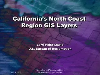
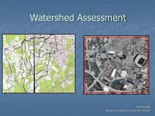
North Coast Watershed Assessment Program GIS Data and Synthesis. Chris Keithley Fire and Resource Assessment Program California Department of Forestry Chris_Keithley@fire.ca.gov. May 1, 2002 For more information on NCWAP http://www.ncwatershed.ca.gov.

E N D
North Coast Watershed Assessment Program GIS Data and Synthesis Chris Keithley Fire and Resource Assessment Program California Department of Forestry Chris_Keithley@fire.ca.gov May 1, 2002 For more information on NCWAP http://www.ncwatershed.ca.gov
North Coast Watershed Assessment Program Goals: 1) Develop baseline information about watershed conditions to evaluate effectiveness of programs 2) Guide watershed restoration programs to ensure efficient and effective projects 3) To guide cooperative approaches to protect and improve watershed conditions through stewardship, easements, and other incentive programs 4) To implement laws requiring assessments, e.g. Forest Practices Act, Clean Water and Porter-Cologne Water Quality Acts, and Lake and Streambed Alteration Permits
What will our assessment program do? • NCWAP will describe current watershed conditions, processes, and uses. • NCWAP will develop hypotheses about linkages among land use activities, natural events, watershed processes and stream habitat conditions for salmon. • NCWAP will identify restoration priorities, develop general management recommendations, and provide context and guidance for cumulative effects analyses. • NCWAP will not provide specific management prescriptions.
Issues Scoping, Sharing Data, Reviewing Products Landowners, Watershed Groups, Local Agencies Landslide and Hazard Maps, Fluvial Geomorphology, and Sediment Storage Maps Department of Conservation/ Division of Mines and Geology Analyses of Factors Limiting Fish Populations By Watersheds Department of Fish and Game Watershed Assessment Products Land Use History, Cumulative Effects Frameworks, Management Recommendations Department of Forestry and Fire Protection Basin Water Quality Assessment North Coast Regional Water Quality Control Board Streamflow Effects and Trends Department of Water Resources
NCWAP Watershed Assessments Current Assessments Redwood, Gualala, Mattole, Big River and Albion Future Assessments (Preliminary) Shasta, Scott, Middle Klamath and M.F. Eel
GIS data to support watershed assessments Land Cover Mapping Vegetation Condition, Change Detection… Land Use Timber Harvesting… Roads Streams Elevation Data Geology Landslides Channel Characteristics -Channel typing, Channel Condition In-Stream Habitat Conditions Stream Temperature
Stream Flow Gages New gages: 8 total, 3 on Gualala River 2 on Big River, 2 on Albion River, and 1 on Mattole River These gauges were also equipped with water temperature sensors. For more information contact: Dept. of Water Resources John Clements, Clements@water.ca.gov
Assessment Methods • EMDS and its Use by NCWAP • Decision support tools. EMDS provides a method for evaluating the • relationships between environmental factors that are represented as • GIS layers for each watershed. • The stream reach component of EMDS evaluates current in-stream conditions and supports an assessment of limiting factors for salmonids. • The watershed EMDS model is applied at the planning watershed level and the sub-basin level.
Purpose of the EMDS Model(s) • Evaluate how watershed conditions compare with desired conditions for salmonids. • Link up with the Stream Reach Condition Model being developed by DFG that evaluates in-stream conditions. • Integrate multiple types of data. • Communicate tool.
Model Structure How does it work? The model consists of a series of networks that evaluate different environmental parameters. The model starts with a basic proposition: e.g., watershed or stream reach conditions are suitable for sustaining salmonid populations
NCWAP GIS data distribution NCWAP Web site: http://www.ncwatershed.ca.gov KRIS Watershed CD’s http://www.krisweb.com/ Participating State Agency Web Sites access via the NCWAP web site Fire and Resource Assessment Web Site http://frap.cdf.ca.gov/