Download
1 / 22
220 likes | 389 Views
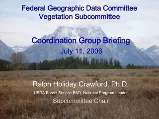
Federal Geographic Data Committee. Vegetation Subcommittee Ralph Holiday Crawford, Chair Sustainable Rangelands Roundtable Boise, Idaho October 21, 2003.

E N D
Federal Geographic Data Committee Vegetation Subcommittee Ralph Holiday Crawford, Chair Sustainable Rangelands Roundtable Boise, Idaho October 21, 2003
The Federal Geographic Data Committee (FGDC) is an interagency committee, organized in 1990 under OMB Circular A-16 that promotes the coordinated use, sharing, and dissemination of geospatial data on a national basis. The FGDC is composed of representatives from nineteen Cabinet level and independent federal agencies. The Steering Committee sets high-level strategic direction for the FGDC as a whole. The Coordination Group advises on the day-to day business of the FGDC. Staff support for FGDC committees is provided by the FGDC Secretariat staff.
History of OMB Circular A-16 • Originally issued in 1958 to insure surveying and mapping activities be directed toward meeting the needs of Federal and State agencies and the general public, and will be performed expeditiously, without duplication of effort • Revised in 1967 Section on Responsibility for Coordination • Revised in 1990 expanded to included surveying, mapping and related spatial data activities
FGDC Membership • Federal Members (AG, Commerce, Defense, Energy, HHS, HUD, Interior, Justice, State, Transportation, EPA, GSA, Library of Congress, NARA, NASA, NSF, TVA) • Non-Federal Members(International city/county management association, Intertribal GIS Council , National Association of Counties, National League of Cities, National States Geographic Information Council, Open GIS Consortium, Spatial Technologies Industry Assoc, University Consortium of Geographic Information Science, Western Governors’ Assoc)
The Federal Geographic Data Committee (FGDC) is an interagency committee, organized in 1990 under OMB Circular A-16 that promotes the coordinated use, sharing, and dissemination of geospatial data on a national basis. The FGDC is composed of representatives from nineteen Cabinet level and independent federal agencies. The Steering Committee sets high-level strategic direction for the FGDC as a whole. The Coordination Group advises on the day-to day business of the FGDC. Staff support for FGDC committees is provided by the FGDC Secretariat staff. • The FGDC subcommittees are organized by data themes. Working groups play a crosscutting role, dealing with issues that span many subcommittees. • FGDC Secretariat Staff • Image map of FGDC Organization • The FGDC Steering Committee • The FGDC Coordination Group • Subcommittees • Working Groups • FGDC Calendar • NSDI discussion list • Contacting FGDC
FGDC Activities • Coordination Group Level • Vegetation Subcommittee Level
Current FGDC Coordination Group Discussions • Geospatial One-Stop • Spatial Data Transfer Standards • Strategy for the Implementation Plan on Commercial Remote Sensing Policy • National Spatial Data Infrastructure Interagency Linkage • Understanding the FGDC Standards Process
Vegetation Subcommittee Update • History • Members • Standards Process
National Vegetation Classification and Information Standards Approved by FGDC On October 22, 1997, Secretary of the Interior Babbitt, as the Chair of the Federal Geographic Data Committee (FGDC), endorsed the Committee's approval of the National Vegetation Classification and Information Standards. This will now be the standard vegetation classification system for use by Federal government agencies and their cooperators. The standard, which has been under development since 1992, is based on the classification system originally developed in 1984 through the United Nations Educational, Cultural and Scientific Organization and Driscoll et al (1984) which were later refined by The Nature Conservancy. The new standard (http://www.fgdc.gov/standards/status/sub2_1.html) has undergone wide public review as part of the FGDC standards approval process. The FGDC Vegetation Subcommittee, which coordinated development of the standard, is also coordinating with the development of the United Nations Environment Programme's Food and Agriculture Organization Land Cover Classification System, to help work toward development of a potential global standard for use in classifying and characterizing land cover. Development of this national vegetation classification standard is an important component in helping to increase sharing and exchange of vegetation-related data among Federal agencies and other partners as part of the NBII and the National Spatial Data Infrastructure (NSDI) federations.
R. Crawford (Chair) D. Powell (FS) L. Bryant (FS) R. Brohman (FS) B. Hale (NASS) D. Thompson (NRCS) L. Gorman (DOD) G. Waggoner (USGS) D. Shaw (EPA) M. Nyquist (USGS) S. Karl (BLM) E. Middleton (NASA) D. Tart (FS) L. Hidinger (ESA) D. Grossman (NatureServe)+ J. Thomas (NOAA) D. Faber-Langendoen+ B. Czech (FWS) C. English (BIA) Current Vegetation Subcommittee Members and Contributors
Vegetation Classification Standard Vegetation Subcommittee Federal Geographic Data Committee June 1997 Federal Geographic Data CommitteeDepartment of Agriculture * Department of Commerce * Department of Defense * Department of Energy Department of Housing and Urban Development * Department of the Interior * Department of State Department of Transportation * Environmental Protection Agency Federal Emergency Management Agency * Library of Congress National Aeronautics and Space Administration * National Archives and Records Administration Tennessee Valley Authority
FGDCNational Vegetation Classification Standard(example) Physiognomic Division Vegetated Order Tree Dominated Class Closed Tree Canopy Subclass Evergreen Group Temperate or Subpolar Needle-leaved Subgroup Natural/Semi-natural Formation Rounded Crowns Floristic Alliance Pinus taeda Closed Tree Canopy Alliance Association Pinus taeda/Symplocos tinctoria-Myrcia cerifera-Vaccinium elliotii
The need for developing standards at the floristic levels • Two levels of classification hierarchy based on floristic criteria are introduced conceptually in the FGDC vegetation classification standard. • No details of nomenclature or methods for delimiting or describing them. ESA Veg Panel
GUIDELINES FOR DESCRIBING ASSOCIATIONS AND ALLIANCES OF THE U.S. NATIONAL VEGETATION CLASSIFICATION The Ecological Society of America Vegetation Classification Panel Michael Jennings, Orie Loucks, David Glenn-Lewin, Robert Peet, Don Faber-Langendoen, Dennis Grossman, Antoni Damman, Michael Barbour, Robert Pfister, Marilyn Walker, Stephen Talbot, Joan Walker, Gary Hartshorn, Gary Waggoner, Marc Abrams, Alison Hill, David Roberts, David Tart
FGDC Standards Process • There is no time limit specified for the standards development group to carry out their development and post-public review work. • On the other hand, the Standards Working Group and Coordination Group have time limits for their work.
Veg Subcommittee Suggestion to ESA Veg Panel • Conversion and correlations of past vegetation data collected • Definitions and usage of association and alliance • Standard versus guidelines and the classifications of vegetation on rangelands
FGDC Agencies ESA NatureServe Funding to Accomplish Veg. Classification MOU Goals Maintenance & Archival of Veg. Plots Data Maintenance & Archival of Veg. Class & Descriptions Standards Process Activities Veg. Classification Science Veg. Classification Science Veg. Classification Science Revise & Refine Existing MOU Implementation & Use Strategies (e.g. Veg. Mapping, etc.) Implementation & Use Strategies (e.g. Veg. Mapping, etc.) Implementation & Use Strategies (e.g. Veg. Mapping, etc.) Call Periodic Meetings of MOU Members ? ? USFS (Agency Lead) Develop Implementation Plan & Budget for OMB Develop Implementation Plan & Budget for OMB Education and Outreach Education and Outreach Education and Outreach Education and Outreach