Download
1 / 5
60 likes | 179 Views
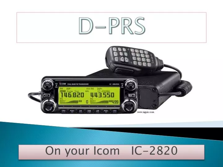
D-PRS. On your Icom IC-2820. Sending GPS Data to APRS via D-PRS iGATE Transmitting your GPS data with longitude, latitude, course, speed, altitude and a message can only be accomplished by setting up the IC-2820 as follows. 1 st turn on your GPS function 2 nd set DV Data TX to PTT

E N D
D-PRS On your Icom IC-2820
Sending GPS Data to APRS via D-PRS iGATE Transmitting your GPS data with longitude, latitude, course, speed, altitude and a message can only be accomplished by setting up the IC-2820 as follows. 1stturn on your GPS function 2ndset DV Data TX to PTT 3rdset GPS TX to GPS 4thselect GPS Message once you select GPS Message you will get this screen Note 2 spaces You can manually enter your GPS message from this screen Two SPACES are required between the LK (symbol) and the first letter of the message. Also remember ALL LETTERS ARE IN CAPS. LK HERE I AM*71 To figure out the message, go to D-PRS Message Calculator http://www.aprs-is.net/DPRSCalc.aspx
Once you get to this page, type in your callsign, pick a symbol (mine is a truck so LK is the symbol I select), enter your message as illustrated below, now enter that message into the GPS MESSAGE screen above. The first four spaces are for the GPS symbol since my TRUCK symbol only takes up 2 spaces (LK) you MUST ENTER TWO BLANK SPACES between the LK and Here the rest are single spaces between words, except for the check sum at the end it must end in *(then the checksum which is the number) as you see above.
The last thing you have to do is setup your GPS sentence on the radio. At a minimum you will need to select RMC and GGA this gives you longitude, latitude, course, speed and altitude, at receiving station.
The GPS mode is less reliable then GPS-A mode. If you look at my raw data on findu or jfindu sometimes you will not see altitude and other parts of the data is missing because of the lack of CRC as GPS-A provides. AE5PL sent me an email explaining the CRC/GPS-A. “GPS-A mode uses a 16 bit CRC, GPS mode uses an 8 bit XOR checksum. GPS-A mode sends one line containing all of the information, GPS mode sends a line for each GPS NMEA sentence and a line for the callsign and GPS message. In essence, GPS-A mode sends one CRC protected line per position report; GPS mode sends 3 checksum protected lines per position report.” For me the intermittent loss of some information is okay and it is accurate enough. A note my radio outputs NEMA compliant GPS data to a laptop using the Data Port on the front of the radio and Navigation software installed on the notebook I also transmit GPS data to other radios and I send that same GPS data to APRS.