Download
1 / 34
360 likes | 398 Views
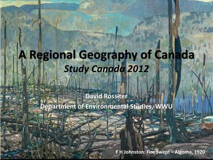
A Regional Geography of Canada Study Canada 2012. David Rossiter Department of Environmental Studies, WWU. F H Johnston: Fire Swept – Algoma, 1920. “If some countries have too much history, we have too much geography.” PM W.L. Mackenzie King,1936.

E N D
A Regional Geography of CanadaStudy Canada 2012 David Rossiter Department of Environmental Studies, WWU F H Johnston: Fire Swept – Algoma, 1920
“If some countries have too much history, we have too much geography.” • PM W.L. Mackenzie King,1936 Whistler, BC backcountry. Photo: D. Rossiter, 2012
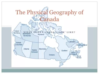
Oh, to brag… • Second largest country • Canada’s total area: 9,984,670 sq.km • 9,093,507 sq.km land • 891,163 sq.km freshwater. • Coastline: 243,042 km • Longest in world • Resource rich • Sparse yet diverse population Source: Statistics Canada
Pop Quiz YK NWT NVT NFLD and LAB BC ALTA MTBA SASK QUE PEI ONT NB NS
Whitehorse Iqaluit Yellowknife St. John’s Edmonton Vancouver Saskatoon Charlottetown Victoria Calgary Winnipeg Fredericton Regina Quebec St. John Halifax Ottawa Montreal Toronto
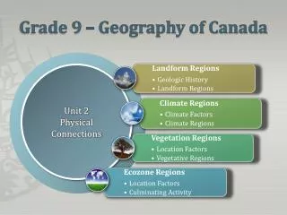
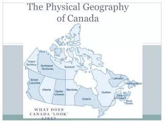
How to make sense of it all? • Physical base • Human geography – current patterns • Historical geography and political economy • Oil Canada: regions, environment, and economy
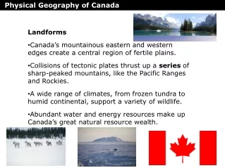
The Physical Base • Geology • Topography • Soils • Vegetation • Climate Fundamental to understanding Canada’s human geography and historical development
The Late Wisconsin Ice Age • Maximum extent 18,000 years ago • Started to recede 15,000 years ago • Last remnants in Rockies 7,000 years ago Drumlin – Alberta Glacial valley - Alberta Glacial till and erratic – NS
Appalachian Uplands • N. Appalachian Mountains • Rounded uplands; narrow river valleys • Rocky, shallow soils • Mixed forest • Cool, maritime climate • short summer, wet winter NFLD Coast
Great Lakes – St. Lawrence Lowlands • Sedimentary rock and glacial deposits • Flat, rolling topography • Good soil • Moderate climate, good growing season • humid and hot summer / cold winter Oak Ridges Moraine – S. Ontario
Canadian Shield • Geol. core of N.A. • Precambrian rocks • > 3 billion yrs old • Widespread glaciation • shallow soils, exposed granite • Mixed and Boreal forest • Northern continental climate • hot, short summer / cold, long winter North Shore, Quebec
Interior Plains • Sedimentary rock • Shaped by glacial and hydrological processes • river valleys • Drain east to Hudson Bay • Decent soils in south • Oil and gas deposits • Continental climate • moderate precip. • hot summer / cold winter Wheat fields outside Winnipeg, MB South Saskatchewan River
Cordillera • Formed 40-80 million years ago • colliding NA and Pac. plates • Glaciers in high alpine • Fertile river valleys and deltas • Mostly coniferous forest • Micro-climates • warmer, wetter on coast • colder, drier in interior Alberta Rockies The Barrier – Coast Mountains
Hudson Bay Lowlands • Youngest phyiso. reg. in Canada • Muskeg • w/ low ridges of sand and gravel • Poorly drained • low elev., level surface • Northern climate • maritime influence • short summer / long winter Muskeg James Bay delta
Arctic Lands • ~25% of Canada’s territory • Coastal lowlands & plateaux and mtns. (Innutian) • Mainly sedimentary rock w/ permafrost • Glaciers still active • Areas of polar desert Baffin Island - Nunavut
Where are all the people? Short answer: • In cities, near the USA • ~80% of Canadians live in cities (100,000+) • ~80% of Canadians live within 100km of USA
Population density, 2006 Map source: Atlas of Canada Legend Density by Census Div. (persons / sq.km) < 0.1 0.1-0.9 1.0-3.5 3.6-19.9 20.0-49.9 50.0-150.0 > 150.0 Total population, 2011 - 33,476,690 Source: Statistics Canada
Where are all the people? Longer answer: • All over • “Heartland” (cities) draws on resources of “hinterland” • north dominated by resource towns and regional service centres
Resource Reliant Communities, 2001 Map source: Atlas of Canada Legend 30-100% of income from: Agriculture Energy Fishery Forestry Mining
Financial Specialization, 1996 Map source: Atlas of Canada Legend Degree of specialization Low to High
An historical-geography of Canada’s political economy in 10 minutes…
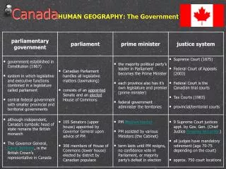
Three Popular Explanations • Staples Development • Canada developed by resource extraction • Heartland-hinterland patterns • International, national, regional scales • Physical disunity (or, unity despite geography) • Human settlement in patches, difference from USA
Storehouse of Raw Materials? • “Hewers of wood and drawers of water” • Early Euro interests more commercial than colonial – fish, fur, timber • Settlement through extraction and export • Trade with “mother countries” • Resources still major economic sector
Regional Run-down • New France (later Quebec / Lower Canada) • From 17th C: “habitant” agriculture, fur trade, forestry • Maritimes (NFLD, Acadia; later NB, NS, PEI) • From 17th C: fisheries, lim. ag.; 19th C: forestry NB • Upper Canada; later Ontario • From 18th C: freehold agriculture; 19th C: manufacturing in south, mining & forestry in north • West (“the NW”, the prairies, the cordillera) • From 18th C: fur trade; 19th C: mining & forestry in BC, agriculture in prairies
Changing Economic Geographies: From East to West (and back again) in the late-19th C… Source: www.canadianheritage.org
…to North and South (and all over) in the 20th C. GM plant – Oshawa, ON
Map source: pacifcwild.org Northern Gateway
References • Many maps and images were obtained at: • www.canadainfolink.ca/geog.htm • http://atlas.nrcan.gc/site/english/index.html • Other resources: • A good atlas of Canada • Historical Atlas of Canada, vols. 1-3, University of Toronto Press • Heartland and Hinterland, McCann and Gunn • Regional Geography of Canada, Bone