Download
1 / 21
210 likes | 371 Views
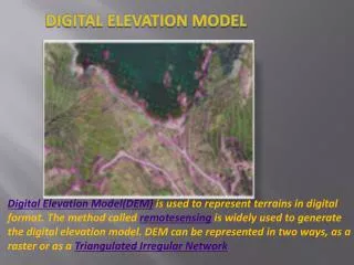
National Digital Elevation Program (NDEP) August 2001. U.S. Department of the Interior U.S. Geological Survey. National Elevation Dataset. Seamless/Framework Elevation Database Concept. Assembly. Irregular Polygons. Conflation Update Tools. National Elevation Data Set

E N D
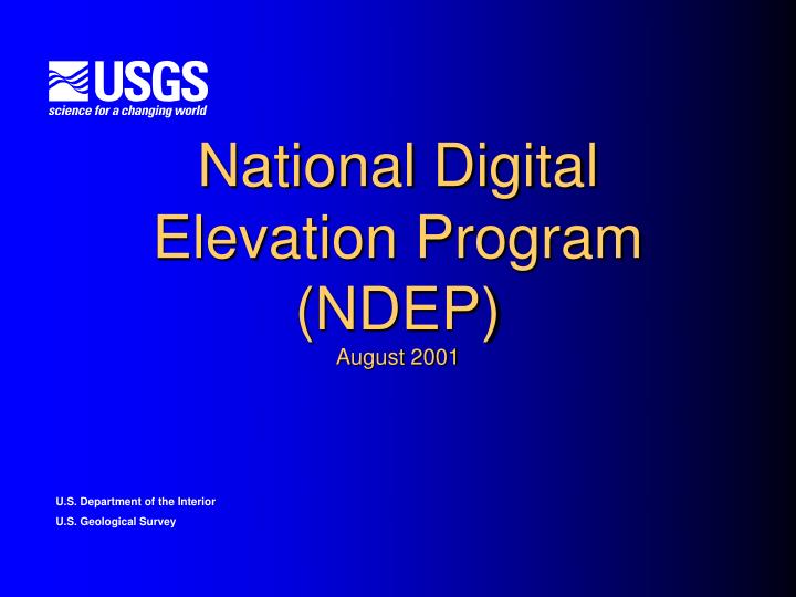
National Digital Elevation Program (NDEP)August 2001 U.S.Department of the Interior U.S. Geological Survey
Seamless/Framework Elevation DatabaseConcept Assembly Irregular Polygons Conflation Update Tools National Elevation Data Set “Best Available” Regularly Gridded Multi-resolution Mass Points Break Lines Contours Source Product Distribution Grids Raw Base Data Control Source Database
National Digital Elevation Program (NDEP) • In keeping with National Spatial Data Infrastructure principals, and Executive Order 12906, establishing the NSDI: • Enhance Data Sharing • Minimize redundant data production • Leverage resources to satisfy multiple requirements • Apply flexible and common standards • Ensure availability of “best available” base cartographic data
NDEP Partnership Mechanisms • Joint Production Plans, developed by the NDEP Project Coordination Subcommittee • Member Agency requirements • Joint funding agreements with other Federal and State agencies • Data Exchange, Data Share, and Work Share agreements with other Federal, State, and local agencies • Innovative Partnerships with State agencies and private firms • Existing partnerships, such as DOI High Priority, and the USGS-USFS-BLM Management Oversight Committee, among others.
NDEP Membership • Bureau of Land Management (BLM) • Natural Resources Conservation Service (NRCS) • U.S. Forest Service (USFS) • U.S. Geological Survey (USGS) • National Oceanic and Atmospheric Administration (NOAA) • National Imagery and Mapping Agency (NIMA) • U.S. Army Corp of Engineers (USACE) • Federal Emergency Management Agency (FEMA) • National Aeronautics & Space Administration (NASA) • National States Geographic Information Council (NSGIC) • Other Organizations can be added
NDEP Charter • Presents Guidelines and Operating procedures for the NDEP Organization. • Establishes the NDEP Steering Committee, identifying functions, authorities, and responsibilities. • Charter signed by Members as of September 2000. • Charter Revision, led by USACE underway.
NDEP Organization • Steering Committee • USGS elected to Chair- Ken Osborn (kjosborn@usgs.gov) • USGS elected to Executive Secretary- John Crowe (jcrowe@usgs.gov) • Technical Subcommittee • USGS Chair, Jim Mauck (jmauck@usgs.gov) • Project Coordination Subcommittee • USGS Chair, Dave Saghy (dsaghy@usgs.gov)
NDEP Steering Committee • Oversee the NDEP, including identifying the vision, direction, and goals of the program, planning and finalizing program requirements, determining general digital elevation production strategies, and reviewing product costs, contracts, funding, contracting mechanisms and resource allocations. • Promote joint funding, cost‑share and work‑share agreements, and innovative partnerships with Federal and State agencies and other entities. • Review and coordinate technical criteria for the program, including the technical standards and guidelines for the development, quality assurance and distribution of digital elevation data, and the assessment of emerging alternative technologies.
NDEP Steering CommitteeContinued • Meet semi‑annually, or when called by the chairperson. Review the MOU and Charter annually to keep current. Update the MOU appendices by reviewing and approving the proposed Interagency Agreements and NDEP production plans. • Participate in annual professional society meetings to provide general information, program status, and other activities of NDEP to agency participants and to potential new Federal and State members and contributors. • Each agency has one voting member. Voting processes and procedures established by the Steering Committee. • The NDEP Steering Committee membership will be comprised of agencies and organizations signed to the Charter and MOU/IA.
NDEP Steering CommitteeContinued • Annual consideration will be given to new leadership of the NDEP Steering Committee and its subcommittees, facilitating alternation among the member agencies. A chairperson will be nominated by the chairing agency and approved by the NDEP Steering Committee • The NDEP Steering Committee will form a Technical Subcommittee and a Project Coordination Subcommittee to provide advice and support. Participating agencies will submit nominations of representatives to the subcommittees to the NDEP Steering Committee. The NDEP Steering Committee will select a Chairperson for each subcommittee.
NDEP Technical Subcommittee • The Technical Subcommittee will address technical issues related to: • research • production • distribution • application • Lead the implementation and or development of digital elevation data product guidelines, to facilitate NDEP operations. • Significant technical issues will be presented to the NDEP Steering • Committee, and specific technical guidance will be provided. • Meetings will occur on an ad hoc basis as required. The committee may seek the input of and participation from representatives from commercial entities, academic organizations, and various levels of government.
NDEP Project Coordination Subcommittee • Coordinates requirements from NDEP members. • Identifies overlapping, matching, or near matching requirements. • Provides a mechanism for adjudication of requirements to facilitate joint data production. • Develops and monitors production and funding plans. • Addresses significant program issues, and reports to the Steering Committee. • Fiscal Year implementation plans and schedules will be presented to the NDEP Steering Committee for review. • Meetings will occur on a quarterly basis prior to NDEP Steering Committee meetings.
Program Execution • Modeled after the successful National Digital Orthophoto Program. (NDOP) • Joint approach to products definition and contract administration. • Consistent approach to quality assessment and quality control. • Unified approach to providing archive and data dissemination services. • Maintain archive of native data. • Provide seamless data delivery over the WWW.
Benefits • Provides the mechanism for the NDEP membership to satisfy requirements for elevation data in support of Member Agency Missions, utilizing a leveraged approach to minimize redundancy, enhance data sharing, and pool resources to achieve common goals. • Enhances the ability to satisfy a broader suite of requirements, from multiple perspectives, by contributing to a National Program which provides broader access to data, constituting a key contribution to the development of a National Elevation Framework. • Provides the potential for a strong, sustainable National Elevation Program in support of National as well as place based requirements. • Shows commitment to NSDI principals and executes the vision of executive order 12906.
Meetings Status • First NDEP Steering Committee Meeting held at USGS, Reston on Dec 11, 2000. • Elections to Technical Subcommittee made by member organizations. Initial focus on standards/specifications, database/archive, and quality control/quality assessment. • Joint meeting of the NDEP Steering Committee and the Technical Subcommittee held at FEMA on February 16, 2001. • Technical guidance provided for subcommittee, work assignments and approach determined. • Reached agreement to elect membership to the NDEP Project Coordination Subcommittee. Data Call and FY 2002 Program Call, initiated 3/16/01.
Meetings Status • Joint meeting of the NDEP Steering Committee and the Project Coordination Subcommittee held at BLM on May 2-3, 2001. • Report on initial results of data and program call • Discussion of development of NDEP information infrastructure • Data Holdings • Production Plans • Program Requirements • Production Management • Process Overview • Status Reporting • Identify Partnership Opportunities • Develop Production Plans
Meetings Status • NDEP Steering Committee meeting held at USDA-FS, August 15-16 • Census Bureau joins the NDEP • Subcommittee Reports • ASPRS/MAPPS Elevation Conference Updates • FEMA Cooperating Technical Partners Program • MOU/IA Discussions/review • Data Licensing/Data Access issues • Intermap Proposals • Consortia Commitments • Public Domain • Program Coordination/Data Sharing • Promote fair Development of Markets and Technologies • Cooperative business solutions