Download
1 / 32
320 likes | 431 Views
Global Pattern of Surface Pressure and Wind. Global Pattern of Surface Pressure. If we averaged the sea level pressures over the Earth throughout the year we would see broad regions of high and low pressure.

E N D
Global Pattern of Surface Pressure If we averaged the sea level pressures over the Earth throughout the year we would see broad regions of high and low pressure. If we ignore the locations of continents and oceans and major mountain ranges, the broad regions would fall in latitudinal belts around the Earth.
North Pole Polar High Pressure Polar Front – low pressure Subtropical High Pressure Intertropical Convergence Zone – low pressure Subtropical High Pressure Polar Front – low pressure Polar High Pressure South Pole
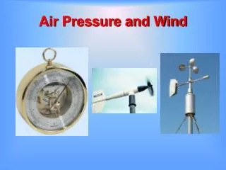
Pressure and Wind Patterns These latitudinal bands of high and low pressure regions help to determine the average wind directions that we see at the surface of the Earth.
North Pole Polar High Pressure Polar Front – low pressure Subtropical High Pressure Intertropical Convergence Zone – low pressure Subtropical High Pressure Polar Front – low pressure Polar High Pressure South Pole
Intertropical Convergence Zone The InterTropical Convergence Zone (ITCZ) is a zone of low pressure near the equator where the trade winds from the northern and southern hemispheres meet.
Trade Winds The trade windsare the relatively steady northeasterly or southeasterly winds between the subtropical high pressure system and the ITCZ that were used by sailing ships to travel across the oceans.
Circulation In the Tropics Most of the air converging on the ITCZ rises, creating an area of relatively calm winds at the surface called the doldrums. Most of the air is sinking near the centers of the subtropical highs, which also creates an area of relatively calm winds at the surface called the horse latitudes.
Hadley Cells The circulation cell formed by the sinking air in the subtropical high, the trade winds blowing toward the ITCZ, the air rising at the ITCZ and the diverging poleward flow just below the tropopause is called a Hadley cell. There are two Hadley cells, one in the northern hemisphere and one in the southern hemisphere.
Precipitation Patterns in the Hadley Cells The rising motion in the region of the ITCZ produces clouds and precipitation. The heavy rains near the ITCZ are sufficient to support the growth of tropical rainforests. The sinking of hot, dry air in the subtropical highs leads to the formation of deserts.
The Hadley Cells and the Seasons The subtropical highs and the ITCZ shift toward the hemisphere that is having its warm seasons. Thus, in January the pattern shifts toward the southern hemisphere and the ITCZ is south of the equator. In July the pattern is shifted toward the north and the ITCZ is found north of the equator.
The Pattern Outside the Tropics The average wind directions outside the tropics are determined by the polar high pressure system, the polar front, and the subtropical high pressure system.
North Pole Polar High Pressure Polar Front – low pressure Subtropical High Pressure Intertropical Convergence Zone – low pressure Subtropical High Pressure Polar Front – low pressure Polar High Pressure South Pole
The Polar Front The polar front moves north and south as it is pushed by the polar and subtropical high pressure systems. Many of the low pressure systemsthat we find on the surface weather map form along the polar front.
North Pole Polar High Pressure Polar easterlies Polar Front – low pressure Surface westerlies Subtropical High Pressure Northeast trade winds Intertropical Convergence Zone – low pressure Southeast trade winds Subtropical High Pressure Surface westerlies Polar Front – low pressure Polar easterlies Polar High Pressure South Pole
Effects of Continents and Oceans Continents, oceans, major mountain ranges, and the formation of transient weather systems all disrupt this nice neat and tidy pattern of winds to produce the actual winds we see at the Earth’s surface.
Air Masses An air mass is a large body of air that has similar thermal and moisture characteristics in the horizontal directions.
Air Masses Air masses form over source regions, which are large, relatively flat areas over the Earth’s surface with relatively uniform characteristics. Air masses typically have a surface high pressure system at their center.
Source Regions Air sinks and spreads out from the same geographic region. H The air takes on the characteristics of the surface.
Typical Air Mass Types Arctic – very cold and very dry Continental polar – cold and dry Maritime polar – cool and moist Maritime tropical – warm and moist Continental tropical – hot and dry
Winter Pressure Pattern The average sea level pressures are generally higher over the continents (Asia and North America) and lower over the oceans (the Pacific and Atlantic) during the winter. This pattern is less evident in the southern hemisphere because there is so much less land in the southern hemisphere.
Summer Pattern The average sea level pressures are generally higher over the ocean (Pacific and Atlantic) and lower over the continents (Asia and North America) during the summer. Again, this pattern is also less evident in the southern hemisphere.
The Monsoon Since Asia is the largest landmass on the surface of the Earth, it has the largest impact on the pattern of pressure and winds at the surface. The most well known manifestation of the impact of Asia is known as the monsoon. The word monsoon means a large-scale shift of wind directions with the seasons.
January Pattern The surface pattern over Asia in January is dominated by a large high pressure system sometimes called the Siberian high.
The Siberian High This large high pressure system produces diverging clockwise flow that spreads cold, dry air over large portions of Asia. Thus, winter is the dry season over Asia
July Pattern The surface pattern over Asia in July is dominated by low pressure over southern and eastern Asia.
July Pattern (Cont.) Warmmoist air flows into Asia from the Indian and Pacific oceans. The warm moist air rises in low pressure systems and as it flows up mountain ranges like the Himalayas, producing clouds and precipitation.
Rainy Season Thus, summer is the rainy season over much of Asia.
North American Monsoon Although North America is not as large as Asia, it is large enough to produce a monsoon over the southwest.
January The average sea level pressure over the southwestern portion of the U.S. is generally dominated by high pressure in January.
July Low pressure develops at the surface in July. If the low pressure is strong enough, it is able to pull in moist air from the Gulf of California into Arizona and summertime thunderstorms can develop.