Download
1 / 48
480 likes | 620 Views
Forecasting extreme meteorological events over complex topography. Daniel Cattani Pierre Eckert MétéoSuisse. Probability forecasts. Based on an Ensemble Prediction System (EPS) DMO Statistical interpretation Rescaling …. Not well suited for rare events:

E N D
Forecasting extreme meteorological events over complex topography Daniel Cattani Pierre Eckert MétéoSuisse
Probability forecasts • Based on an Ensemble Prediction System (EPS) • DMO • Statistical interpretation • Rescaling • …. • Not well suited for rare events: Positve scores for prob(rr>10 mm/day) Negative scores for prob(rr>50 mm/day)
EFI LEPS ECMWF Medium range model “does” generate severe weather events: forecast/observed frequency ratio (FBI)
Three „downscaling“ techniques for extreme events • Extreme Forecast Index (EFI) • rescale with respect to model climate • LEPS • downscale ensemble with a LAM • Artificial neural Network (ANN) • pattern recognition of extreme situations with respect to a given meteorological parameter
Three „downscaling“ techniques for extreme events (plan) The final goal is to compare (HR vs FAR) the three techniques A few recent cases (EFI and LEPS) Presentation of ANN Verification of ANN Presentation of EFI D. Cattani Verification of EFI D. Cattani
A few recent cases • November 2002 flodding • Calvann 2.1.2003 • Rainfall of 30.4.2003
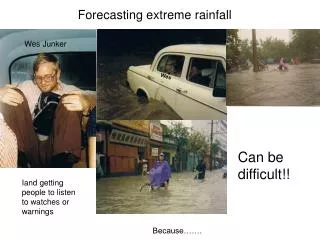
November 2002 flooding • 14-16th November • Low over western Mediterranean • Southerly current over the Alps • Over 100 mm/day south of the Alps (classical) • Geneva: 92 mm in one day (14th) Very exceptional
LEPS rr>20 mm, 14.11.2002 12z – 15.11.2002 12z ZUR VAD SIO GVE LUG
LEPS rr>50 mm, 14.11.2002 12z – 15.11.2002 12z ZUR VAD SIO GVE LUG
LEPS rr>100 mm, 14.11.2002 12z – 15.11.2002 12z ZUR VAD SIO GVE LUG
LEPS rr>150 mm, 14.11.2002 12z – 15.11.2002 12z ZUR VAD SIO GVE LUG
LEPS rr>20 mm, 15.11.2002 12z – 16.11.2002 12z ZUR VAD SIO GVE LUG
LEPS rr>50 mm, 15.11.2002 12z – 16.11.2002 12z ZUR VAD SIO GVE LUG
LEPS rr>100 mm, 15.11.2002 12z – 16.11.2002 12z ZUR VAD SIO GVE LUG
LEPS rr>150 mm, 15.11.2002 12z – 16.11.2002 12z ZUR VAD SIO GVE LUG
LEPS rr>50 mm, 14.11.2002 12z – 17.11.2002 12z ZUR VAD SIO GVE LUG
LEPS rr>100 mm, 14.11.2002 12z – 17.11.2002 12z ZUR VAD SIO GVE LUG
LEPS rr>150 mm, 14.11.2002 12z – 17.11.2002 12z ZUR VAD SIO GVE LUG
LEPS rr>250 mm, 14.11.2002 12z – 17.11.2002 12z ZUR VAD SIO GVE LUG
Storm Calvann 2.1.2003 • Close to the warning threshold: • 100 km/h gusts at low altitude • 130 km/h in mountains • Touched northern Switzerland • Early warning has been issued on 31.12.2002
Preciptation 30.4.2003 • Warning has been issued on the threshod: • 30 mm/ 12h • For western Switzerland
Preciptation 30.4.2003 Niederschlagssumme Millimeter Code 30.04.03 01Z 01.05.03 00Z ............................................................................. SHA 8 BAS 14 GUT 3 RUE 9 LAE // TAE 7 FAH 23 KLO 10 STG 3 BUS 13 REH 11 SMA 6 HOE // CHA 14 WYN 18 WAE 12 SAE 17 CDF 33 NAP 25 ? LUZ 9 VAD 7 NEU 18 BER 24 PIL 6 GLA 7 FRE 23 PAY 25 ALT 3 CHU 10 PLF 37 INT 18 ENG 7 WFJ 7 SCU 7 MLS 19 JUN // GUE 14 DIS 12 DAV 7 DOL 35 PUY 36 ABO 13 GRH 12 PIO 49 HIR 48 SAM 16 CGI 23 AIG 21 MVE 14 ULR 11 ROE 79 COM 27 SBE 43 COV 12 GVE 23 SIO 8 VIS 4 CIM 30 ROB 24 FEY 8 OTL 29 MAG 17 EVO 7 ZER 12 LUG 6 GSB 66 SBO 3
Recognition of extreme events with ANN • Old method: • Self Organising Map (SOM) = classification of synoptic patterns with H500 and T850 • The classification is independent of the weather element • Interpretation in terms of weather elements made in a second step: probabilty to exceed some threshold for each element of the classification
Recognition of extreme events with ANN • New developments (R. Kretschmar) • Supervised learning, classification is dependent on the weather element and the theshold. • More predictors
Verification: experiments SOM with H500 and T850 SOM with 250 PCA FFNN with 250 PCA FFNN with 250 PCA and DMO rainfall as input Station Lugano (south of the Alps) Rescale DMO precipitation: event is realised when RR exceeds 10mm, 20mm, 30mm,…
Verification: scores • Hit Rate = B / (A+C) • FAR = A / (A+B)
Verification: scores SOM (unsupervised) FFNN (supervised)
Verification: scores Rescaled DMO (T511) FFNN with DMO RR as input
Verification: scores Rescaled DMO (T511) FFNN with DMO RR as input
Conclusion • Forecasting of rare events requests special treatment • Downscaling / rescaling • Hit rate is usable • False Alarm Rate can be optimised • DMO, EFI, LEPS, ANN have each their own qualities • Define methods based on combinations ot these techiques • Critical eye of the forecaster is still requested, mostly for reducing the False Alarm Rate.