Download
1 / 1
10 likes | 174 Views
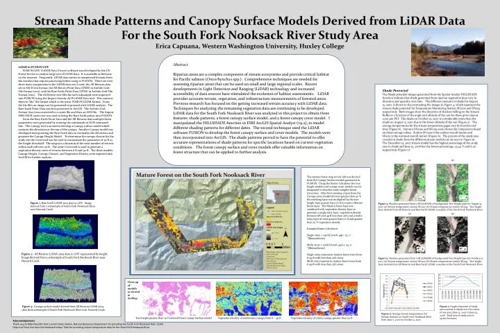
Stream Shade Patterns and Canopy Surface Models Derived from LiDAR Data For the South Fork Nooksack River Study Area Erica Capuana, Western Washington University, Huxley College. LiDAR in FUSION/LDV

E N D
Stream Shade Patterns and Canopy Surface Models Derived from LiDAR Data For the South Fork Nooksack River Study Area Erica Capuana, Western Washington University, Huxley College LiDAR in FUSION/LDV FUSION/LDV (LiDAR Data Viewer) software was developed by the US Forest Service to analyze large sets of LiDAR data. It is available as freeware on the internet. Frequently, LiDAR data comes in compressed formats from the vendors that require processing before using in FUSION. There are were three main components to the LiDAR data sets I used, the All Returns data set in ASCII text format, the All Return Point Data (DEM) in ArcInfo Grid File Format (e00), and the Bare Earth Point Data (DTM) in ArcInfo Grid File Format (e00). The All Return text files for each subsample were imported into FUSION using the Import Generic ACII LiDAR Data tool. This converts them to “lda” file format which is the main FUSION LiDAR format. From the lda files an image can be generated to proceed with LiDAR analysis. The Bare Earth Point Data was first processed in ArcGIS. The ArcInfo Grid Format (e00) was converted to a raster file and then an ASII file. The Import ESRI ASCII raster tool was used to bring the Bare Earth points into FUSION. From the Bare Earth Point Data and the All Returns data multiple forest parameters were generated by running the commands in DOS command line. The Canopy tool was used to develop a Canopy surface model which contains the elevations at the top of the canopy. Another Canopy model was developed incorporating the Bare Earth data to normalize the elevations and generate the Canopy Height Model. To determine the canopy closure for the study site the Cover tool was be used to incorporate the parameter of 50 ft as the height threshold. The output is a function of the total number of returns within each cell over 50 ft. The same Cover tool is used to generate a vegetation density cover of returns between 6 ft and 50 ft. The three models: Canopy Height, Canopy Closure, and Vegetation Density were exported into ArcGIS for further analysis. Shade Potential The Shade potential images generated from the Spatial Analyst HILLSHADE function indicate that shade generated from riparian vegetation does vary in direction and quantity over time. The different amounts of shade for August 15, 2007 is shown in the contrasting the images in Figure 4, which represent the stream shade potential for Temperature Monitoring Station SF0200 and SF0153 respectively. Both images show the direction of shadows falling on the Stream Buffer as a function of the angle and altitude of the sun for those given days at 12:00 pm PST. The shade on October 15, 2007 is considerably more than the shade on August 15, 2007 due to the lower altitude of the sun (Figure 5). The average temperatures for the stream temperature gages vary by location and time (Figure 6). Stations SF0200 and SF0153 were chosen for comparison based on these average values. Station SF0200 is the coolest overall station and SF0153 is the warmest overall station (Figure 6). The percent of the study area covered in shade from the different stream models can be seen in Figure 16. The December 15, 2007 stream model has the highest percentage of the study area in shade and June 15, 2008 has the lowest percentage, 23.44 % and 6.20 respectively (Figure 7). Abstract Riparian areas are a complex component of stream ecosystems and provide critical habitat for Pacific salmon (Oncorhynchus spp.). Comprehensive techniques are needed for assessing riparian areas that can be used on small and large regional scales. Recent developments in Light Detection and Ranging (LiDAR) technology and increased accessibility of data sources have stimulated the evolution of habitat assessments. LiDAR provides accurate terrain, vegetation, and infrastructure measurements of forested areas. Previous research has focused on the getting increased terrain accuracy with LiDAR data. Techniques for analyzing the remaining vegetation data are continuing to be developed. LiDAR data for the South Fork Nooksack River was analyzed in this project to obtain three features: shade patterns, a forest canopy surface model, and a forest canopy cover model. I manipulated the HILLSHADE function in ESRI ArcGIS Spatial Analyst (v9.2), to model different shading patterns for different dates. The second technique used the LiDAR software FUSION to develop the forest canopy surface and cover models. The models were then incorporated into ArcGIS. The shade patterns proved to have the potential to offer accurate representations of shade patterns for specific locations based on current vegetation conditions. The forest canopy surface and cover models offer valuable information on forest structure that can be applied to further analysis. (a) (b) The mature forest map on the left was derived from the Canopy Surface models generated in FUSION. Using the Raster Calculator the tree height models and canopy cover models can be integrated to describe more complex forest structures. After first creating a layer from the Canopy cover model of cover greater than 50 % the resulting layer was multiplied by the tree height layer greater than 70 ft to create a Mature forest layer. The Mature forest layer was combined with vegetation density layer to generate a single story layer, vegetation density between 6ft and 49 ft less than 25% and a multi-story layer of trees greater than 70 ft and greater than 25 % vegetation density. Example Raster Calculator Single story = con([Cover6_49]< 25, 1) *[Matureforest] Multi-story = con([Cover6_49]>= 25, 1) *[Matureforest] Single story represents mature forest trees from 6-49 ft with less than 25% cover Multi story represents mature forest trees from 6-49 ft with less than 25% cover Figure 1: Bare Earth LiDAR 2005 data in LDV. Image derived from a subsample of South Fork Nooksack River near Howard Creek. Figure 4: Shadows generated from a HILLSHADE of background Tree Height layer for August 15, 2007 (a) Stream temperature station SF0200 (b) Stream temperature station SF0153. Tree height layer derived from All Returns and Bare Earth LiDAR 2005 data of the South Fork Nooksack River. (a) (b) Figure 2: All Returns LiDAR 2005 data in LDV represented by height. Image derived from a subsample of South Fork Nooksack River near Howard Creek. Figure 5: Shadows generated from a HILLSHADE of background Tree Height layer for October 15, 2007 (a) Stream temperature station SF0200 (b) Stream temperature station SF0153. Tree height layer derived from All Returns and Bare Earth LiDAR 2005 data of the South Fork Nooksack River. Close up of models as viewed in ArcMap Figure 7: Graph of percent of study area covered in shade over the course of one year, June 15, 2007 to June 15, 2008. Total area of study area is 29,620 hectares. Figure 3: Canopy surface model derived from All Returns LiDAR 2005 data from subsample of South Fork Nooksack River near Howard Creek. Figure 6: Average stream temperatures for Stream Stations on South Fork Nooksack River from June 7, 2007 to October 5, 2007. Acknowledgements Thank you to Mike Maudlin from Lummi Indian Nation, Natural Resources Department for providing the South Fork Nooksack River LiDAR Data and Treva Coe from the Nooksack Indian Tribe for providing stream temperature data for the South Fork Nooksack River. Tree height greater than 70 ft derived from Canopy Surface model Vegetation density of understory canopy from 6 – 49 ft Vegetation density of crown canopy greater than 50 ft Discussion – shade model In examining the use of the Spatial Analyst HILLSHADE function in ArcGIS I found it to be a valuable exploratory tool. I was able to derive multiple shade calculations for different days. The percent of the study area covered in shade does vary over the course of one year (Figure 7). It is surprising that there is the highest percentage of shaded area around December. The smallest percentage of shade occurring in June coincides with the smallest azimuth for the year, 173.48. However, the biggest azimuth occurs in November not December. If the area was predominately deciduous you would think that without leaves in the winter months the shade potential would decrease. I hypothesis there is a combination of conifer and deciduous which when combined with the decrease altitude of the sun in the winter months genets greater shadows overall than in the summer months. A more comprehensive understanding of the tree species in the area would be beneficial in deciphering conifers from deciduous. It is interesting that there is more shade in August than in June and July which is beneficial for maintaining cooler water temperatures during August which is typically the warmest month. In developing this project I wanted to relate stream temperature data to the shade models I derived from LiDAR. However, I can only superficially do this because I have not been able to generate an accurate depiction of the stream channel in terms of wetted width or bankfull width. In relating close ups of the average overall warmest stream gage station and the overall coolest stream gage station there is not a large discrepancy in shade over the channel as observed in the aerial photo (Figure 4, Figure 5). I attribute this mainly to location because the cooler stream station, SF0200 is much further upstream from the warmer site, SF0153 which would indicate it is less influenced by heating of the channel in lower stretches. It is also experiences snowmelt first which likely keeps the overall temperatures lower. Developing an accurate stream width layer that can be intersected with the shade models will help to quantify the amount of the channel and not just the entire riparian corridor receiving shade. This is a much more complex process than I anticipated and realistically I need more data to segment the stream based on Riparian Condition Units.