Download

1 / 43
480 likes | 800 Views
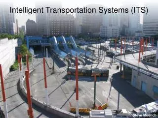
Intelligent Transportation Systems (ITS). CEE 320 Steve Muench. Outline. Need for traffic solutions Possible solutions Intelligent Transportation Systems. Road Use Growth. From the Bureau of Transportation Statistics, National Transportation Statistics 2003.

E N D
Intelligent Transportation Systems (ITS) CEE 320Steve Muench
Outline • Need for traffic solutions • Possible solutions • Intelligent Transportation Systems
Road Use Growth From the Bureau of Transportation Statistics, National Transportation Statistics 2003
Problems Caused by Congestion • Increased… • Travel time • Travel cost • Air pollution • Accident risk
Options • Construct new roads • Covered in geometric design • Not likely to happen on a large scale • Reduce Traffic • Travel demand management • Alternative transportation • Increase existing infrastructure capacity • Uses intelligent transportation systems (ITS)
Option 1: Construction Highway Construction Cost Sampling General ConclusionHighways cost $1 to $10 million per lane-mile to build
Option 2: Alternative Transport But significant new rail capacity will face the same hurdles as new highway capacity.
New Slide Tacoma-Seattle Began 2000 4 trips each way daily Everett-Seattle Began 2003 2 trips each way daily Sounder Commuter Rail
New Slide Seattle-Everett Interurban Railway Co. (1907) Asahel Curtis Photo Company Collection, University of Washington Digital Collection
New Slide Sounder vs. Interurban
Option 2: Alternative Transport SkyTran: Personal MagLev Transporter
Option 3: Increase Existing Infrastructure Capacity • An alternative to expensive new highway construction is the implementation of strategies that promote more efficient utilization of transportation infrastructures. • These strategies are known as the Intelligent Transportation Systems (ITS), which aims to reduce travel time, ease delay and congestion, improve safety, and reduce pollutant emissions
How Much Capacity Is There? Full Capacity Highway Capacity
How Much Capacity Is There? Remaining Effective Capacity Incidents can comprise 50% of peak period congestion. 1 min delay in clearance = 4 to 5 min of traffic backup. Highway Capacity Incidents: more delay is caused by incidents than by recurring peak period congestion.
How Much Capacity Is There? Remaining Effective Capacity Caltrans reports 20% of freeway centerline miles are under construction. Work zones: major cost is delay imparted to the traveler Highway Capacity Incidents: more delay is caused by incidents than by recurring peak period congestion.
How Much Capacity Is There? Remaining Effective Capacity 75% of NHS is subject to snow & 100% is subject to rain. Weather: Snow, fog, rain can all restrict capacity Work zones: major cost is delay imparted to the traveler Highway Capacity Incidents: more delay is caused by incidents than by recurring peak period congestion.
How Much Capacity Is There? Remaining Effective Capacity Periodic events can cause further restrict capacity. Special events and disasters further restrict capacity Weather: Snow, fog, rain can all restrict capacity Work zones: major cost is delay imparted to the traveler Highway Capacity Incidents: more delay is caused by incidents than by recurring peak period congestion.
How Much Capacity Is There? Remaining Effective Capacity Special events and disasters further restrict capacity Weather: Snow, fog, rain can all restrict capacity Work zones: major cost is delay imparted to the traveler Highway Capacity Incidents: more delay is caused by incidents than by recurring peak period congestion.
How Much Capacity Is There? ITS Remaining Effective Capacity Highway Capacity
Five Primary Functional Areas of ITS • Advanced Traffic Management Systems (ATMS) • Advanced Traveler Information Systems (ATIS) • Commercial Vehicle Operations (CVO) • Advanced Public Transportation Systems (APTS) • Advanced Vehicle Control Systems (AVCS)
Advanced Traffic Management Systems Photo from the Human-Computer Interaction Lab: University of Maryland
WAP Traffic www.wiresoft.net/traffic/seattle
Commercial Vehicle Operations • Apply, pay for and receive permits, registrations, and licenses electronically • Share of common trucking data across agencies • Exchange information electronically with roadside enforcement personnel • Electronic “screening” of trucks for safety or other regulatory violations • Share information across state lines and with Federal information systems
An Example of APTS http://busview.its.washington.edu/busview_launch.jsp?maps=gif
New Slide Advanced Vehicle Control Systems Intelligent Cruise Control (ICC) System Lexus LS430/460, ES-350 Benz S-Class, E55, AMG, CLS, SL, CL Acura RL Audi A6, A8, Q7 Cadillac DTS, STS, XLR Honda Legend Infinity M, Q45 Jaguar XK-R BMW 3, 5, 7 Series Nisan Primera Range Rover Sport Toyota Sienna XLE, Avalon Volkswagon Phaeton, Passat Renault Vel Satis Volvo S80