Download
1 / 42
420 likes | 653 Views
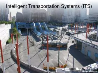
Intelligent Transportation Systems (ITS). An Overview. What are ITS?. Intelligent Transport Systems (ITS) involve the collection and processing of data: to provide information; to advise or control the actions of: travellers; drivers; fleet operators; and network managers

E N D
Intelligent Transportation Systems (ITS) An Overview
What are ITS? • Intelligent Transport Systems (ITS) involve the collection and processing of data: • to provide information; • to advise or control the actions of: • travellers; • drivers; • fleet operators; and • network managers • using computers with multi-media communications and other technology.
What Does ITS Offer? • Allows improved use of existing infrastructure by: • Providing a better understanding of the transport network • Live traffic and travel information – quick response • Providing new methods to manage the network • Improved traffic signals and vehicle priority • Improved intra/inter organisational communications • Providing new services to the public • Travel Information to make journeys easier and more pleasant
How Does ITS Help? • ITS is a tool to implement transport (and other) policy • Not an end in itself • Not a panacea • ITS can be beneficial • On its own • Supporting other measures • ITS builds on what is there • Not all new • SCOOT UTC • Flexibility to respond to changing priorities
Central Processing Unit Data Sources Communication Link Communication Link Information Destination Information & Management Monitor Acquisition Processing Distribution The Underlying Processes
ITS Applications • Two Main Categories • Urban • Inter-Urban • ITS can also help co-ordinate actions across authorities and networks • Sharing data • Enhanced strategies
Urban ITS Improving Transport Within Towns and Cities
What Challenges Can ITS Address? What are those ITS solutions? • Congestion • Poor safety • Integrated services • Accessibility • Environmental impact • Urban regeneration • UTMC systems • Speed limit enforcement • Real time information • Bus Priority systems • Alternative vehicle routes • Parking management
UTMC Urban Traffic Management and Control • Based on a common database • Can fulfil many objectives • Costs vary depending upon the complexity of the system and its requirements • Designed for interoperability with non proprietary systems • May include, for example • SCOOT Urban traffic control • Variable message signs • Bus priority measures at traffic signals • Real time travel information
Other Users of Information Operators Terminals Other Systems & Services Common Database UTMC COMMUNICATIONS NETWORK Signal Control Road Pricing Other Functions as Required Public Transport Priority Emissions Monitoring VMS Integration - Sharing Data
Data Gathering • Data gathered automatically - in a variety of ways • induction loops • Cameras • CCTV • ANPR • Floating Vehicle Data • Information from RUC schemes and tolling information
Information Dissemination • Information available pre trip and on trip • Information for Fleet managers, Network operators • Delivered in a variety of ways • Website • VMS • Highways Advisory Radio (HAR) • Information to your phone via SMS • Etc
UTMC Demonstration Projects • Early UTMC Systems now operational in Preston, York, Reading and Stratford • Largely a ‘Proof of Concept’ using UTMC specifications • Different focus in different demonstrators – including VMS, SCOOT, Environmental Monitoring, Car Park Guidance, Real Time Information • Sizes of projects also varied • Preston UTMC capital costs rated at £1.5m • York UTMC costs rated at £4m
Speed Limit Enforcement • Old style speed enforcement including Gatso wet film cameras is being superseded • Digital Photography • Eliminates the need to remove and replace film • Cheaper to operate • ANPR systems • Allows “Distance over time” enforcement • IR photography • Encourage compliance • “Secret Signage” • Intelligent Road Studs to measure speeds and advise drivers
ANPR Systems • ANPR:- Automatic Number-plate Recognition Systems • Uses neural net programming for image recognition • High levels of accuracy • Technology used for other purposes such as London’s Congestion Charge System
Distance over time Enforcement • Some speed enforcement measures cause rapid acceleration and deceleration as drivers break in front of cameras • ANPR systems allow vehicles to be identified at different positions on the network • Average speed between two points is measured • Speed across the entire length of road can be enforced.
Speed Warning Devices • ITS provides speed control devices that are not aimed at prosecutions • Speed activated signs, • Displaying registration of speeding vehicle • Maximum appropriate and safe speed may be significantly below signed speed limit • Variable Speed Limit applications now being used
Secret Signage • Speed activated signs • Flash speed limits at drivers exceeding the speed limits • Effective at reducing accidents along dangerous stretches of road • Guidance is to use it as a last resort
Inter-Urban ITS Improving Capacity and Preserving the Asset
ITS on the Motorways and Trunk Roads • No longer able to keep building new roads to accommodate predicted demand • Need new ways to improve capacity • Need to ‘lock in’ capacity provided by new / improved road schemes • Drivers want more information and more reliable journeys • 10% of delays result from road works, 25% from incidents • ITS can advise of congestion and help manage road works and incidents • Safety improvements result
Ramp Metering – Motorway Access Management • Popular in America • Used in Glasgow for access to the M8 (introduced 2004) • Used on the M6 for many years – many new sites planned • Can increases throughput • Can improve journey time reliability • Guidance on deployment now available from the HA
VMS For Strategic Management and Tactical Control • VMS (Variable Message Sign) Display selected information • Can be used for special event signing • Warns of congestion and can advise of alternative route • Different sizes and complexity • Controlled by NTCC (strategic) and RCC (tactical) • Automatic sign settings with signals possible - linked to MIDAS
MIDAS and VMS • MIDAS - Motorway Incident Detection and Automated Signalling • Uses induction loops to monitor traffic flow on strategic road network • Predominantly for queue protection • Automatically sets signals and signs, including variable speed limits • Good response: Average time till the system displays signs appropriate to an incident is routinely before RCC is aware of incident • Signs and signals clears down automatically when flow returns to ‘normal’
Hazard Warning Systems • Companion System • Intelligent Road Studs (IRS)
Companion System • Series of “companion posts” at the side of the carriageway • Radar detector in posts every 0.5 km for automatic activation • Posts can flash in groups – including ‘running lights’ • approaching the driver – to warn of problem • Away from the driver – to encourage throughput • Headways / throughput improves • Secondary incidents avoided
Intelligent Road Studs (IRS) • Deployed on the M8 Between Edinburgh and Glasgow • Part of NADICS (National Driver Information and Control System) • Used for • Guidance in Fog • Surface water detection • Incident detection • Hazard warning
51,000 vehicles a day • Cheaper than induction loops • Improved visibility over cats eyes • 1 road stud per 18m makes the route visible for up to 1km ahead • Detector studs every 250m provide information on speed and flow as well as weather conditions • Flashing studs give hazard warning of upcoming incidents
Active Traffic Management A Trial of Different ITS Tools and Operational Regimes • M42 Junctions 3a - 7: Birmingham • Multi-Million pound project • Uses the latest technology • Not just Controlled Motorways M42 J3a-7
Active Traffic Management Not just Controlled Motorway… • Access Control • CCTV Based Incident Detection • Emergency Refuge Areas • Hard Shoulder Management • HADECS Digital Speed Enforcement • MS4 Variable Message Signs capable of displaying pictograms • Possibility of ‘dedicated lanes - including HOV
Active Traffic Management The reality ATM Picture
Active Traffic Management Timetable • Installation works now complete • Three Lane Variable Speed Limits from Late 2005 • Four Lane Hard Shoulder Running from Autumn 2006 • Access Control: still to be determined
Active Traffic Management Education Advert in Birmingham METRO: Monday 21st November 2005 ATM Website: www.highways.gov.uk/atm
Network Advisory Assessment Tool (NASS) Summary • Computer modelling tool developed by IPL • Will be used by ATM Operators in the Control Room • Predicts traffic conditions an hour ahead • Match conditions to a library of traffic patterns • Decide which one of three associated plans will have the most benefit
What is NASS A screenshot… Image
What is NASS Faber Maunsell involvement • Working for WSP in Basingstoke • Ultimate client is the Highways Agency • Testing Phase B of the system completed • “Offline” testing / proof of concept • Phase C to be installed in the Control Room • FM to develop strategies / plans to address incidents
What is NASS TRL SISTM Simulator Used in Phase B • Used to simulate road conditions and assess Flows, Speed and Journey times across the network with and with proposed Plan • “Graphical” modelling tool available to the engineer / operator • Each “dot” is a car! • Colours show speed of each car Image
NASS Results An example assessment of a proposed plan …
Integrated use of ITS – The Key to Success • Better management / more efficient operation • Sharing data – collect once, use many times • Standardising equipment and protocols – using the best IT can offer • Reducing cost / achieving operational targets • Dealing with information overload - highlighting what is important • Presentation in a digestible format and there when you need it • Coordinating effort – knowing what is happening and who is dealing with it